Good Saturday to one and all. It’s a much cooler pattern that has taken control of our pattern and this will throw a frost threat or two at us in the coming days. Looking longer range, our weather likely turns pretty toasty and stormy as we head into the start of May.
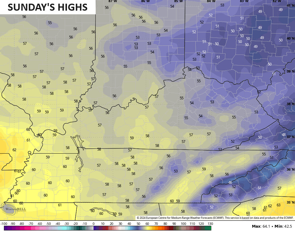
Temps today range from the mid and upper 50s north to the middle 60s across the south. All these temps are much cooler than the normal highs of 70-75 degrees. Winds out there today will also be pretty gusty.
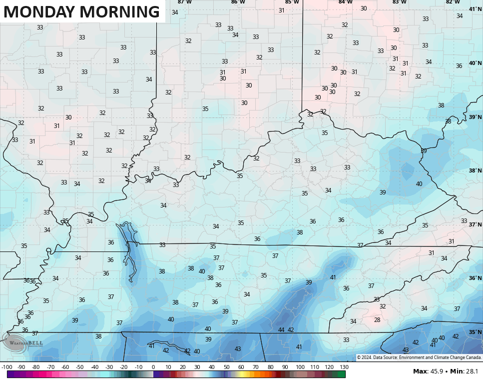
Skies today feature a mix of sun and clouds. Those clouds will be around into tonight as well and will play a factor in the Sunday morning frost threat. With clouds, there’s no frost. Without clouds, some patchy frost and temps in the 30s are a good bet.
Clouds will be around for part of Sunday as a southern system zips by to our south and east. Temps will be even cooler than today with highs will be into the middle 50s for many…
With clearing skies by Sunday evening, the stage is set for widespread frost Sunday night and Monday morning. Lows will make a run at the freezing mark for many…
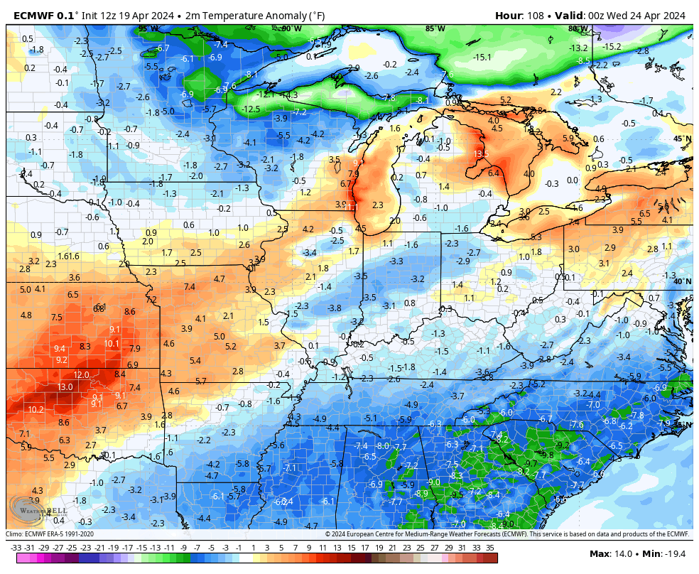
We stay cooler than normal through much of next week with another cold front moving in here by late Tuesday and early Wednesday. This brings a few showers and storms with it with a few more storms likely to come at us several days later into next weekend.
Here’s the EURO from Tuesday through next weekend…

Temps behind that first front go well below normal again but bounce back quickly after that with above normal numbers…
The last weekend of April through the first few days of May look to be pretty warm for much of the region. Check out the roughly week long average temp departures…

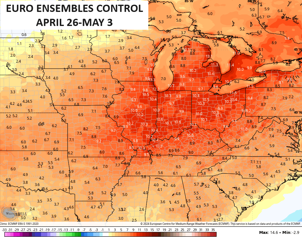
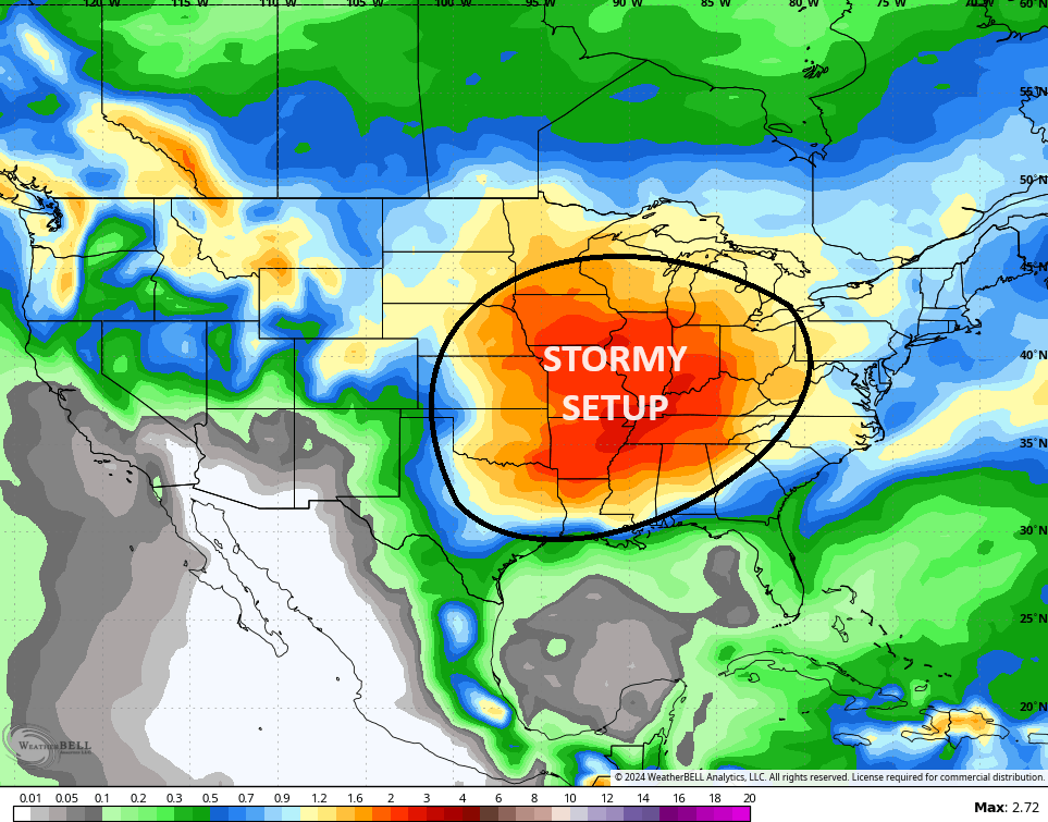
This same time period likely features rounds of thunderstorms, likely some severe, targeting the Plains States into the Ohio Valley…
Make it a great day and take care.

Frost will certainly be a threat on Sunday night, but temperatures will stay well above freezing. Hopefully this will be Winter’s last gasp, but we are far from seeing an end to Spring severe weather season. And we are already seeing convection trying get started in the tropical Atlantic.
2024 will be a very busy year indeed!
The one time I want those ensembles to be right. 🙂 #TeamHeat