Good evening, folks. A significant severe weather outbreak appears likely Sunday and Sunday night. Waves of severe storms will roll across Kentucky, bringing all modes of severe weather along the way.
A few thoughts:
- The first wave of severe storms works across western Kentucky Sunday morning and into central and eastern Kentucky during the afternoon.
- Widespread wind damage is possible with this line.
- Additional severe storms then develop behind this during the evening.
- Another massive line of severe storms then crosses the state from west to east Sunday night.
- This line may also bring widespread wind damage with it.
- Hurricane force wind gusts are possible at some points along both of the main lines of severe storms.
- A few tornadoes will also show up with the greatest threat across western and southern Kentucky.
- Large hail of greater than golf ball sized will also be possible.
- Flash flooding will show up in some areas.
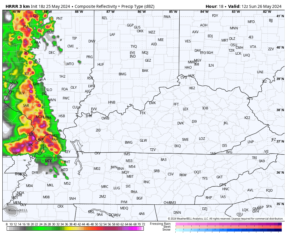
The latest future radars from some of the hi resolution models show this whole scenario very well.
Here’s the HRRR from 8am Sunday to 8am Monday…
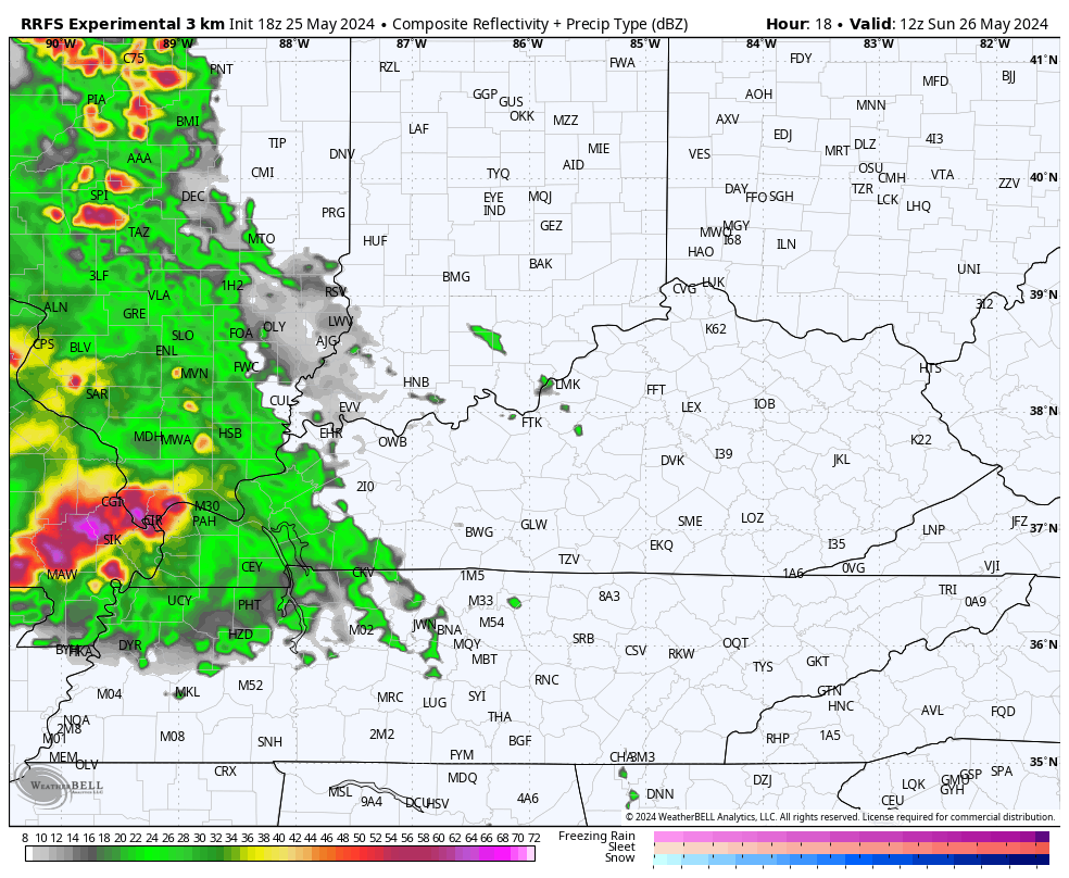
The new RRFS is very similar during the same time period…
The peak wind gust forecasts from the models are increasing as we get closer. The HRRR peak wind gusts…
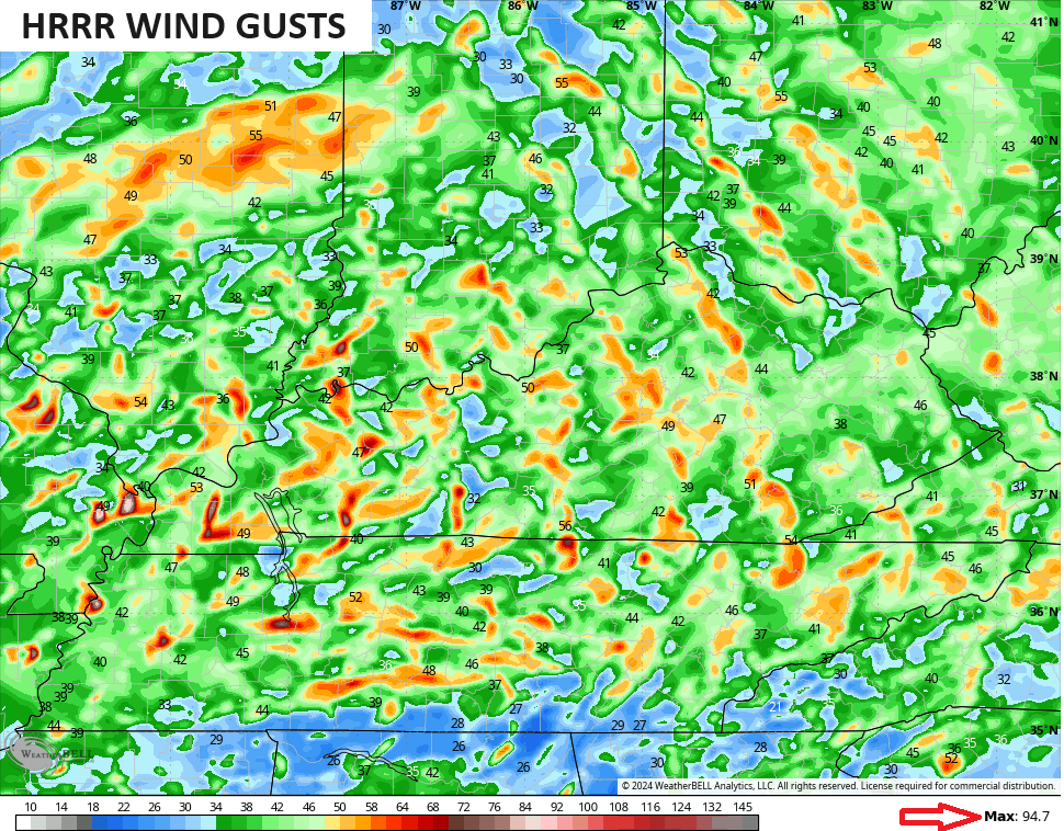
Notice the max wind gust in the bottom right corner is at 95mph.
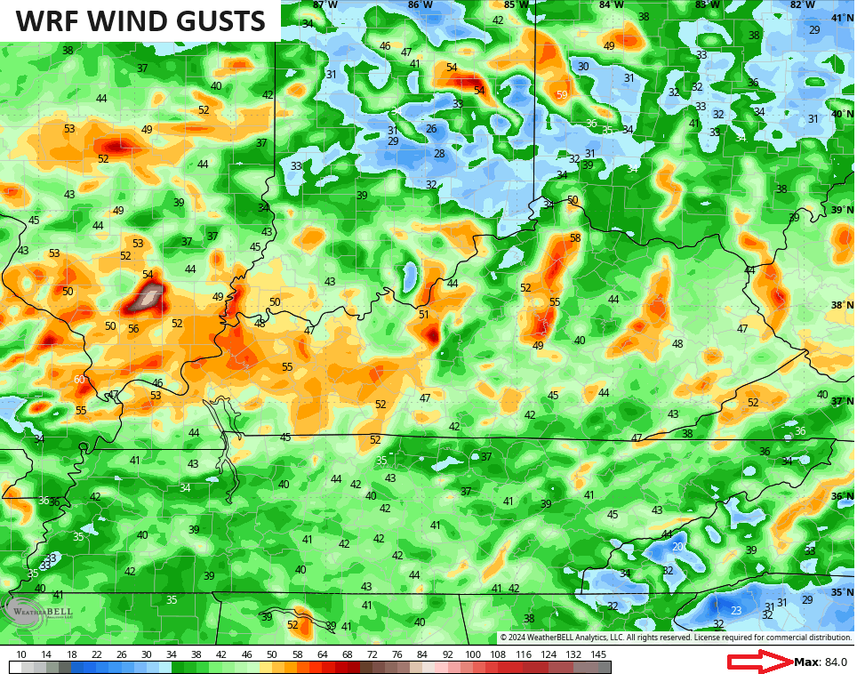
The WRF wind gust forecast is similar…
The Storm Prediction Center has most of Kentucky in the Enhanced Risk for severe storms on Sunday…

I think an upgrade to Moderate Risk is possible for parts of the area.
The current Tornado Outlook from the SPC continues to paint the bullseye in the west…

Widespread wind damage shows up on the Severe Wind Outlook from the SPC…

Some severe hail is likely…

We also have to be on guard for a couple of strong to severe storms going up Monday afternoon, well after the main severe weather clears the region. The SPC has a Marginal Risk in the east, but that may be expanded west and upgraded to a Slight Risk in time…

I’ll see you guys later tonight with the latest, until then, here are your storm trackers to follow along with the severe storms to our west…

Current watches

Possible Watch Areas

Have a great rest of the evening and take care.
