Good Monday, everyone. The bluegrass state is cleaning up on this Memorial Day after widespread severe weather ravaged much of the state. Damaging winds and tornadoes caused all kinds of issues across Kentucky. Sadly, at least two lives were lost.
Hundreds of thousands of customers are without power to start the day after hurricane force wind gusts blew across Kentucky. The NWS will likely confirm several tornadoes that touched down on Sunday, as well.
Much calmer weather is showing up out there today with mainly dry skies and temps in the 75-80 degree range. There’s still the chance for a stray shower or storm going up this afternoon and evening.
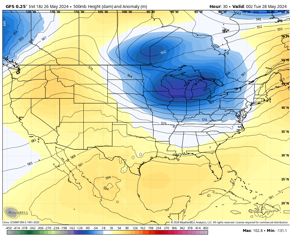
Another shower or two may show up late Tuesday and Wednesday as a deep trough digs into the region for the closing days of May…
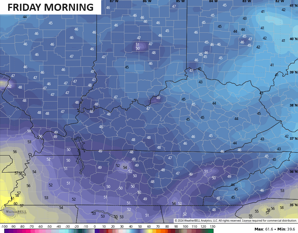
Highs in the 70-75 degree range look good from the middle of the week into the start of the upcoming weekend. Low temps for the final few mornings of May will likely drop into the 40s with Friday morning throwing a few low 40s at us…
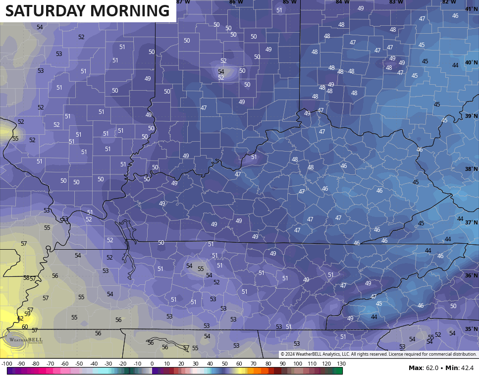
The first morning of June may also start off with some 40s…
Temps remain below normal into the weekend as the threat for showers and storms fights back in and takes us into early next week…
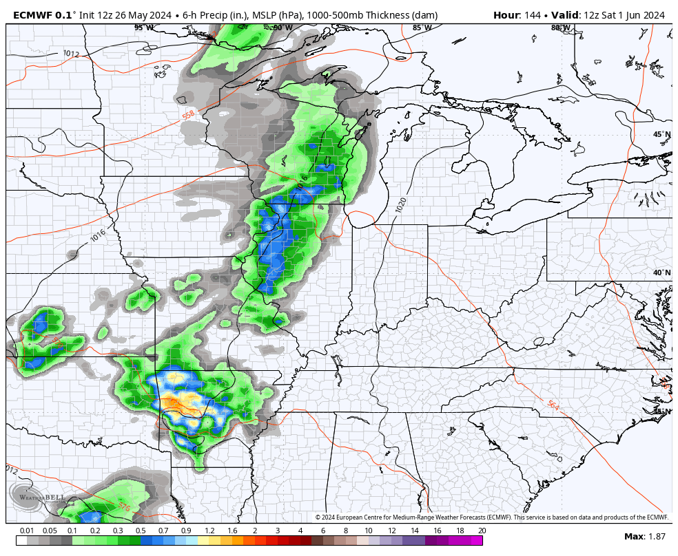
This is ahead of another series of troughs looking to dig into the eastern half of the country through the first 10 days or so of June…
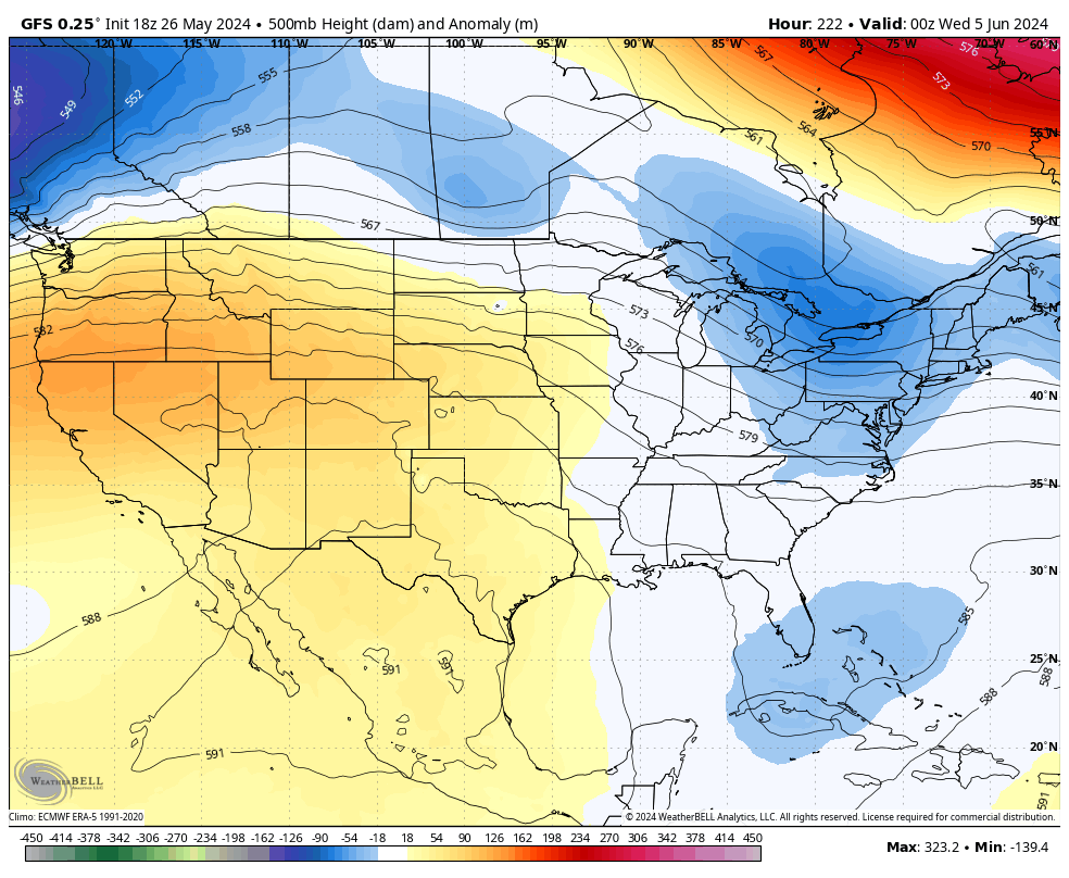
Much cooler than normal temps look to be with us to start Meteorological Summer!
I leave you with your Monday storm tracking toys…

Current watches

Possible Watch Areas

Make it a great Monday and take care.

It’s not going to be cool as long as predicted.
It looks like a great start to the summer.
Nope
We had about three inches of rain here in Maple. I’m hoping that the reaction to the recent storminess will eventually be Sunny and Dry.
Here’s the storm report from last night :
https://weatherstreet.com/weather-forecast/storm-reports.htm
NOAA’s probability forecast for the Summer months ( J J A ), take it for what it’s worth :
https://www.cpc.ncep.noaa.gov/products/predictions/long_range/seasonal.php?lead=1
I’ve been watching these CPC forecasts for years, and found that they’re either consistently wrong, or too general. I think they use the GFS algorithm, so I’m not surprised
That should make Jeff happy.
You too, since rainfall looks good.
Two Tornado Warnings in BG yesterday, but the real damage was caused by the straight-line winds. I recorded a 47 mph gust at my location, and we picked up a total rainfall of 3.15 inches.
This is the Eddyville tornado, recorded by my stormchaser friend, Heather Carter:
https://youtu.be/d4ST-WZRZ9o?si=WMGGz8TtMFucD8p