Good Sunday, folks. We are putting the wraps on the weekend with another cooler than normal day. This will also come with a few showers and storms in the west and south with much of the region staying dry.
This cool weather really settles in to start the new week but a little normal summer sizzle is on the way for the end of the week into next weekend.
Today’s temps are mainly in the 70s once again with those showers and storms hitting the west and south. This isn’t all day stuff by any means, but some heavy rains will be possible in some areas.
Your Kentucky radars are on tap to track the action…

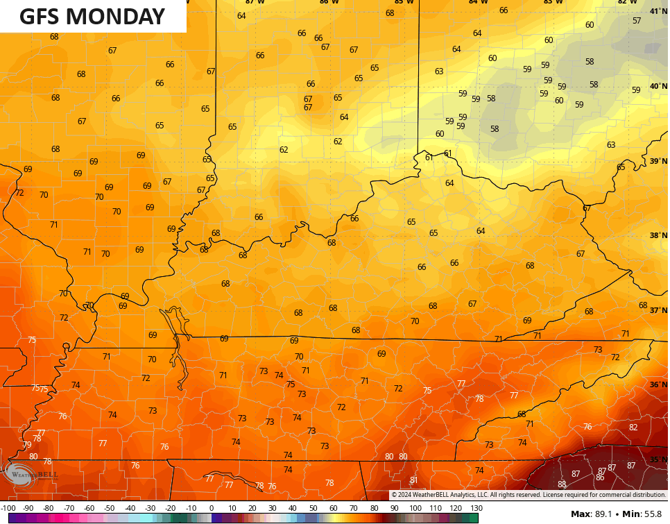
A few clouds filter back in for Monday as a very cool wind blows. Highs will be WELL below normal with the GFS spitting out temps in the 60s for highs…
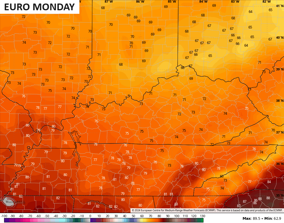
The EURO is usually overdone with temps but is also showing northern Kentucky staying in the upper 60s with 70-75 for much of the rest of the state…
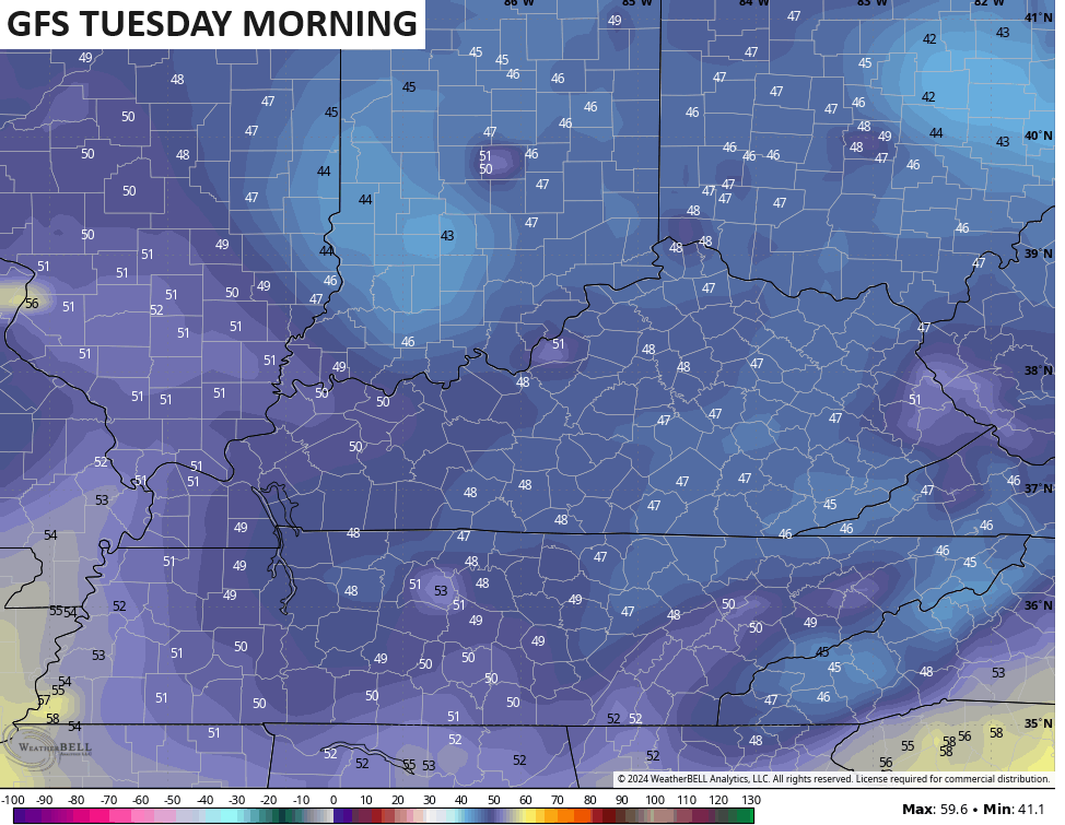
This sets the stage for temps to take a tumble into the 40s in several locations by Tuesday morning…
Highs on Tuesday remain in the 70s with another awesome weather day taking shape.
Temps get to near normal by Wednesday then to normal Thursday. Temps are going to try to surge by Friday into the upcoming weekend, but a few things are at play to try to tame that. First is a sneaky system trying to bring a few showers and storms in from the northwest. The second is a system down in the Gulf of Mexico.
The GFS has both of these scenarios…
The EURO doesn’t see the first system from the northwest but has a healthy surge of moisture coming from whatever goes up in the Gulf of Mexico…
Still, there’s a really good chance for 90 degree temps to show up at some point during this time.
The active Gulf of Mexico is also something the new AI model from the EURO. You can see two systems on the 2 week rainfall totals. The first goes across Florida with the second coming from the central Gulf into our region…
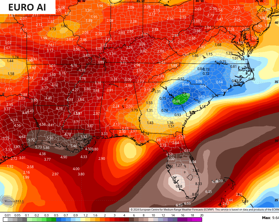
A hyper-active hurricane season is likely and Gulf systems tend to impact our weather more times than not.
Make it a great Sunday and take care.

Thanks Chris. In my local forecast, ninety degree plus temperatures are a sure bit from the fifteenth and thereafter. About time for though’s tempertures to show up. In the near future, I will enjoy the below normal night temperatures. The Euro A I model on accumulating rainfall looks interesting. We shall see how that pans out. The Tropical storm and Hurricane season looks down right SCARY !
Have a happy and peaceful Sunday everyone.
#TeamHeat