Good Saturday, everyone. Our weekend is off and running with cool temps and a few showers and storms roaming across the state. This isn’t a washout and not everyone sees much rain, but let’s have a backup plan for any outdoor activity just to be safe.
Temps out there today are in the 70s as clouds thicken from west to east. Showers and some thunder move across western Kentucky early today but this fades as it moves into central Kentucky. This will then disappear as it hits the east.
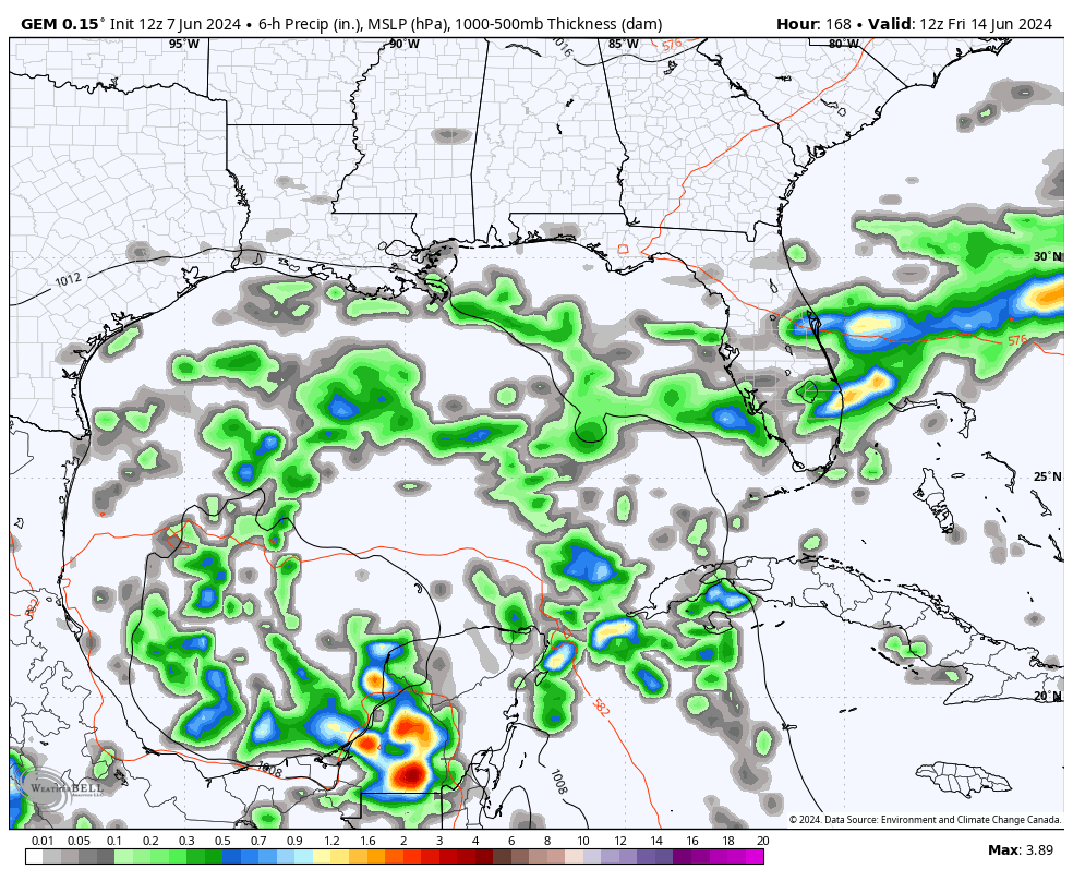
Here are your radars to follow along…

BTW, temps drop into the 60s wherever rain falls.
The southern half of Kentucky has the best chance for more showers and storms late tonight and Sunday. The future radar from the HRRR is the most aggressive with these rains and it’s also the farthest north…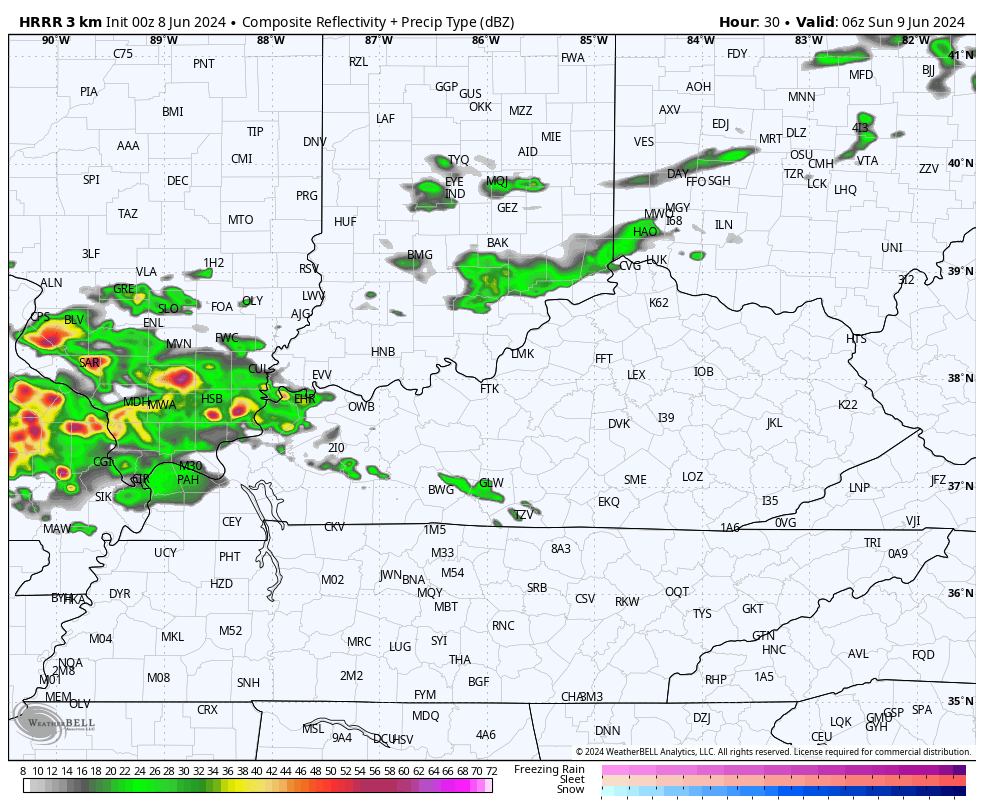
Monday looks even cooler with temps that can be way down there behind this departing system. That’s especially the case with the GFS which keeps low clouds around with highs failing to reach 70 in some areas…
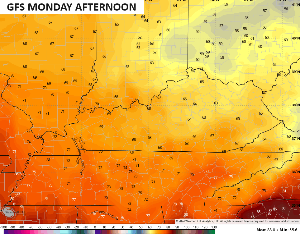
Lows may hit the 40s by Tuesday morning with the below normal temps taking us through Wednesday, at least.
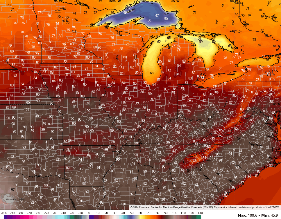
That said, there’s a growing potential for temps to make a run at 90 by next weekend…
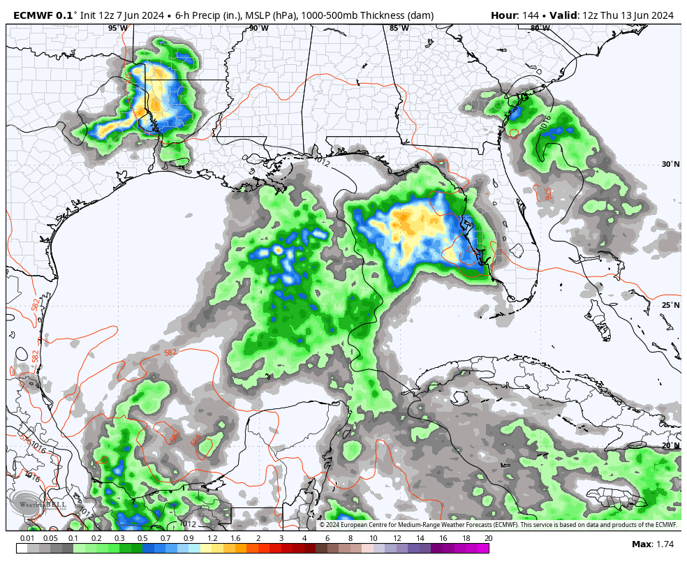
As some typical summer steam builds in, we will need to watch the Gulf of Mexico for some possible development at some point from that weekend into the following week.
The models have lowering pressures in this region…
EURO
CANADIAN
It is that time of year, y’all!
Enjoy your day and take care.

I love some 90s.
Yesterday was beautiful. Worked outside all day. Lovely. Hoping for another today.
BTW, I could hardly find the text & graphics for all the advertising!
The kind of weather that I always wanted when I had my nursery years ago. Chris’s page loaded fine for me this morning.
OK… but just so u know….and I know you do… if upper 80s are forecast for daytime highs… the official temp is probably going to be end up being 90 or better….even though it never was really 90s at all…
Thanks Chris. We are good on soil moisture, but there’s a number of 90 degree plus temperatures in my local forecast. Hoping that will change ?
On June 8th, 1982 where I was living in Indiana, we had one of the worst thunderstorms that I’ve ever experience. It took me, and the help I had the rest of the Summer to get the nursery back to way it was in time for the Fall selling season.
Enjoy the day everyone !
I’ve been watching the Gulf of Mexico, as my older Sister and Brother in Law live in a small coastal town in southwest Florida. I notice since the beginning of June, that the convection has been increasing. My Brother and I had a Zoom call yesterday from them. The temperature at that time was 97 degrees and they are expecting a lot of rain in the comming days. The Tropical storm season this Summer looks very active due to a negative PDO ( La Nina ) I wish the PDO would phase positive ( El Nino ) to end this.