Good Friday to one and all. It’s a September feeling start to this early June weekend as a cooler than normal pattern settles in for a while. Unfortunately, this will also brings a few showers and thunderstorms along for the ride this weekend.
Let’s start with today as temps are in the 50s this morning and in the 70s this afternoon. Blue skies will combine with a strong northwest wind to give us that early fall look and feel. This is my kind of weather, folks!
A few showers and thunderstorms rumble into western Kentucky tonight with this action fading east into Saturday. A few of these showers may make it all the way into central Kentucky. That will be followed by additional showers and storms Saturday night into Sunday with the greatest concentration across western and southern Kentucky.
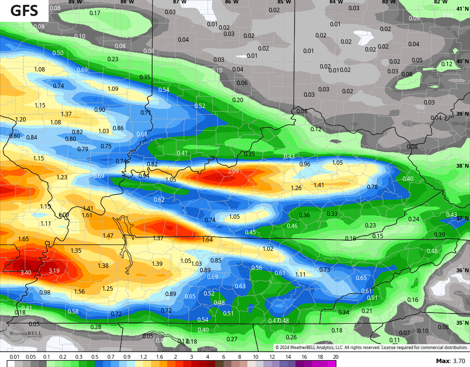
A few of the models are spitting out some hefty totals. The GFS is leading the way…
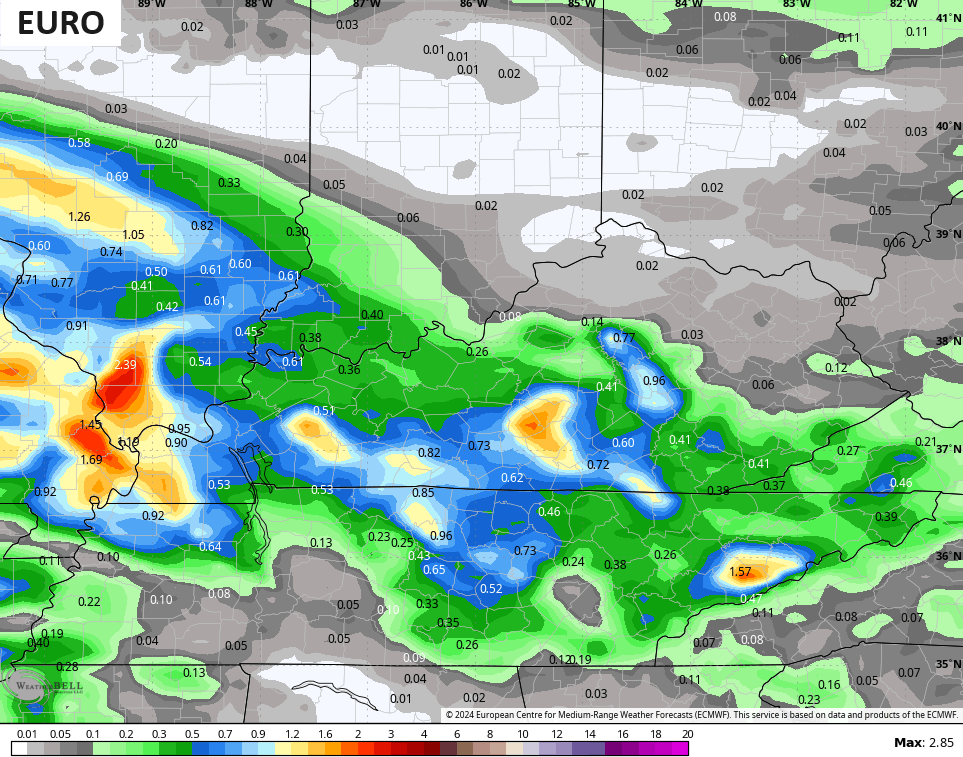
The EURO isn’t too far behind…
We will need to watch this setup for a little too much rain in a few spots.
Temps with this weekend setup will be rather cool for this time of year, keeping that fall feel going.
What happens for Monday and Tuesday? That’s a question to be answered over the weekend as the chance is still there for a low to wrap up close enough to us to keep some showers going. The GFS has been showing this fairly consistently…

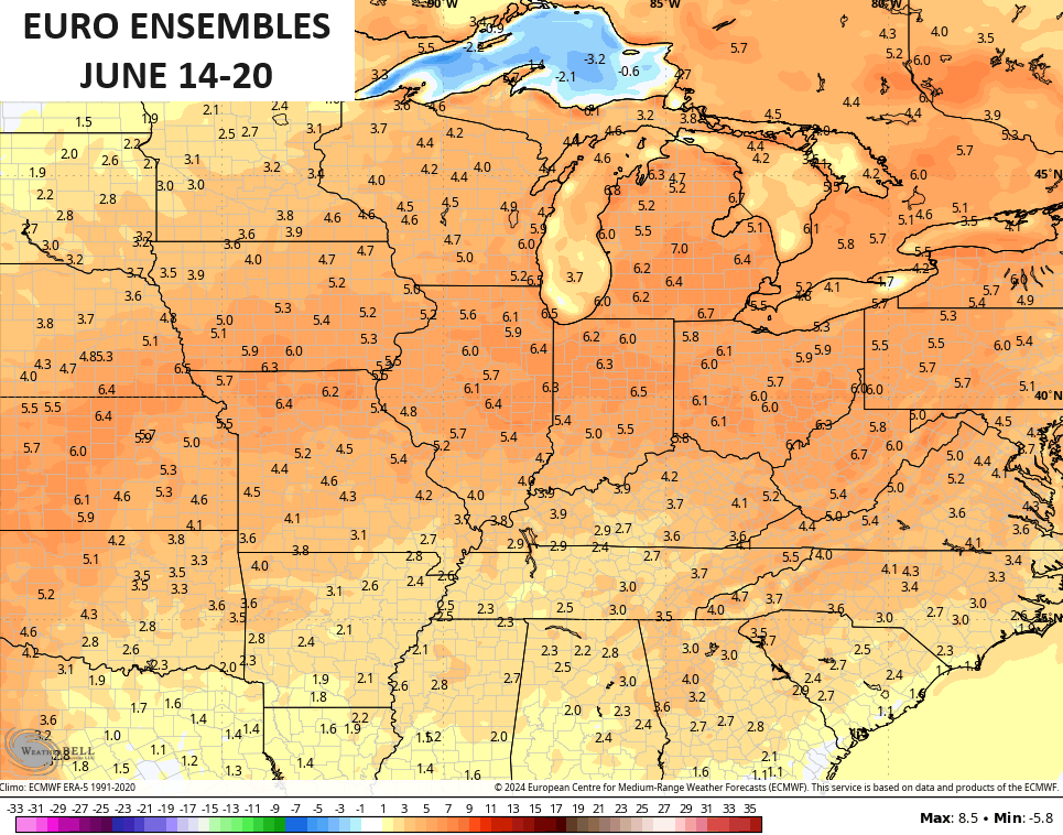
Temps stay cooler than normal into much of next week before we see signs of a warmer setup taking shape. The EURO Ensembles are the most bullish with above normal temps in the 7 day period starting on the 14th..
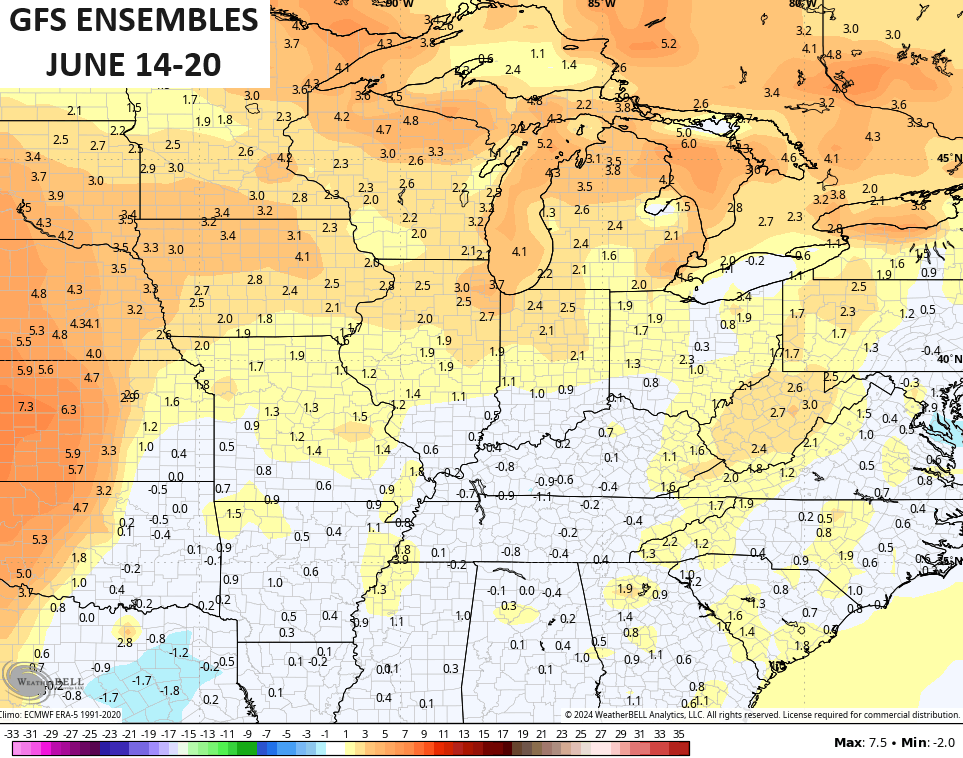
The GFS Ensembles are quite a bit cooler…
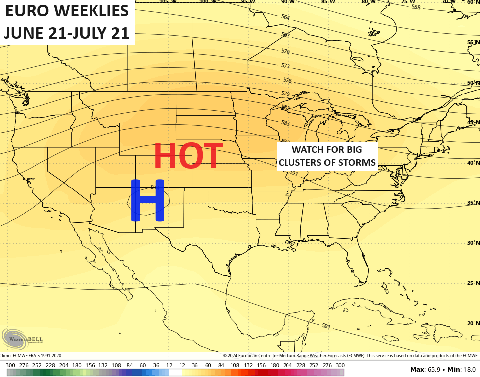
If we look into the longer range, we find the EURO Weeklies going toward a big plains heat signal with our region on the eastern edge of that. This is typically a region where clusters of storms like to hang out…
Have a fantastic Friday and take care.

#TeamHeat 🙂
Thanks Chris. I can’t complain, just as long as we have plenty of rainfall, but with a drier trend in late Summer.
Have a great day everyone !