Good Thursday, everyone. We continue to track two cold fronts across the state today as our pattern goes toward a much cooler and calmer look. This settles in for the weekend and early next week, but some toasty signals are showing up after that.
Today is a windy and warm day with temps generally in the 80-85 degree range with a gusty southwest wind. Those winds are ahead of another cold front dropping in this afternoon with a scattered shower or storm along and ahead of it.
Here are your radars to follow along…

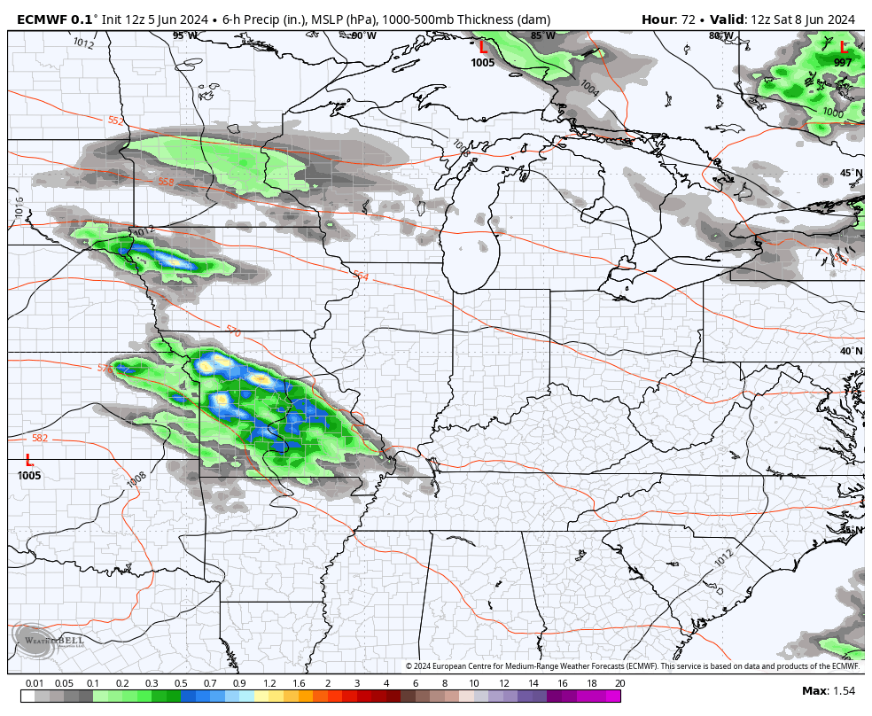
Pleasant temps come in behind this with highs generally in the 70s Friday into the weekend. That’s when another system drops in with the chance for a few showers and storms into western Kentucky on Saturday and the chance for a shower or storm areawide Sunday into part of Monday.
Watch this system zipping through here over the weekend…
How far below normal is the air this weekend and early next week? Take a look…
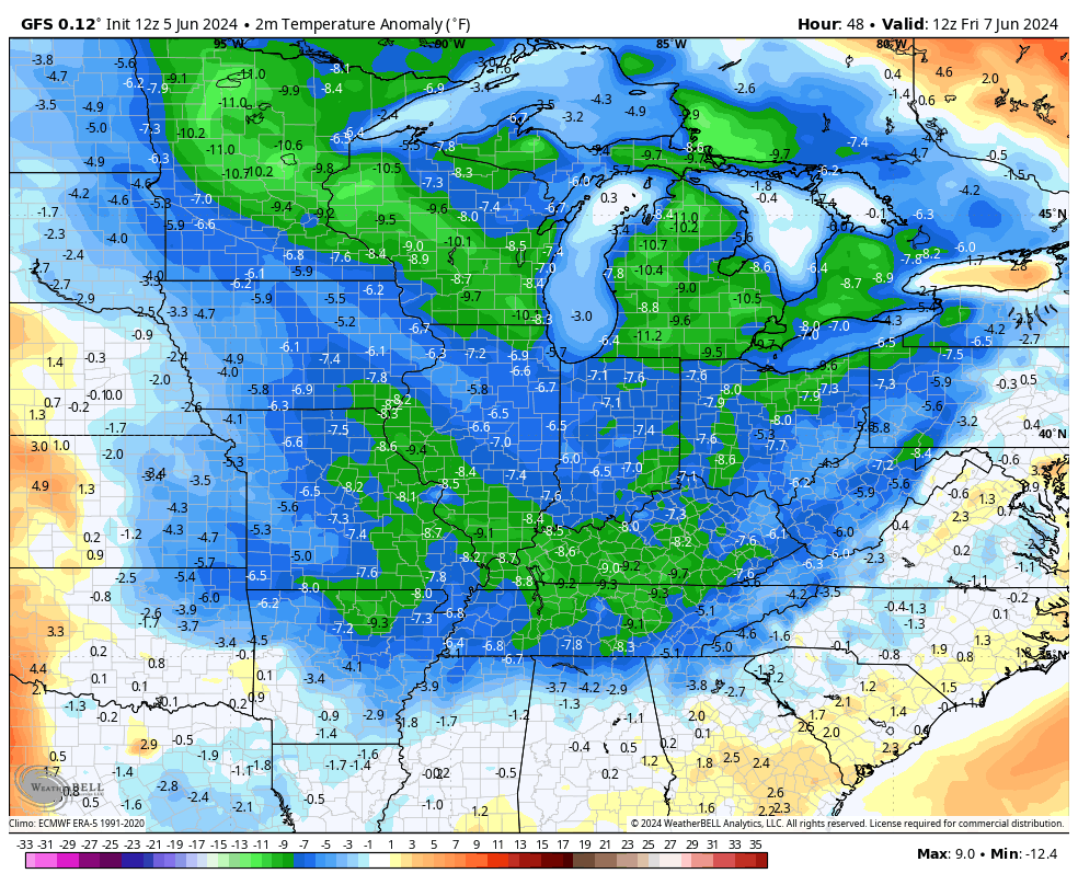
The chance for some early summer upper 40s is there by Monday or Tuesday mornings…
This is coming from a deep trough digging into the easter half of the country. That will be followed by another system that the model trend is trying to keep to our north as of now. That would allow for much warmer air to surge in with a ridge going up…
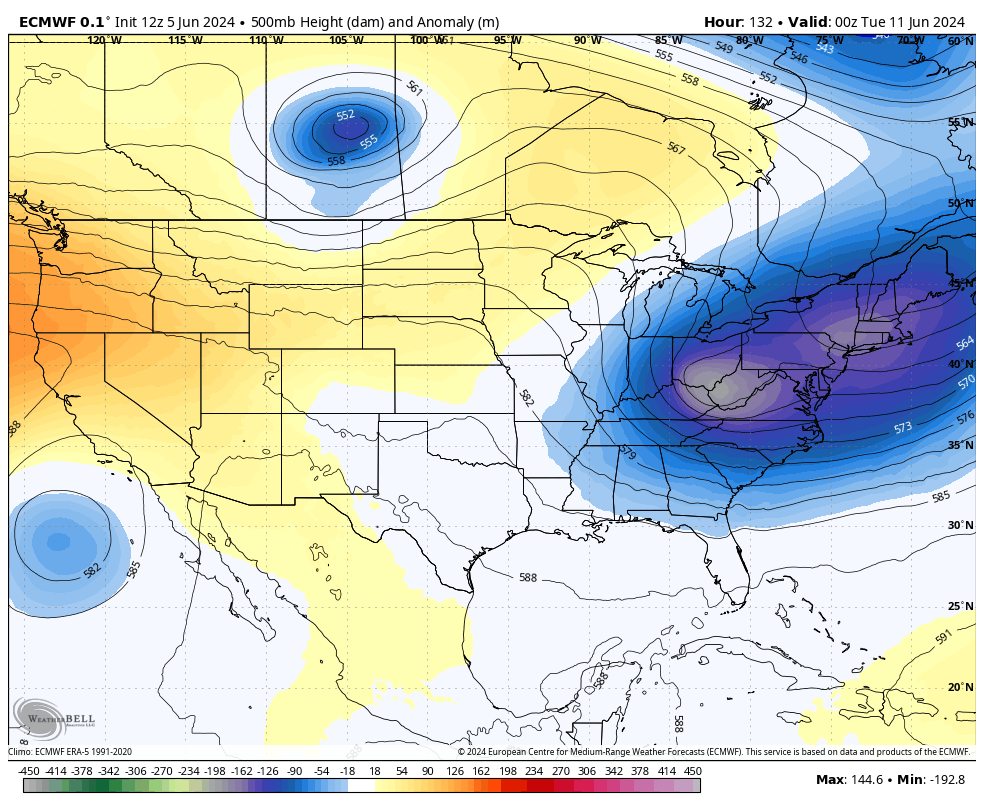
You notice that ridge also showing up very well on the EURO Ensembles…
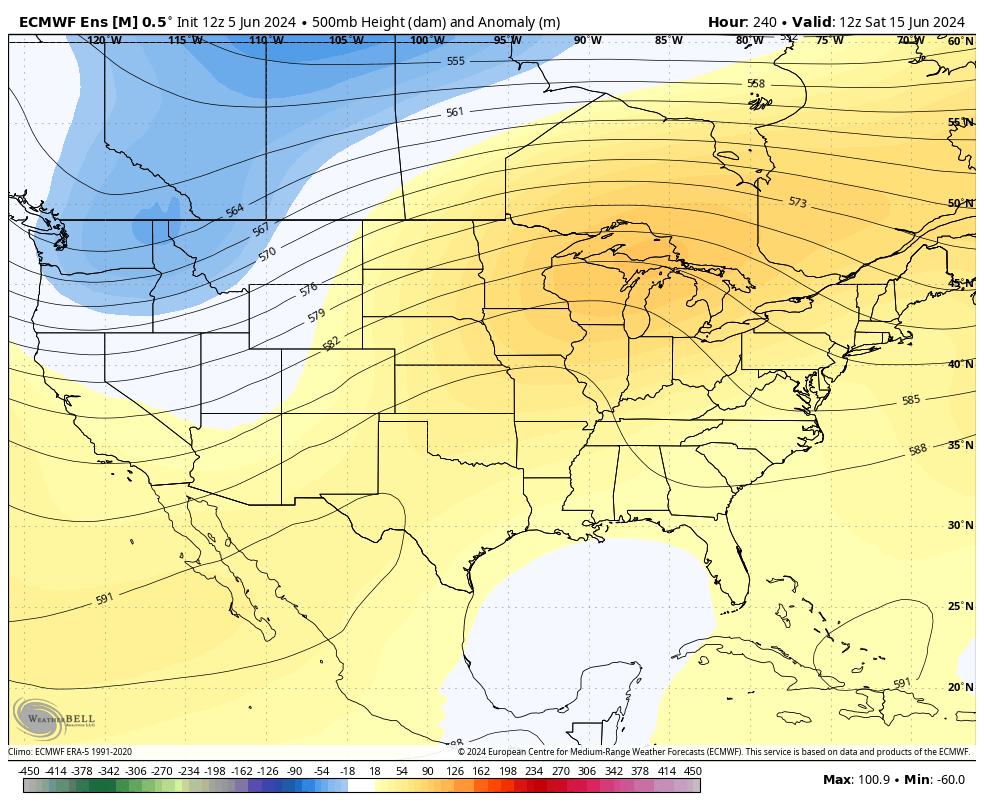
That’s the same ridge we talked about in my last update, but the models are just a little faster in bringing it into the region. I could use a little summer sizzle!
Enjoy your day and take care.

Thanks Chris. We sure are receiving plenty of rain. Going into town yesterday, I noticed the crops look great. Hoping for a late Summer dry period to ripen the crops in September.
Have a great day everyone !
so far this summer has been fine with me temp wise… Not to extreme… I know it can’t last.
Bring on the heat!
Looking at my weather records, that I kept since 1962. The hotest temperature was 105 degrees in July, 1962, and was followed by a very cold and snowy Winter.