Good Wednesday, everyone. It’s another day of muggy air and rounds of thunderstorms across the Commonwealth. I suspect that will be a common sentence of the summer ahead. although some cooler changes are set to blow our way in the short term.
Let’s begin with today and roll forward.
It’s a very tropical feeling day with high humidity and temps reaching 80-85 in several areas. Scattered showers and storms will be floating around through the afternoon before a more pronounced round of storms develops and sweeps to the east.
I can’t rule out a strong storm or two, but the true severe threat looks to be to our north and northeast. That’s what’s showing up on today’s Severe Weather Outlook from the Storm Prediction Center…

Any storm out there today is capable of putting down a few inches of rain in a short amount of time and that may very well lead to local flash flooding issues. Keep that in mind if you’re in a flood prone area.
We get one more really warm day on Thursday as a cold front blasts through here with a scattered shower or storm. This front is being pushed by a big dip in the jet stream that likely gets reinforced by another dip into the first part of next week…
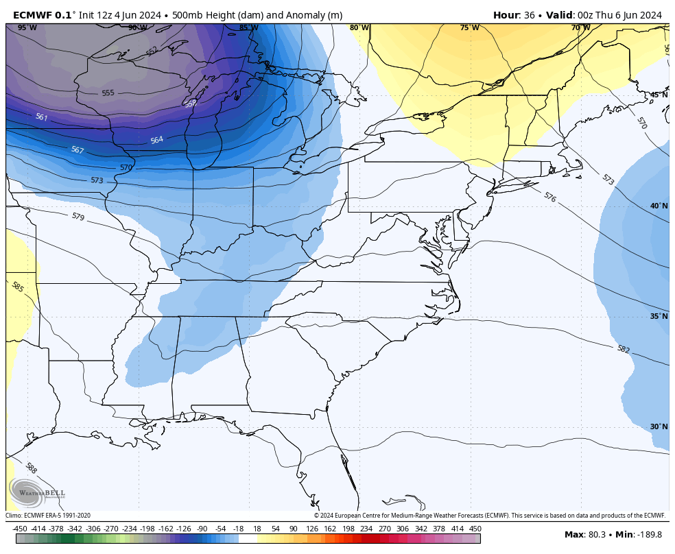
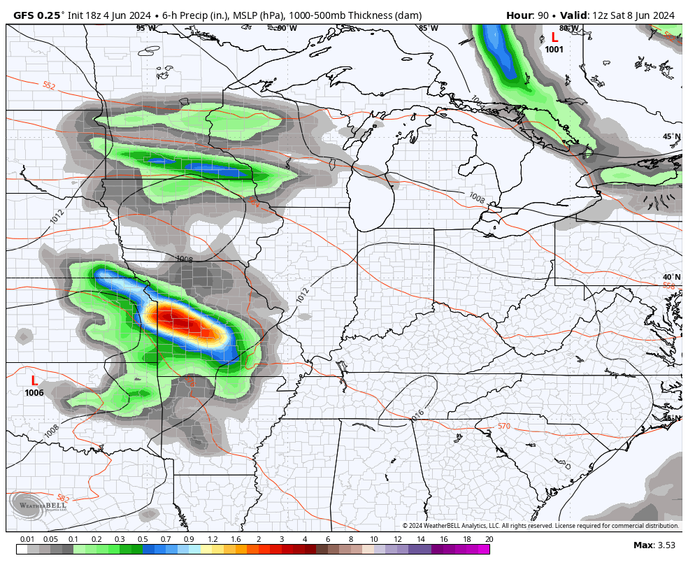
We will need to be on guard for a few late weekend showers and storms to work through here. There’s also the chance for a low to wrap up near us by Monday or Tuesday…
That could keep some ugly and very cool weather around here.
I expect this cooler than normal setup to carry us through much of next week before we start to come out of that the following week. The Ensembles are trying to send the trough into the west with a ridge going up in the east…
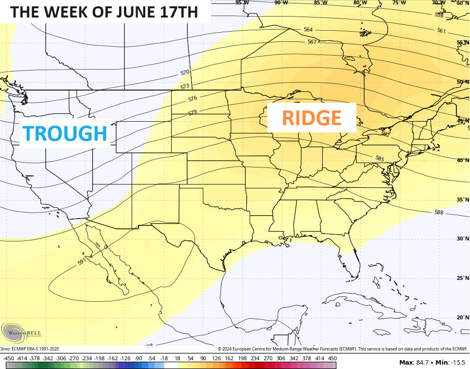
This scenario could mean a little summer sizzle if it comes to pass.
I leave you with everything you need to track some Wednesday thunder…

Current watches

Possible Watch Areas

Enjoy your Wednesday and take care.

Yeah – we’re not gonna get outta this summer with no 90s….I think one summer we did not reach 90 at all… except the airport hot spots… At this point I almost don’t even count those official airport temps… I’m talking ANY airport… they are all the same… they are all hotspots
2004 was a very cool and wet summer.
Where I grew up in Indiana, there wasn’t any Summer where the temperature didn’t exceed 90 degrees. I remember those hot and humid nights without air conditioning.
Thanks Chris. Yesterday afternoon we had a brief encounter with a very heavy rainstorm that manage to deposit 0.41. ” Glad there wasn’t any severe weather.
Enjoy the day everyone !
I’m hoping those ensembles verify, but no drought.
That’s a huge ridge the model is displaying. They must have factored in the ” strong southeast ridge ” due to the La Nina expected. I’ll be ready for ” Fall like ” weather after the Fourth of July. It will be here before long. One thing about getting older, time seems to go fast.
Today’s song is “Time” by Pink Floyd.