Good Tuesday to one and all. Our blast of September temps continues for another few days before the pattern flips around. Steamy temps are on the way for the weekend and early next week, but the extent of the steam is still in question.
Let’s start with today and roll forward.
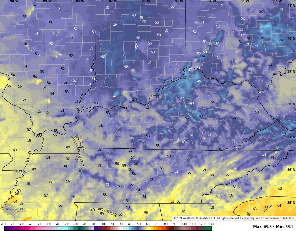
We start things out deep into the 40s for many areas with afternoon temps back into the low to middle 70s. Humidity is low and skies are awesome.
There’s the chance for a few more 40s to show up Wednesday morning…
Highs rebound into the 75-80 degree range for many as we hang on to the sunshine.
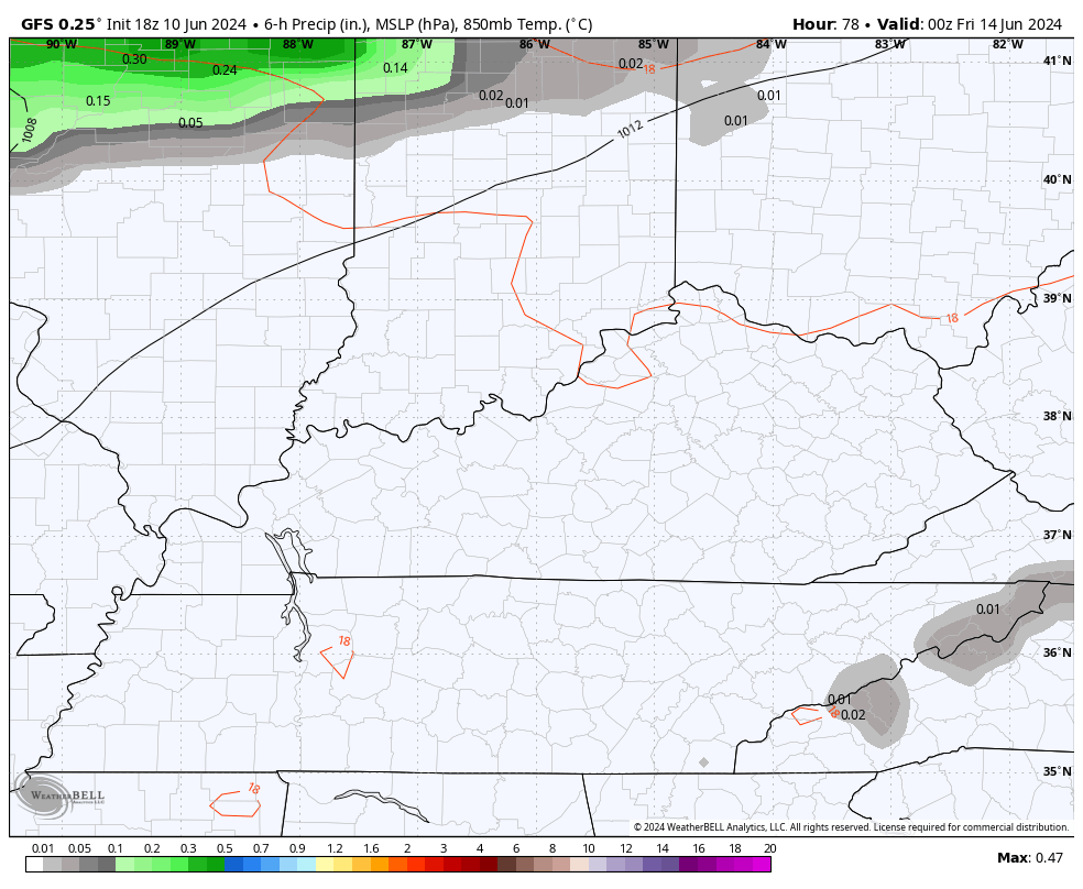
Thursday finds normal temps into the low and middle 80s for the entire region as a few clouds show up later in the day. Those clouds are ahead of a weak front dropping into the region on Friday. That brings a broken line of showers and storms with it.
The GFS has been picking up on this for a while now…
The EURO is just now seeing it…
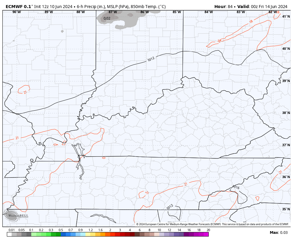
A few of those storms may also be on the strong side.
I bring up the GFS seeing something before the EURO because we see the models having a bit of a disagreement in terms of how toasty things get this weekend into next week.
Let’s bypass the operational models and go straight to the Ensembles.
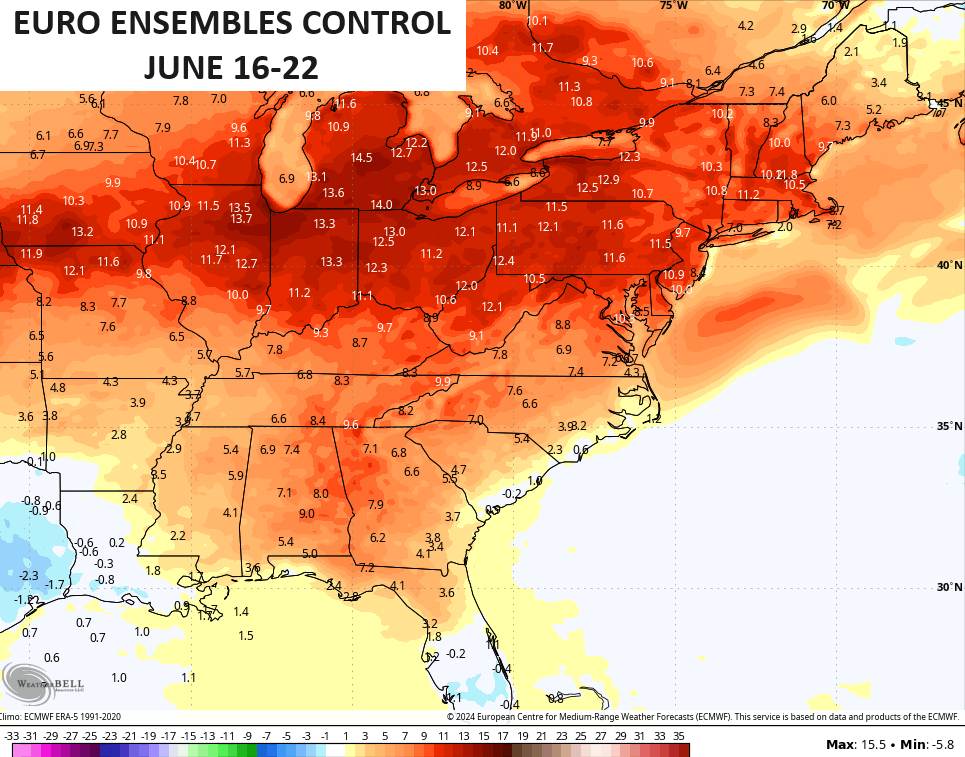
The 7 day average temp departure from the EURO Ensembles shows the core of the heat across the northern Ohio Valley and Great Lakes…
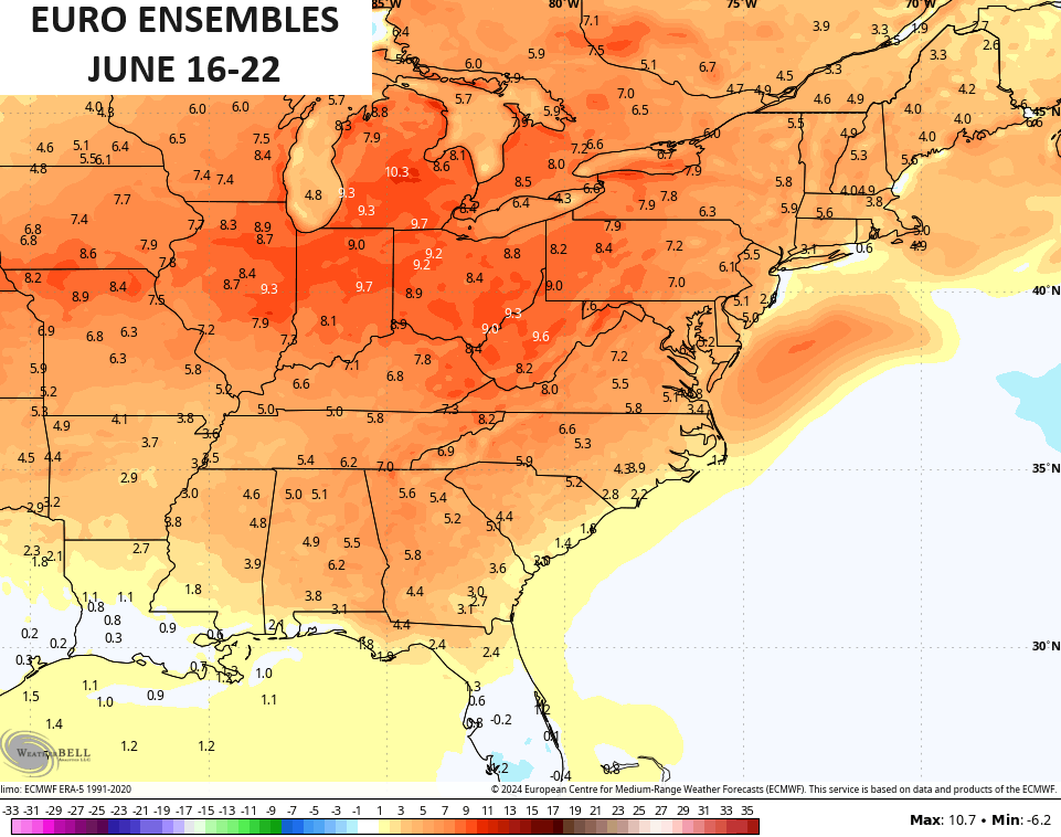
The Control run is even more emphatic on this…
The GFS Ensembles during the same time are nowhere near as hot as the other models…
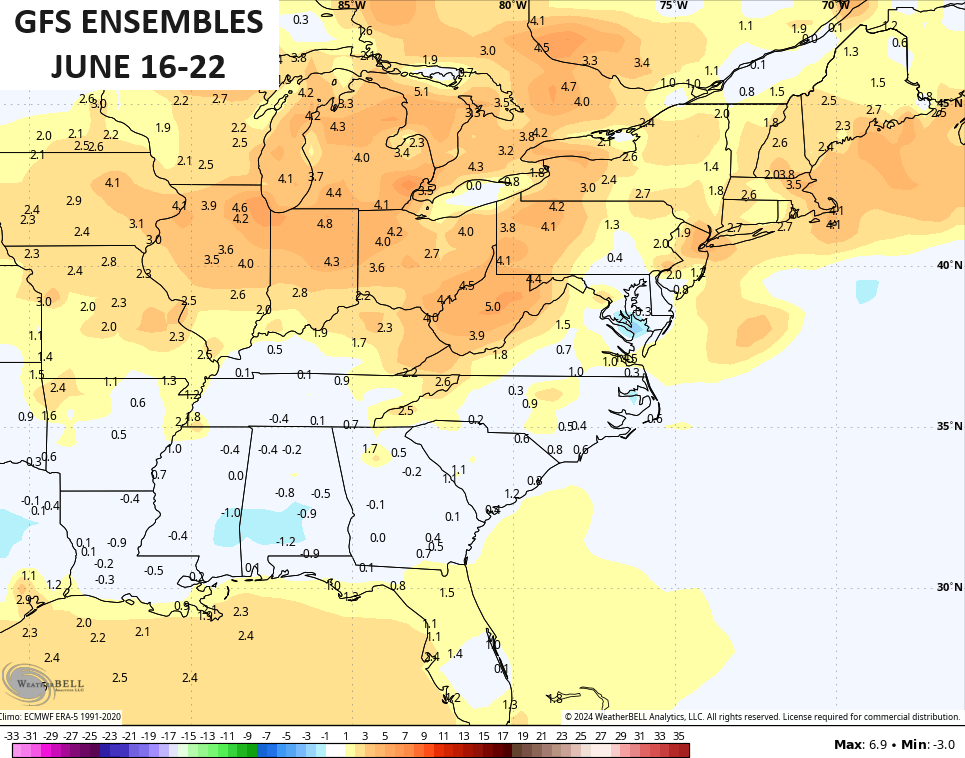
This is because the GFS family is seeing much more of a northward transport of tropical moisture from the Gulf of Mexico. There’s going to be a ton of juice in the Gulf and we may see a named storm or two develop over the next few weeks.
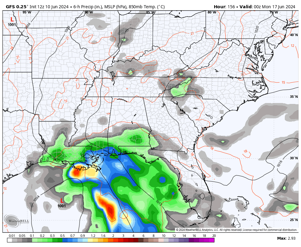
Some of the operational GFS runs bring some decent moisture into our region next week…
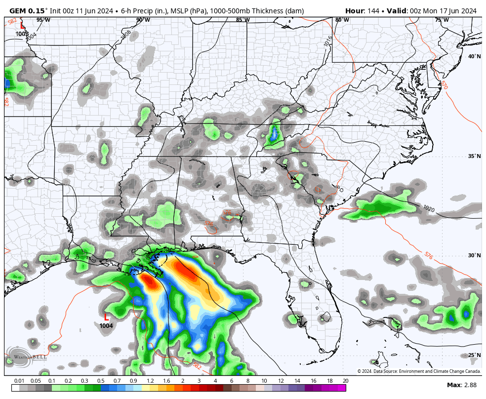
The Canadian decided to partner up with the GFS…
Obviously, that setup would keep our temps way down while bringing high humidity and a better threat for tropical rains.
Weather is so fun to watch, folks.
Enjoy your day and take care.

LOL! I would LOVE for this to be one of those summers when the models see heat and everyone jumps on it… only for it to ultimately be squashed.
I’d love a hot summer.
LOL, I think we saw that happen last summer.
I bet we will see GFS predictions of temperatures running between 110-120 before the summer is over.
Thanks Chris. Weather, indeed is interesting and fun, because it’s constantly changing. By the time we enter next week, we will probably need the rain.
Enjoy this beautiful Summer weather !
Yesterday was the perfect June day.
I am going to try enjoy the outside weather over next couple of days.
Because we might not be able to see comfortably temperatures like today until mid September.
Mid-90s are in the forecast for the Chicago Metro Area for Sunday and Monday.
It’s a gorgeous day today, with plenty of sun and temps in the low 70s with low humidity.