Good Wednesday, everybody. It’s another winner of a weather day across Kentucky and surrounding states as we gear up for a pattern change. Toasty temps, high humidity and the increasing chance for showers and thunderstorms take center stage late weekend into next week.
Today starts in the upper 40s to middle 50s and end in the upper 70s and low 80s for many with the west reaching the middle 80s.
Thursday finds the mid and upper 80s across the entire state with a mix of sun and clouds. Those clouds are ahead of a weak cold front dropping in for Friday, bringing the chance for a scattered shower or thunderstorm…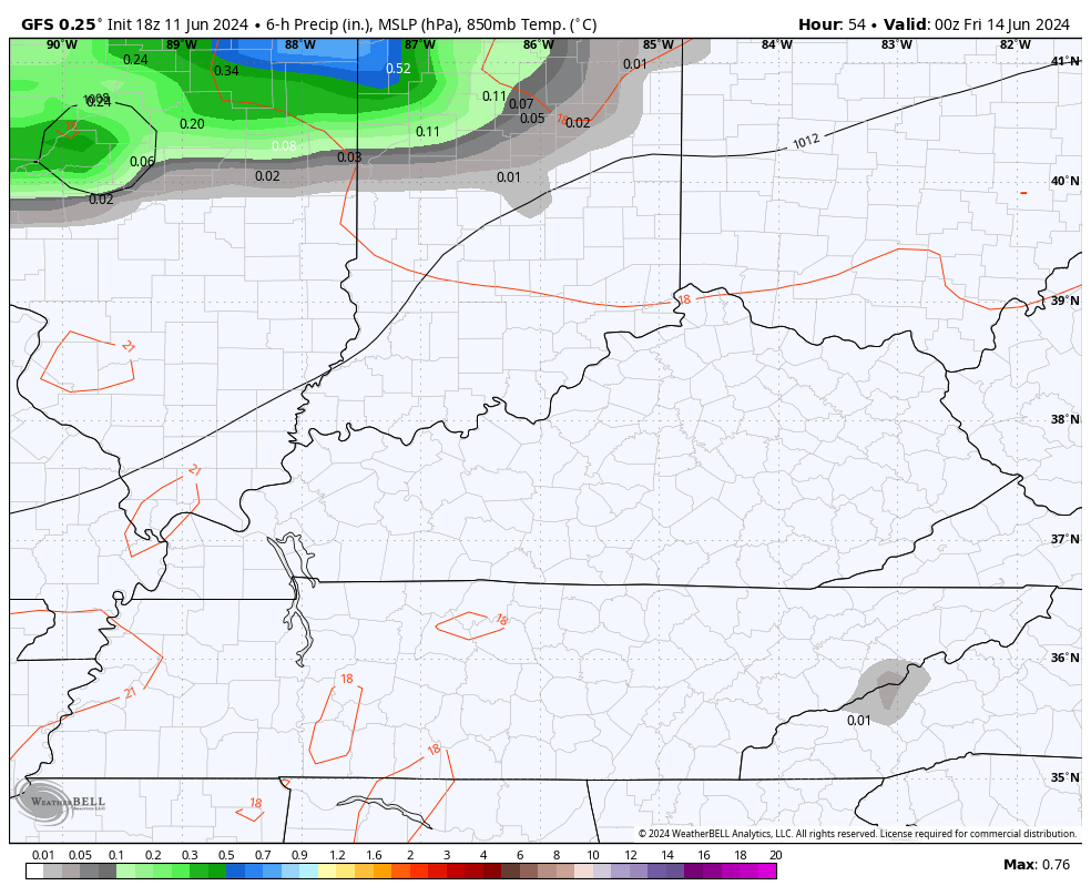
High Friday are back into the middle and upper 80s with a local 90 in the west.
Those numbers slide back down behind the front on Saturday…
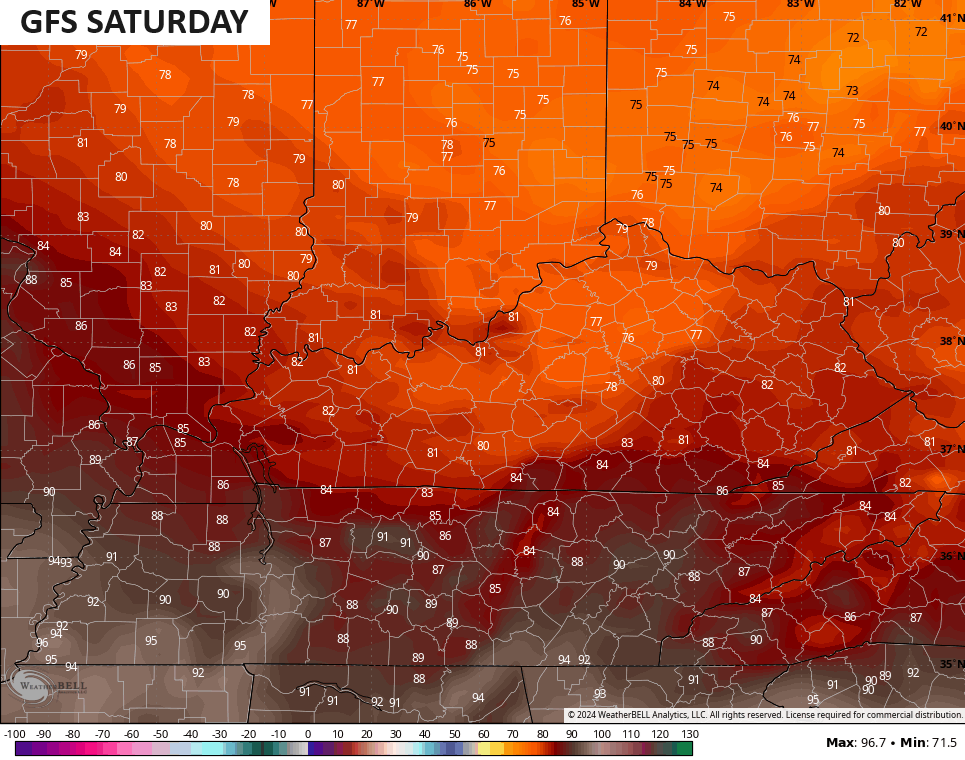
Humidity levels stay pretty low during this time before they start to bounce up Sunday as temps reach 85-90 in most areas.
From here, much of what happens depends on what happens in the Gulf of Mexico. There’s a lot of action blowing up down there and the National Hurricane Center is even highlighting possible development…

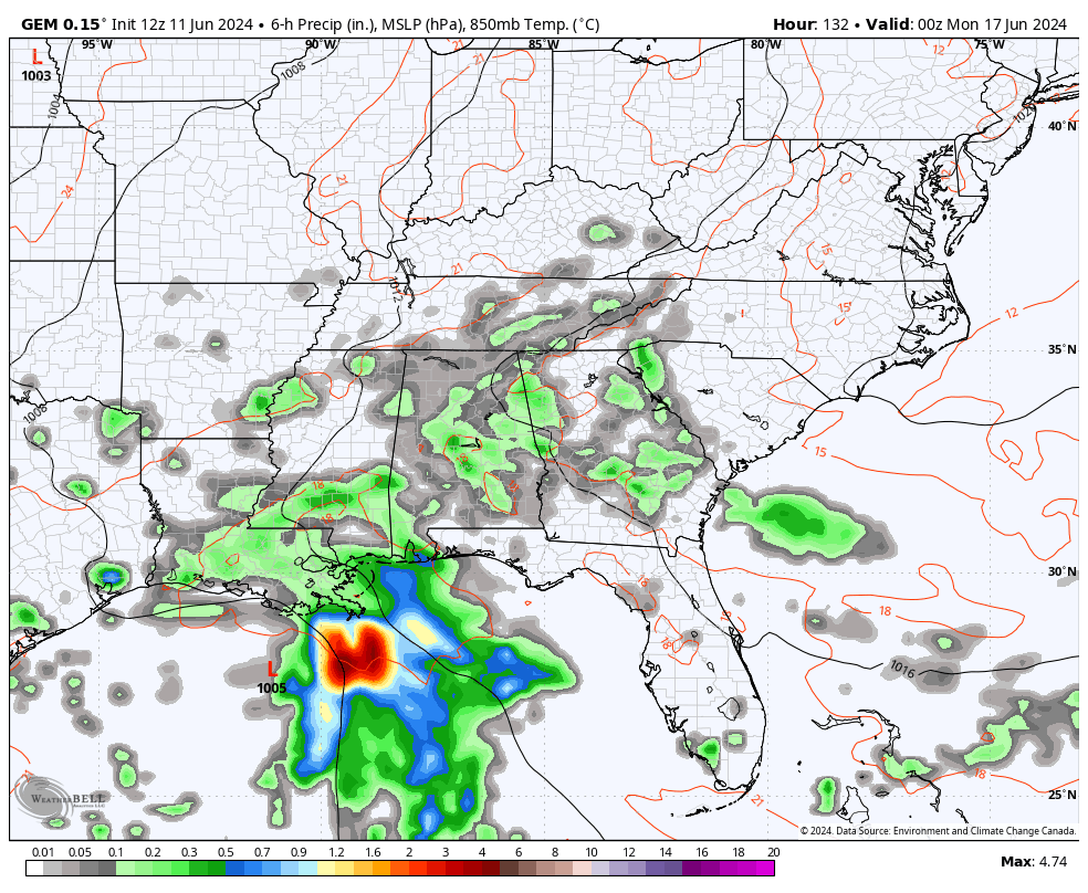
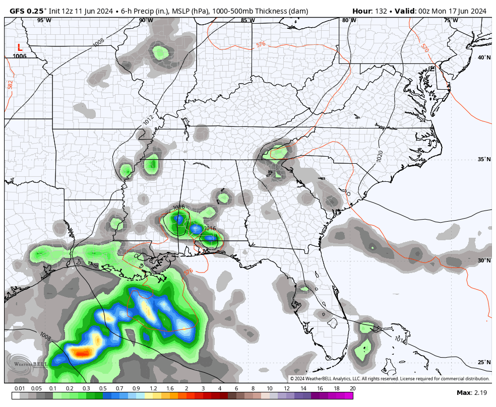
The Canadian and GFS models have been consistently bringing Gulf moisture into our region Monday through much of next week. This would result in super humid air, leading to rounds of showers and storms…
CANADIAN
GFS
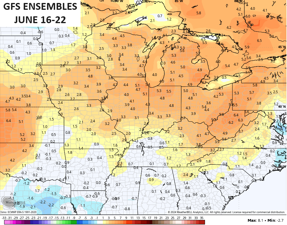
If those models turn out to be accurate, then temps would be held down in our region with the core of the heat staying to our north and west. This is something the GFS Ensembles have been showing for a while…
The EURO Ensembles continue to keep us much drier and, therefore, hotter…

Enjoy your Wednesday and take care.

Go EURO! 🙂
Thanks Chris. Appears the Gulf of Mexico and Atlantic are gearing up for an active tropical storm season. Hoping the precipitation forecast for next week pans out for our area of the country. Don’t really care for the extremely hot and dry weather. Bad for the crops, that are growing soo well now.
Have a great day everyone !