Good Thursday to one and all. Temps are FINALLY getting back to normal out there today as summer finally starts to show up. We do have a Friday cold front sweeping in before we get into much more of a tropical pattern into next week.
Let’s start things out with what’s going on out there today. Highs are generally in the 80s after we start things out in the 50s. Humidity levels are still low, so this will actually be a nice feeling day.
Our Friday cold front drops in with a scattering of showers and storms along and ahead of it. A few strong storms will even be possible, but not everyone gets rain out of this setup. The models are showing mainly some light amounts…
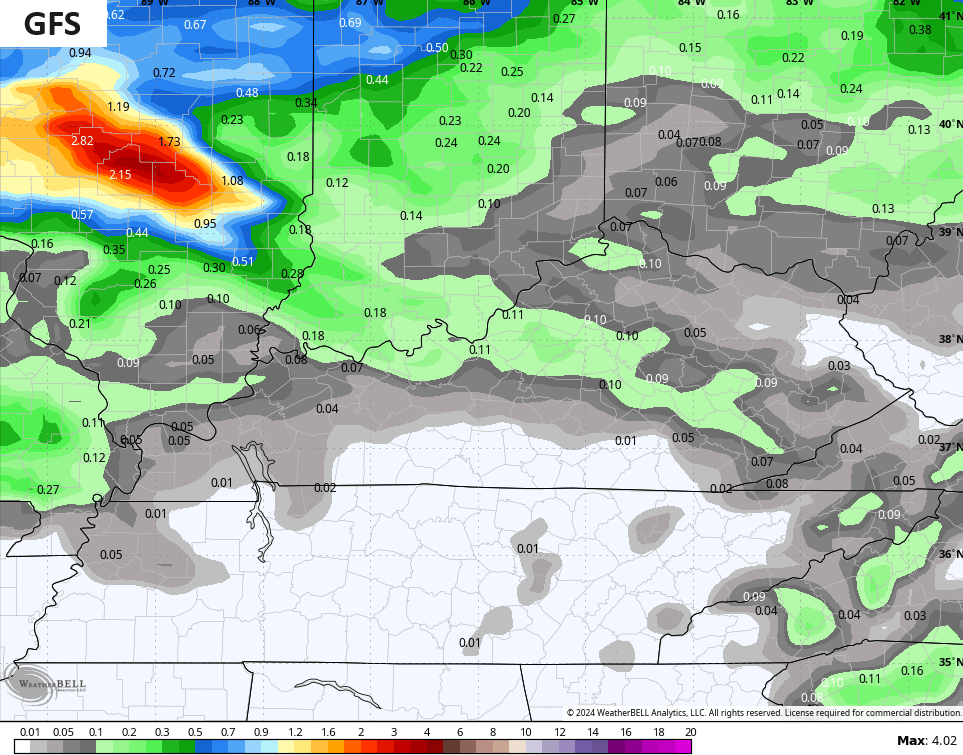
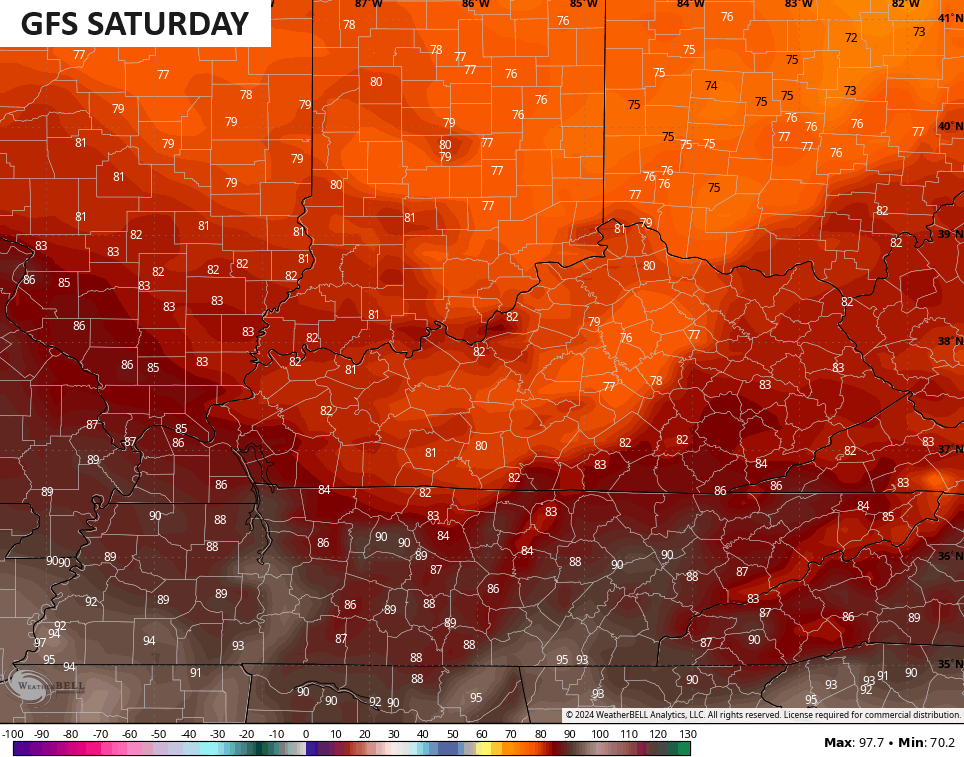
The air behind this front feels really nice with 50s to start Saturday and highs that generally reach 80-85 in most areas with low humidity levels. The GFS is trying to linger some low clouds into some areas of central and eastern Kentucky with upper 70s…
Temps by Sunday are into the mid and upper 80s for central and eastern Kentucky with 90 in the west. Humidity inches back up, but it’s nothing we can’t handle.
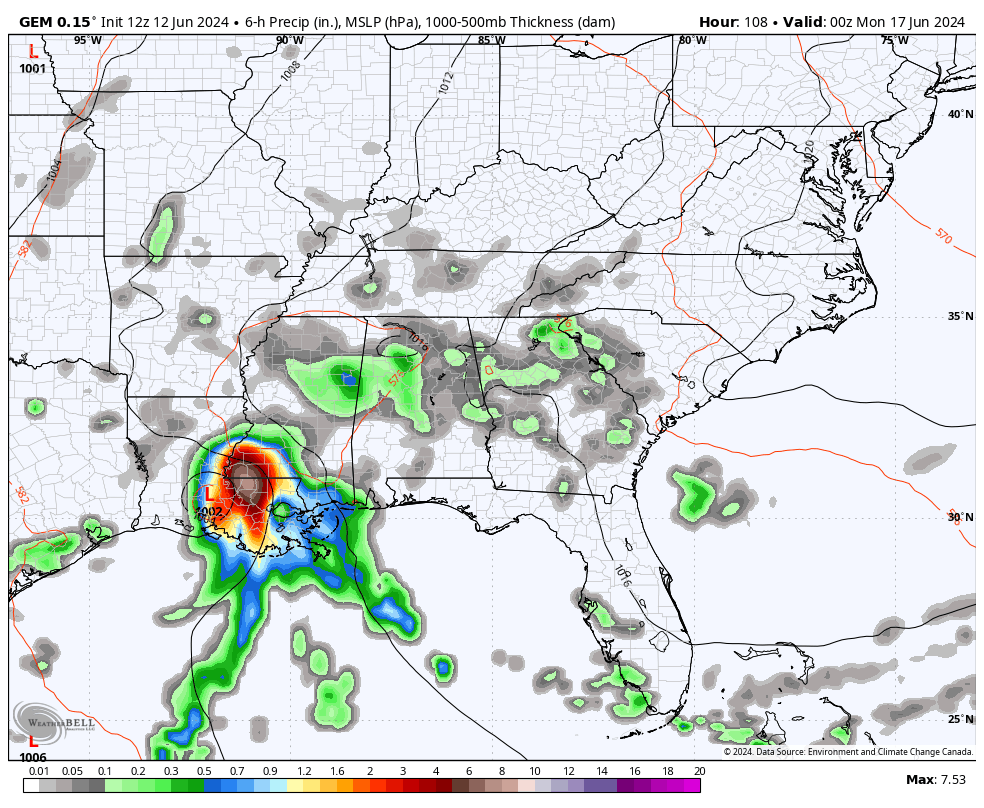
This leads us into a week that will feel very tropical with temps mainly 85-90 for many with high humidity levels. Any day that features more sun than storms can reach the low 90s. We are also likely to see a few showers and storms going up each day. The whole progression of the showers and storms is directly related to what all happens in the Gulf of Mexico.
I’ve been highlighting this time period for a while now and the National Hurricane Center is now showing two areas of interest for possible development…

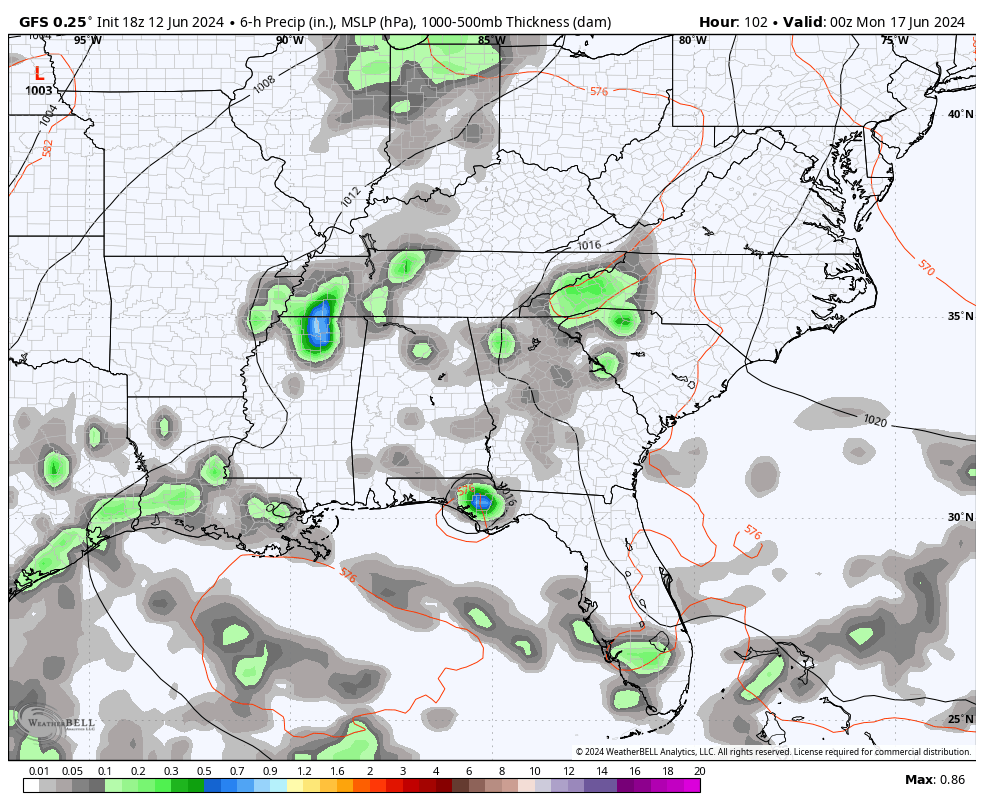
The Canadian and GFS models have been insistent upon moisture from the Gulf winding up here in our region starting Monday…
CANADIAN
GFS
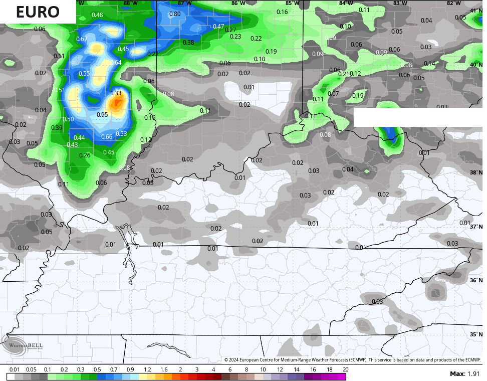
The EURO has essentially no rain at all next week and has highs in excess of 100 degrees on multiple days. Yes, this is the same EURO that said we would hit 115 last summer. It has some serious temperature issues.
Enjoy the day and take care.

Somewhere in between the GFS and EURO would be nice.
Jeff looks like you may get your Hot days me I like the mild but it’s that time!
Thanks Chris. A series of dry ” cool fronts ” have been invading our area of the country this past week, but now a change to the climate of warm to hot days and warm muggy nights, with a daily chance of scattered rain / showers. Our usual Summer weather pattern.
Lots of convection over the past few days in south Florida. Many areas flooded. The Gulf and the Atlantic are explosive. With a negative PDO ( La Nina ) has me very concerned for a very active Tropical storm season.
Have a great day everyone !
Yes what’s going on with all the Florida flooding???
Crystal, a lot of convective distrubances in the southwest Gulf moving over south Florida. My older sister and Brother in Law are right in the middle of where the floods are occurring. I have a Zoom meeting with them tomorrow.
HEAT and subsequent RING OF FIRE pattern coming late June into July.
Oceanic analogs would indicate an increased threat of #Derechos this Summer following an already active spring.
That’s what one may expect in a negative charged Pacific.
Here’s the IR satellite showing the convection over the Gulf into Florida :
https://www.meteo.psu.edu/ewall/SAT_US/animir.html