Good Sunday to one and all. It’s another gorgeous weather day in the Commonwealth as all weather eyes turn toward Beryl down in the Gulf of Mexico. This storm becomes a hurricane again as it targets Texas with the possibility of the remnants impacting us in the week ahead.
Beryl is barreling toward the Texas coast today and it’s doing some flexing down in the Gulf of Mexico…

Take our exclusive interactive radar out for a spin and go right down to street level in Texas to track this storm. You will also be able to get live storm chaser streams embedded within the radar…
Hurricane Warnings are out for much of the Texas coast as this storm makes landfall overnight or early Monday. The storm will then bend toward the northeast once it gets over land with a track from Texas to the Ohio Valley likely through Thursday. The exact track remains uncertain, and you can see that with the super wide cone from the National Hurricane Center…

An inland track like that is VERY unusual for a storm hitting Texas. If we look back through recorded history, we find 50 tropical or extratropical storms have moved across Kentucky. Most of those come from storms hitting east of the mouth of the Mississippi River…
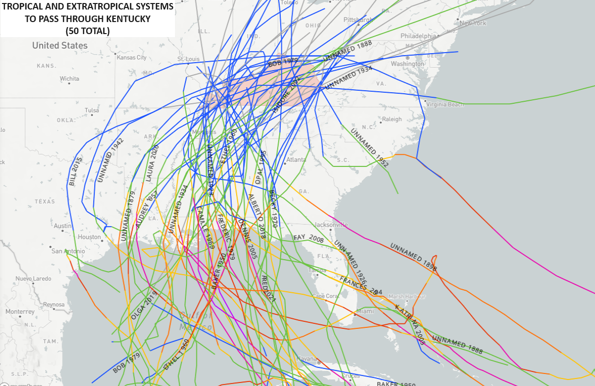
The lone hurricane on record to hit that far west and move across Kentucky is Harvey from August of 2017…
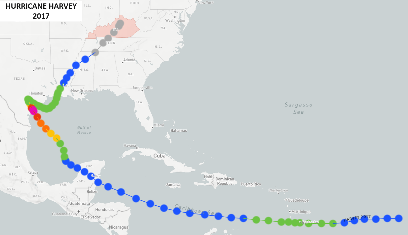
That track through the Caribbean, across the Yucatan and into Texas is very similar to Beryl. Harvey had the devastating loop across eastern Texas then made another landfall in Louisiana. This is where the tracks differ.
Still, you can see what an unusual storm Beryl is from a historical track perspective.
Can the remnant low actually make it into Kentucky, though? That’s still the million-dollar question. As of now, the favored area of the state to be impacted by this storm is the west and north.
Many of the hurricane model forecasts are in this region or just west of the Ohio River…

Here are the GFS Ensembles…

And the GEPS…

The GFS has the farthest west track with only a minimal impact on our weather…
The NAM is quite a bit farther east with a track right across western Kentucky…
The Canadian family is even east of the NAM. Here’s the Short Range Canadian…
And the normal Canadian…
The inland track comes down to a trough across the Plains states and just how it interacts with Beryl. Where does it turn this system to the northeast? That will make all the difference in a healthy impact verses a minimal impact on our weather.
I may throw you guys another update later today. Make it a good one and take care.
