Good Saturday, everyone. Scattered showers and thunderstorms are pressing into the region once again as our pattern begins to skew much wetter than what we have seen over the past several weeks. A flow from the southwest looks to combine with a stalled boundary to help us out over the next week.
Temps out there today are back into the 80 to 85 degree range for many, which is still really nice. A few rounds of showers and storms will be noted for some areas, especially across eastern and southern Kentucky.
Locally heavy rains will be possible in these areas. Here are your Kentucky Weather radars to help you through the day…

Additional showers and storms will roll in from the south and southwest on Sunday. The showers and storms will target a little farther west into central Kentucky.
The NAM shows this well…
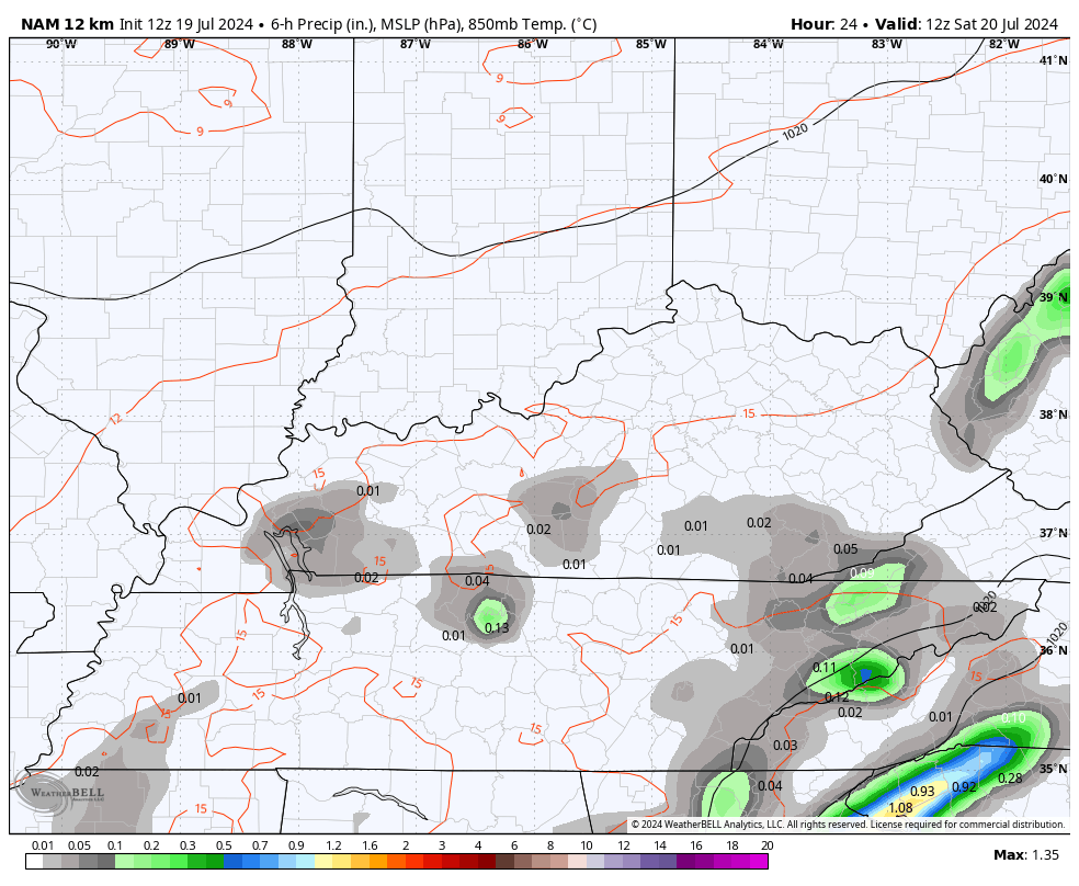
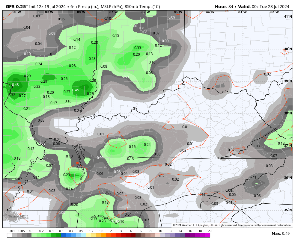
Additional rounds of showers and storms then funnel in from the south for the week ahead. The heaviest totals will show up in the south and southeast…
Make it a great Saturday and take care.

Just received the notification that my power bill was ready… I reluctantly went to look at it thinking it was going to be OUTRAGEOUS….. To my shock it was only $234… That’s definitely higher than what it usually is but in my mind I was expecting it to be much higher.
Mine is only $142
Richmond getting a good drink of water this morning, but hopefully the afternoon is dry so I can do outside chores.
Thanks Chris. Still waiting on that good soaking rain. This has been the driest Summer ( here in Maple ) since I’ve moved to Kentucky 16 years ago. Maybe some changes in the upper atmosphere, but I couldn’t find any on my various weather sites. It is looking like Summer weather may be with us through the Autumn months ? I hope not, as I’m a Fall and Winter ( lots of snow ) type person.
Good afternoon to everyone !
Good afternoon to you Schroeder. We were getting concerned since you haven’t posted in a while so it’s good to see you back with us!
Thanks Dottie for your concerns. I’m fine, just been occupied with matters around the home. I will be back posting more often when interesting weather occurs.
I’ve heard a CPC forecast of above normal temps for August.
It’s up to mother nature Jeff. As we heading down the last part of summer and day light is getting shorter by each day. Ole man winter will be here before you know it