Good Monday to one and all. It’s the last full week of July and we are starting things out with more in the way of scattered showers and storms. This is becoming a common pattern across the state and that remains this week as our temps check in below normal.
Just like what we had over the weekend, periods of showers and storms will be coming at us from the south and southwest today. Any of these storms can put down torrential rains that can cause local high water issues.
One or two storms may even pulse to severe levels for a hot minute.
Here are your radars to follow today’s rain makers…

Additional showers and storms come at us each day this week, but that does NOT mean it rains at your house each day. Y’all got that? Good.
All of this comes as an upper level system hangs from the Ohio Valley into the lower Mississippi Valley and southern Plains states. The 5 day average 500mb height anomaly map shows this well…
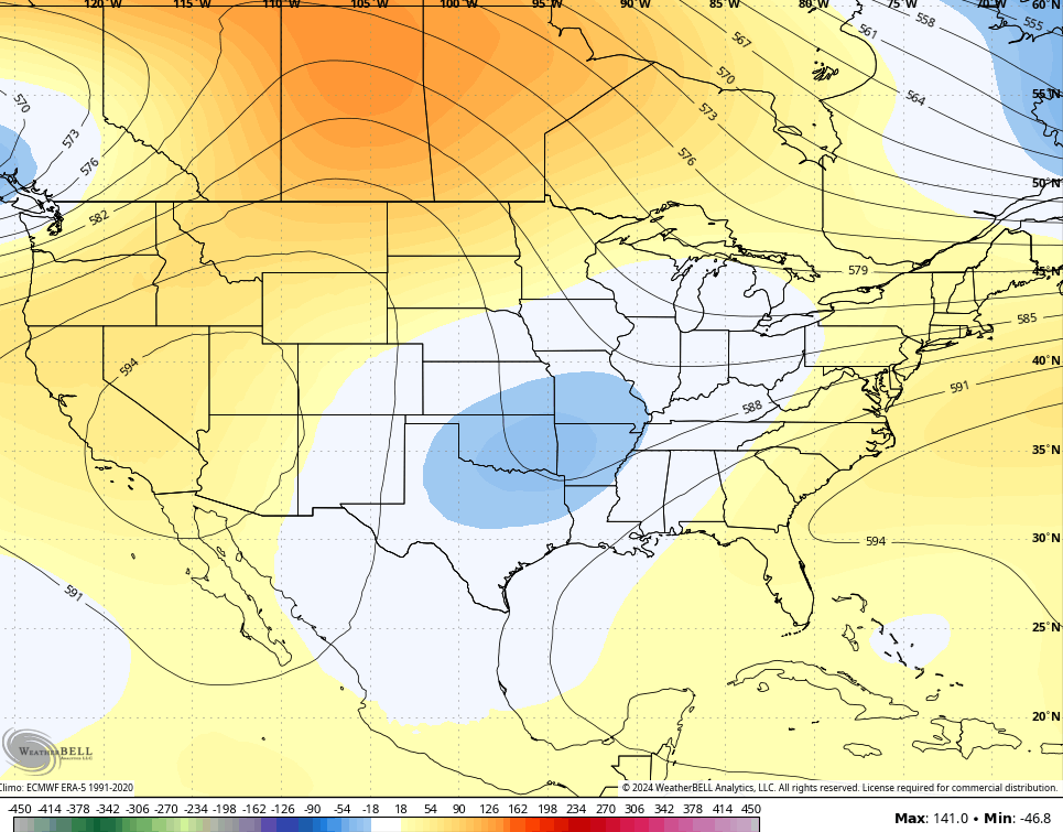
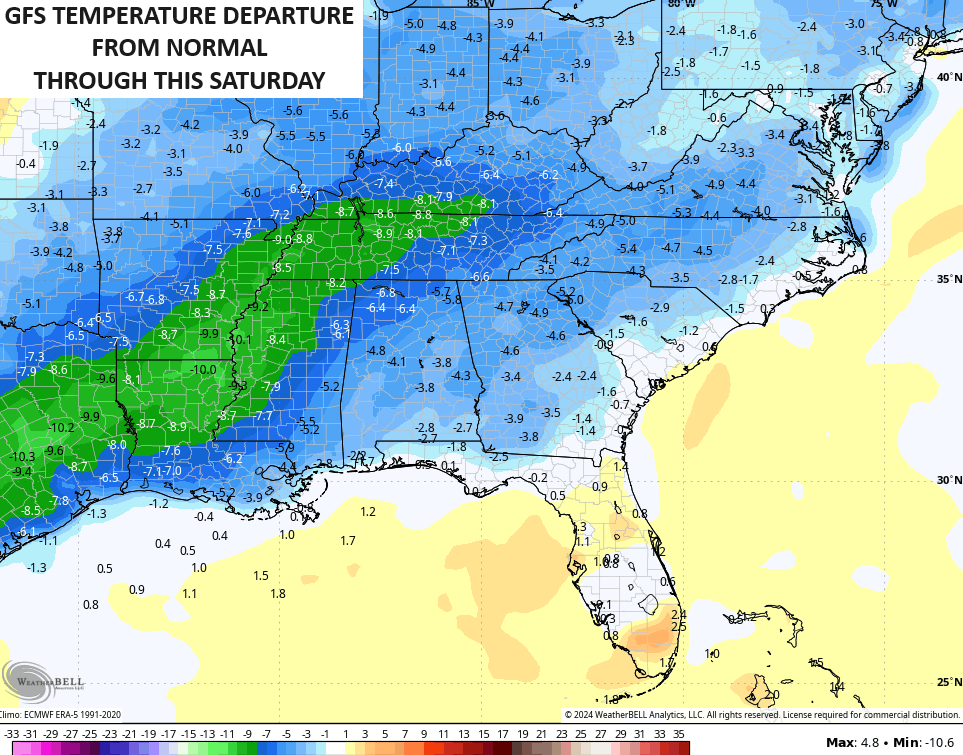
That’s not exactly a very Summer-like looking pattern and the end result is much cooler than normal temps through the week. Those 5 day averages are impressive for the eastern half of the country…
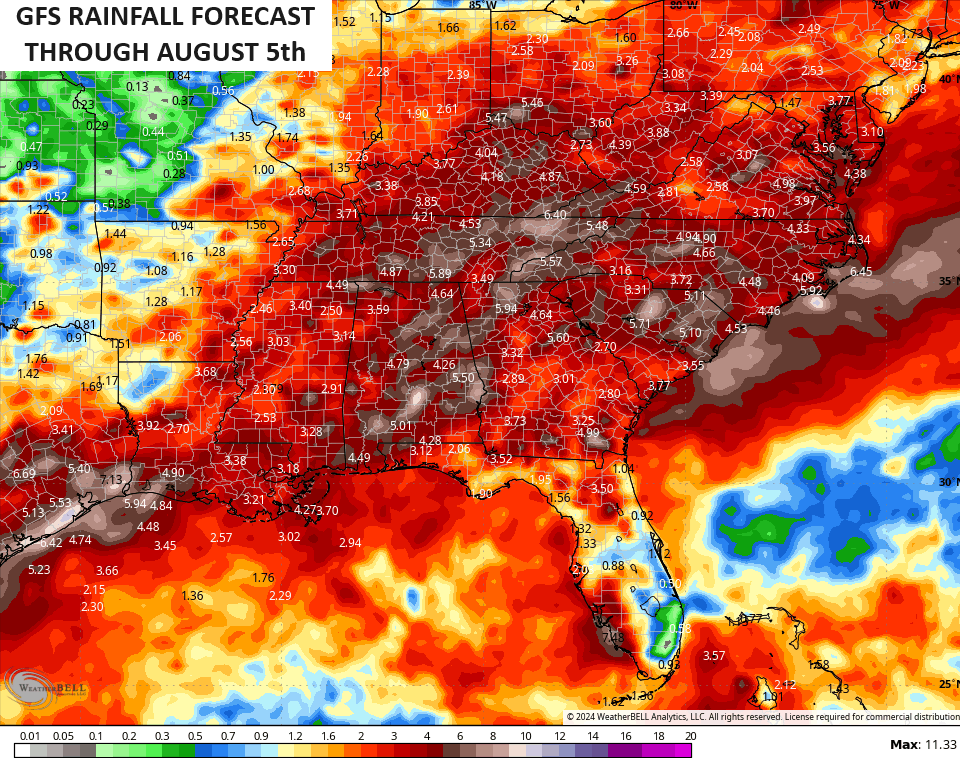
If you recall, the EURO Weeklies from 2 week ago starting locking onto a wetter pattern and the operational models are showing this well. Here’s the GFS for the next 2 weeks…
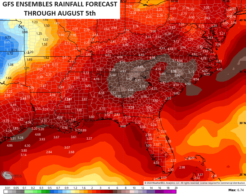
The smoothed-out averages from the GFS Ensembles show this similar look…
Have a happy Monday and take care.

Temperatures are not “much” below normal at all.
I don’t blame you for trying to make it clear that it doesn’t mean it will rain where YOU are… got that? Because it’s true… some areas might get through the week with no rain
Richmond got soaked this morning. Very much welcomed.
This morning saw the first soaking rains we’ve had up in NKY (CVG) in months. Before that it was storms 5 miles to our north, storms 5 miles to our south, but we stayed dusty dry save for a few sprinkles.
A strong thunderstorm moved through Warren County around 2:30 am this morning, dropping 0.38 inches of rain in the Bowling Green area. That brings our July rainfall total to 7.20 inches. Nearly half of that total came from a series of storms that trained over the area on the 17th, and we were fortunate to benefit from some small storms, spread across several days.
Thanks Chris. I had about a half inch of light rain early this morning. A very small start to ending this awful ‘ pocket drought ‘ in my area of the state. The GFS model is well overdone in their temperature and rainfall predictions in my opinion. In the words of the late great Marcia Yockey ” Those that got get and those who don’t won’t. ” Very true this Summer.
Enjoy the day everyone !
She had some wisdom words that for sure Schroeder. Glad to hear from you.
Thanks Winter Lover. I believe we are the only weather commentators that remembers the late and great Marcia Yockey. I watch her weather presentation all through the 1960’s and 70’s, and no one in today’s world has ever match her accuracy. She had the hand drawn weather maps that were a work of art. Now days it’s just a computer game.