Good Tuesday, everybody. It’s another day of showers and thunderstorms roaming about the region, bringing some much needed rains. This is pretty much a pattern that’s on repeat for the rest of the week with the chance this continues for a few more days.
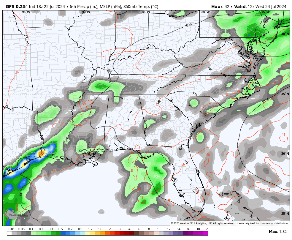
Storms Sunday night and Monday put down 1″-3″ of rain in some areas and today’s storms have the potential to do something similar. The greatest concentration of showers and storms will likely be across the east and southeast.
Here are your Kentucky radars to get you through the day…

Outside of storms, temps are in the 80s with a mix of sun and clouds.
Scattered stuff continues Wednesday ahead of a front dropping in from the northwest later Thursday and Friday. This boundary will give us an uptick in the coverage of showers and storms as it sinks toward the Tennessee Valley…
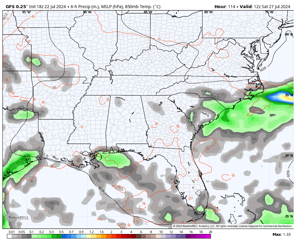
That boundary then slowly comes back to the north over the weekend and brings another chance for showers and storms. That boundary then hangs around into the first half of next week with storm chances likely continuing…
Again, this does NOT mean you get rain every darn day, but we will, at least, be tracking it.
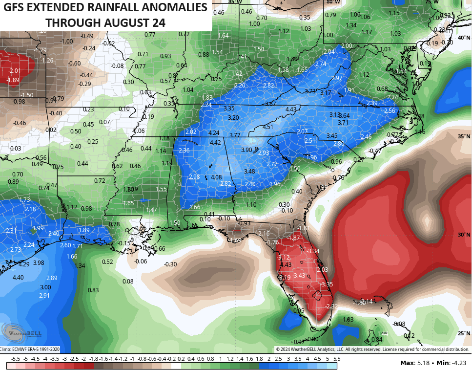
The new GFS Extended continues to point toward above normal rainfall through much of August…
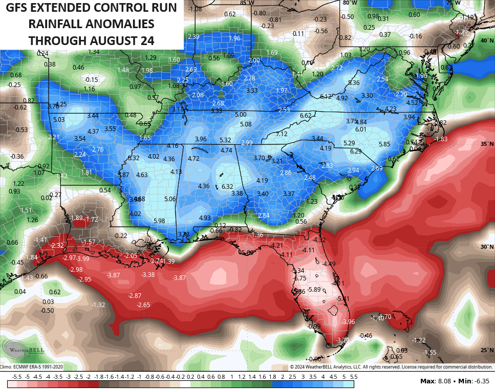
So does the Control Run…
Have a terrific Tuesday and take care.

Thanks Chris. It will be very difficult to track ‘ scattered showers. ‘ We are having a very foggy morning here in Maple. At lease that is some available moisture.
Make it a great day everyone !
Been watching rain slip by to the south and east. Today’s models suggest more of the same. ¯\_(ツ)_/¯
Warmer temperatures are on the way for the remainder of July and into the start of August with excessive heat possible in the Northern Plains.
Looking ahead to the fall months, pattern drivers are indicative of temperatures staying much above average!
Write it down!