Good Wednesday, everyone. Our broken record of a forecast continues out there today with more in the way of scattered showers and storms. The pattern does change a bit by the weekend before we go into a stormier setup by early next week.
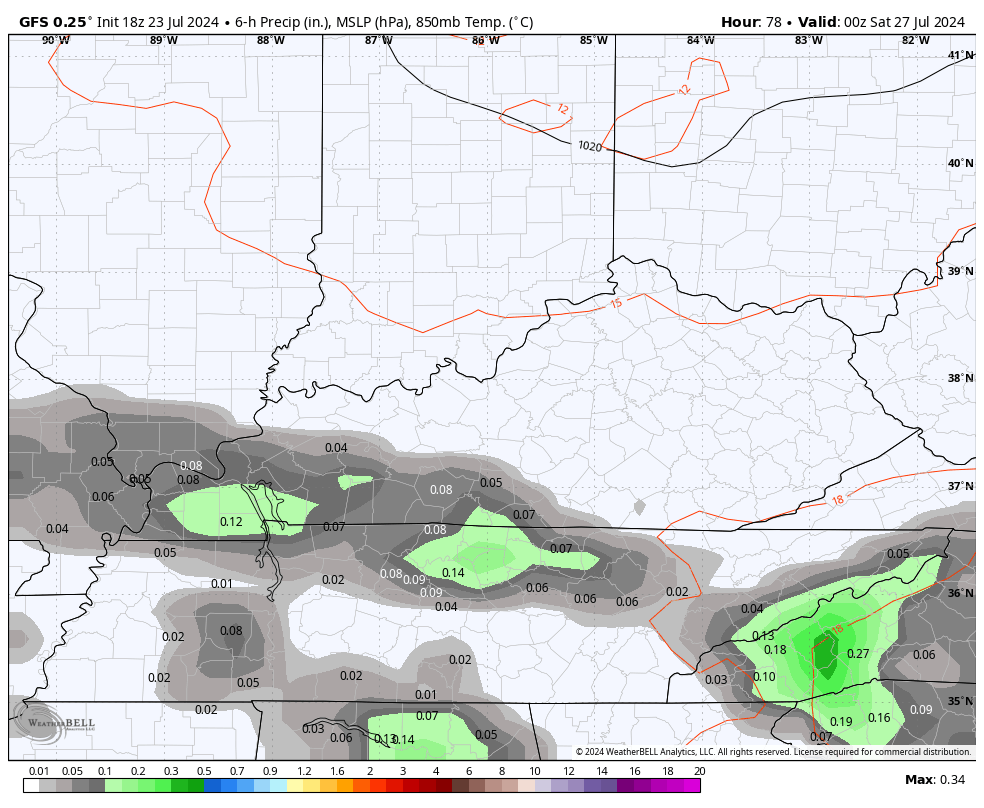
Showers and storms over the past 3 days have put down some big time rains across the region. While not everyone has received heavy rains, many areas have picked up a general 1″-3″ during this time and we have more today.
These showers and storms will be more prominent across the southeast and this is where the heaviest rains show up. Farther north and west, the action is much more scattered.
Here are your radars to follow along…

Showers and storms will be scattered again on Thursday as a cold front drops in from the northwest. This boundary slides in from the northwest Thursday night and moves into Tennessee for Friday. That gives us drier skies than anything else on Friday with just a small storm chance in the west and south.
That same trend continues into Saturday before the threat for scattered storms slowly builds back to the north by Sunday. Here’s a look at the GFS for the weekend…
This leads us into a pattern that features a heat ridge going up to our west into the Plains States. This puts our region on the eastern side of this and that’s an area where rounds of thunderstorms like to crank…
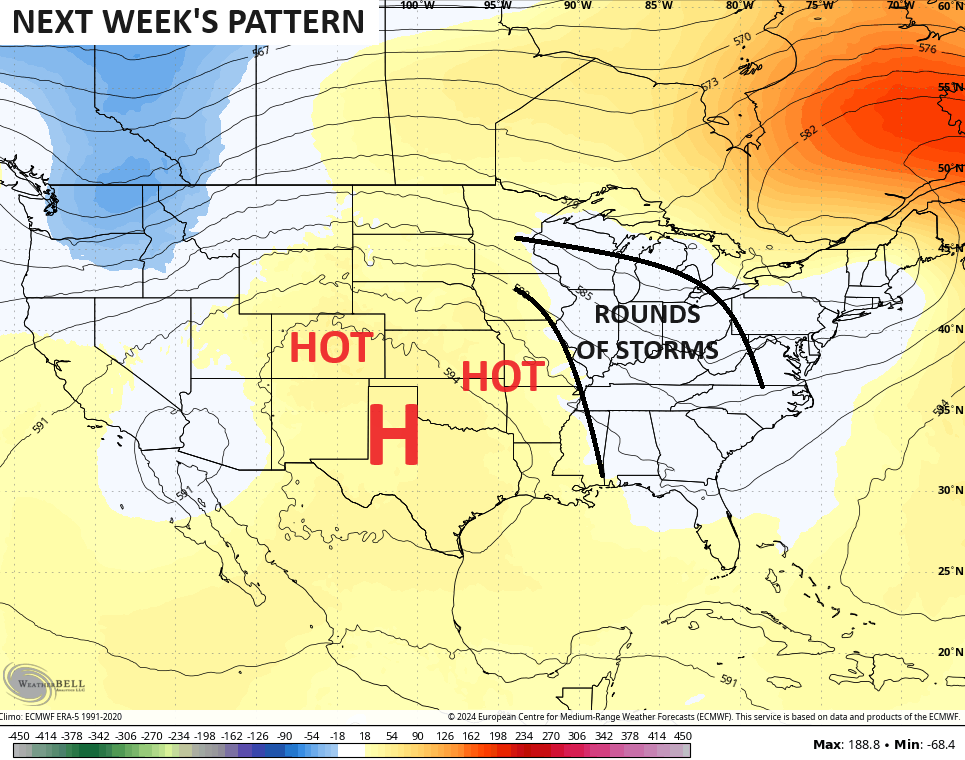
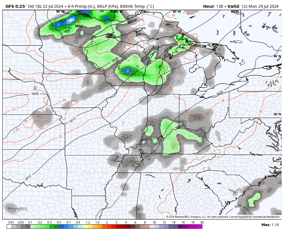
Northwest to southeast thunderstorm complexes are a good bet during this time. Storms like these tend to be loaded with lightning and torrential rains and, sometimes, big winds. Here’s the GFS from Monday through next Friday…
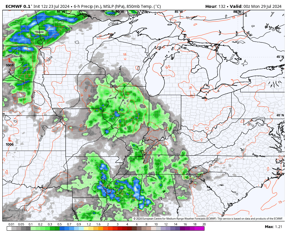
The EURO doesn’t go out as far, but has a similar look…
Have a wonderful Wednesday and take care.

We already have had a ring doorbell for AGES… but we put up two more at the side of the house…. Looking at the yard from that higher angle is depressing the yard looks like a field of brown straw… I mean, we’ve had a couple of decent showers.. maybe 1/2 inch each time… but it seemed to have done NOTHING for the yard at all. Usually it will green up really fast..
Mark, the lawns have gone dormant for the year. If you want a luxury green lawn you have to irrigate every three days. For most people that’s quite an expense. I don’t irrigate any, except the one Rhododendron I have in my yard. Last month’s water bill was 70 dollars. The highest water bill I ever payed since I lived here in Kentucky.
Thanks Chris. The large high pressure in the southern plains is just an amplified extension of the large Bermuda high in the Atlantic. In between ( our area ) there is a weak trough with a northwest flow. It’s been the same weather pattern since the beginning of Summer. In my local forecast through the rest of July the temperatures look to be near normal, but the precipitation will remain scattered with the same areas of the state that have received good rains this Summer will continue to be wet. In times of the past we always see changes in the upper levels ( cold fronts moving farther south ) in mid to late August. I hope this happens for the cooler and wetter, but with the increasing chances of ENSO / La Nina for this Fall and Winter, I have my doubts.
In the Tropics the depression of storms may be due to Saharan dust in the upper levels of the atmoshere, but this may change as we get closer to the end of next month.
That’s my take on the weather. If I need to be corrected please let me know Chris, as I’m still learning meteorology.
Have a great day everyone !