Good Thursday, everyone. August is off and running and it’s a carbon cop of the final few days of July. More in the way of strong to severe storms rumble through the region today and this may cause additional issues.
Severe storms on Wednesday knocked down trees and power lines across much of the state. That was courtesy of two huge complexes of storms that swept across the state from northwest to southeast.
Guess what? We are likely to see another complex or two of strong to severe storms sweep across the state once again today.
The Storm Prediction Center shows another risk on today’s Severe Weather Outlook…

Just like the past few days, damaging wind is the greatest threat with any of the storms out there today. Here’s a breakdown of the various threat levels from the Storm Prediction Center…


This threat continues into Friday. Here’s the Severe Weather Outlook for those days from the Storm Prediction Center…

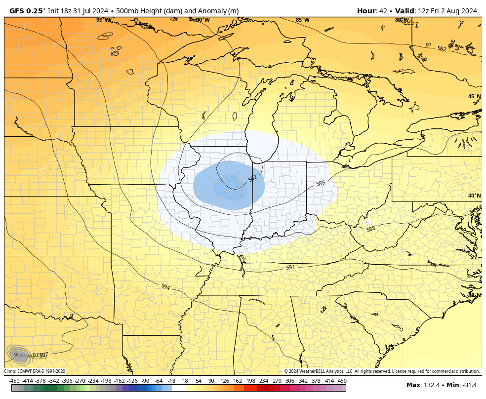
A big upper level system spins in here for Friday and into Saturday. This likely brings more in the way of showers and storms spinning around it with the potential for a few more strong storms and heavy rains.
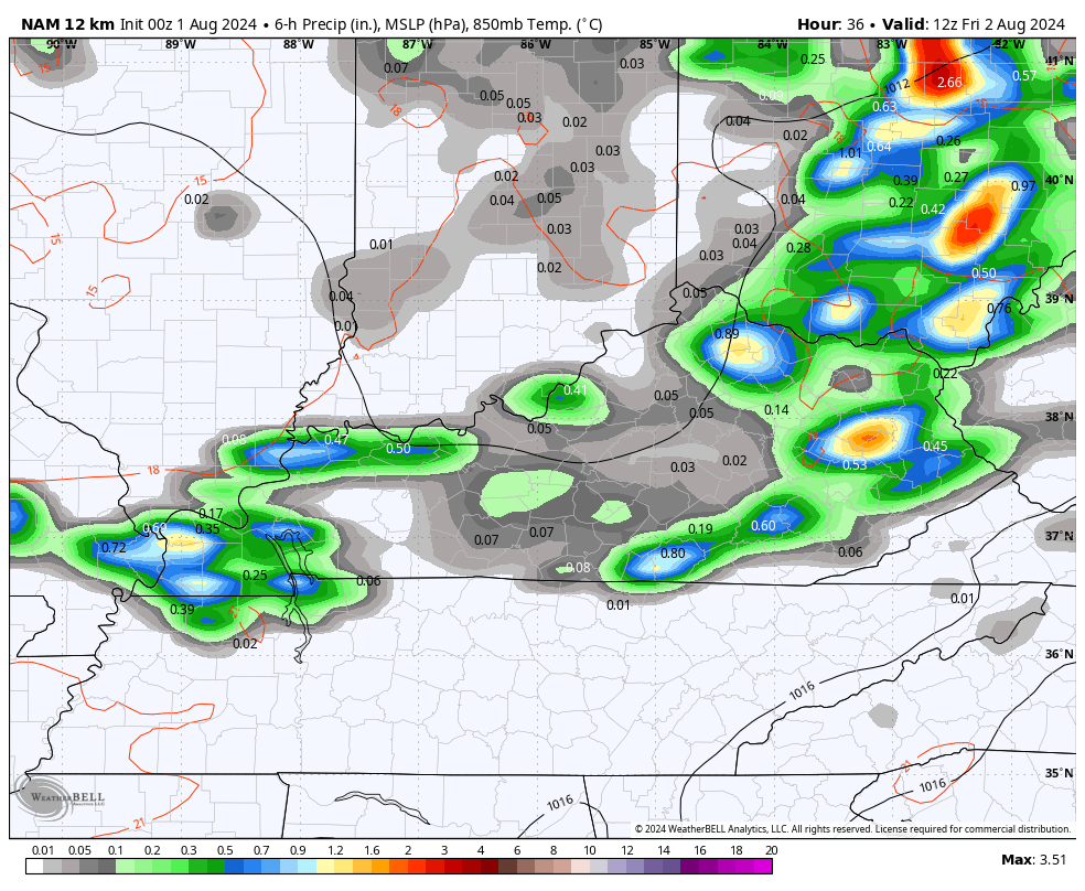
The NAM is really jazzed up with the Saturday rainfall across the eastern half of the state…
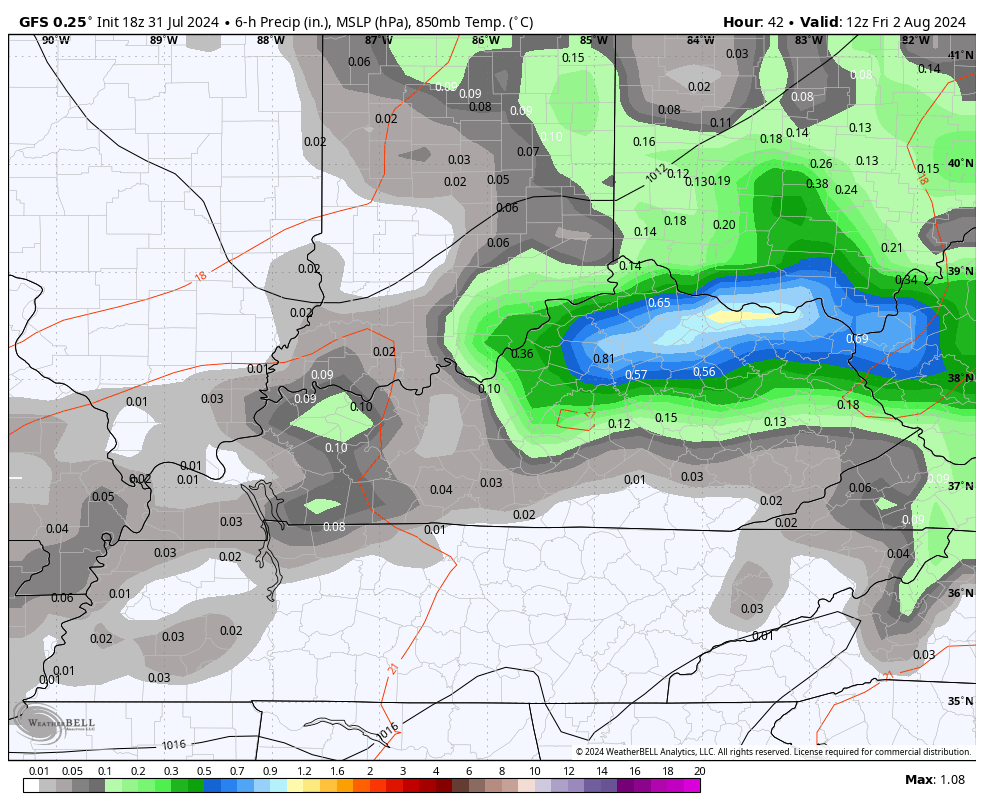
The GFS also has some pretty good rains over the course of those two days…
Here’s that upper level system dropping in…
Temps should rebound early next week as skies dry. From there, we will need to keep watch on a possible tropical system developing near Florida. This is something the National Hurricane Center is keeping a close eye on…

Does this system get into the Gulf or does it hang off the southeastern seaboard? That’s a good question as it may be spinning when a deepening trough gets into the eastern half of the country.
As always, I leave you crazy weather kids with all your storm tracking tools…


Current watches

Possible Watch Areas

Have a great day and take care.

We need a break from the rain.
That may happen if the high pressure to our west weakens or dissipates.
Thanks Chris. I received the rain I need. Interesting that my rainfall total for July was 6.00 inches. Hoping the storms later today are not too severe.
Have a great day everyone !
Well it looks like it may be heading my way got another severe thunderstorm warning but that happened yesterday got all kind of watches and warning didn’t get anything it went around us.I am ready for summer to be over the heat was bad today just muggy. My favorite time is fall winter and the great pumpkin lol. I would like a good downpour.
I’m ready for Fall and Winter too Crystal. I don’t like hot and humid weather either. I don’t care for La Nina Winters, but we will have to take what we get.