Good Saturday, folks. We are coming off an incredibly wet week of weather across Kentucky as several inches of rain fell across the Commonwealth. As we kick off the weekend, we are still tracking some scattered stuff as our focus turns toward a tropical system near Florida.
An upper level system drops through the region behind a departing surface low today. This will keep a few showers and storms rolling through central and eastern Kentucky, especially this afternoon and evening.
There’s still enough low-level juice hanging around for some heavy downpours in a few spots.
Your Kentucky Weather radars have had a workout over the past week and they’re still standing strong on this Saturday…

Sunday looks to be a dry day and that hangs around into Monday and Tuesday as temps turn seasonably steamy.
From there, much of what happens may be dictated by the developing tropical system near Florida. You can see this spin coming off Cuba and into the southeastern part of the Gulf just off the coast of Florida…

This will become Tropical Storm Debby later today as it heads toward the big bend of Florida for a Sunday night or early Monday landfall. Can it become a hurricane before it does so? This crosses the state and emerges into the Atlantic early next week. Here’s the latest from the National Hurricane Center…
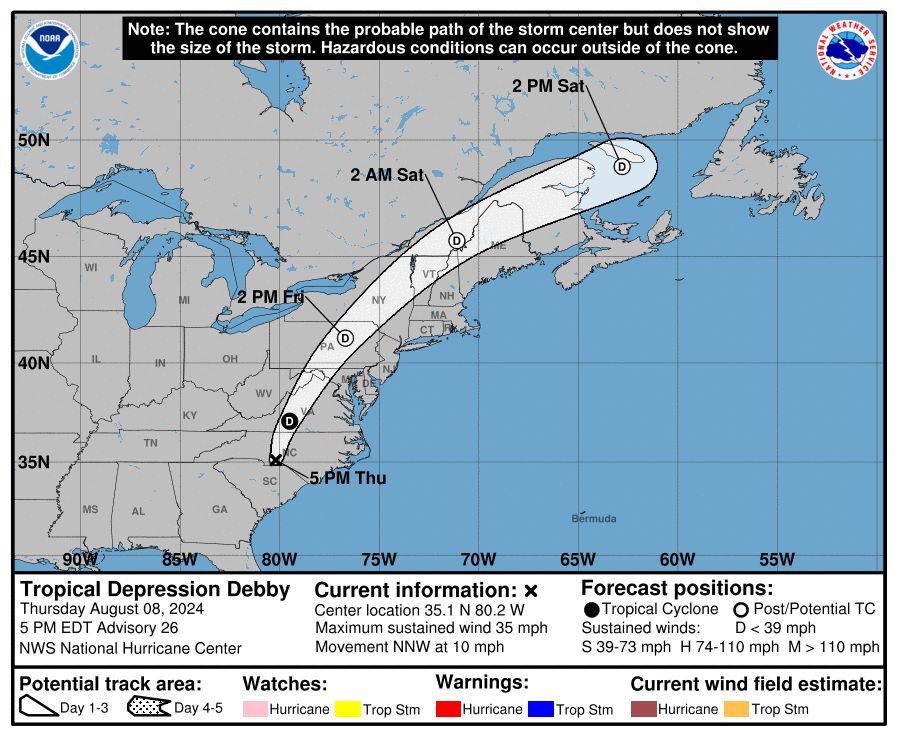
This system slows down along or just off the Georgia/South Carolina coast. This system may even try to loop around for a few days before trying to lift out to the north.
Here are the latest tracks from the Hurricane Models…

Here are the latest tracks from the various members of the GFS Ensembles…
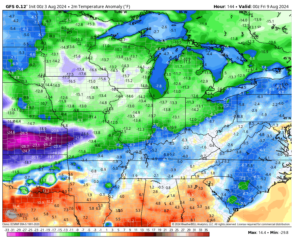
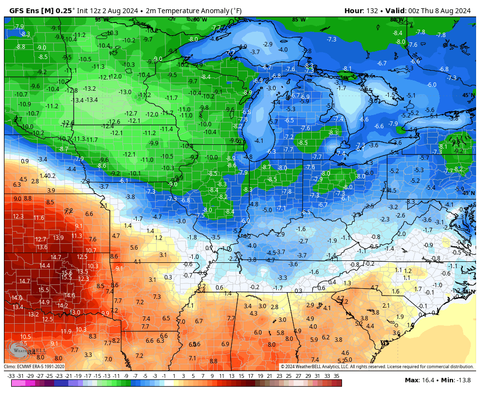
As this system likely lumbers up the east coast, there’s a lot of cooler than normal air waiting to be pulled in behind it. We may get a cold front to settle across Kentucky by Wednesday and this will help usher in this below normal blast.
The GFS shows a healthy blast of cool for this time of year…
The GFS Ensembles are similar…
Have a great Saturday and take care.

Thanks Chris. Since the past seven days we accumulated a little over four inches of very welcome rains. Went from very dry to very wet. What we can expect in ” the new normal .”
Enjoy the weekend Folks !
‘
It’s normal to see some 50s for lows in August, but I’m not buying into any significant chill yet.