Good Sunday, everyone. We finally have a dry day taking shape across the region and it’s the first one we’ve had in more than a week now. While we turn it dry for a bit, we are also focusing on soon to be Hurricane Debby down in the eastern Gulf of Mexico. This system is going to be a super-slow mover!
The rainfall numbers were every bit as impressive as I thought leading into this pattern. Several inches of rain fell with the highest totals across central and southeastern Kentucky…
Yes, there are spots of 8″-10″ showing up.
Where does this put us in terms of normal for the year, so far? The rainfall departures since January 1st are absolutely insane…
There is a huge swath of the state running more than 8″ above normal. Yet, at the same time, there are pockets of the state running close to 8″ below normal across northern Kentucky. This is just another example of the extreme climate we are living in.
Our wet ground comes into play today and over the next few days. Temps generally hang in the 85-90 degree range today with readings nearing 90 for Monday and Tuesday.
Ok, let’s talk about Tropical Storm Debby. This system is spinning toward the Big Bend of Florida and should become a hurricane before landfall late tonight or early Monday. What happens after this is going to be interesting to watch as it likely does some loops across Florida, Georgia and South Carolina into the first half of the week ahead.
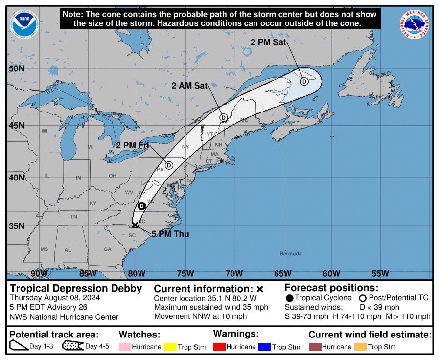
Here’s the latest information and track forecast from the National Hurricane Center…

Here’s the satellite shot of Debby…

All the models are going to struggle with exactly how to handle this slow-moving and looping system, so expect some big changes from run to run. Here are the latest spaghetti plots from the hurricane models…

And the individual members of the GFS Ensembles…

The latest GFS shows how “loopy” Debby might become and even throws a little moisture into our region to interact with a front dropping in from the north…
That kind of setup can cause one major trough to sweep in with much cooler than normal temps…
Our interactive radar will take you right into the heart of Debby where you can also pull up live streams from storm chases in the path of this soon to be hurricane…
Make it a great day and take care.
No, you were a bit off about the pre-Debby numbers.
I thought Chris was spot on too.
In some areas, yes. Just not all.
Chris’s predictions on this Tropical Storm ” Debby ” were right on.
Thanks Chris. Tracking this Tropical Storm ” Debby ” will be very interesting. The changing climate worldwide has intensified all weather events.
Have a restful and peaceful Sunday everyone.
Not really
My area didnt end up gettimg ANY rain from all of this going on the previous week. We’re now in terrible drought conditions. I dont know what the farmers are going to do. Our forecast shows bone dry conditions for at least the next 5 to 7 days. Debby may be the only way we get some much-needed rainfall here.
Same for my county in Northeastern Kentucky. All week long, storms would come barreling at us and fall apart just before they hit my area. A couple of claps of thunder is all I got!
The Canadian and NAVGEM models both show a tropical system in the Gulf (impacting the Yucutan and then extreme southern Texas) around August 10th…
So far this year in the Chicago Metro Area, we are also running above normal with precipitation. At O’Hare Airport so far, 24.77 inches of liquid equivalent precip has fallen, which is 1.87 inches above normal.
At the NWS Forecast Office in the SW Suburbs, 30.01 inches has fallen, which is 4.62 inches above normal for that location.