Good Thursday, everybody. Showers and storms get set to rumble across the region later today into Friday and some of these may be strong or severe. This is part of a pattern that keeps a few storms into the weekend with another blast of September set to follow next week.
Temps today are generally mid and upper 80s for many as humidity levels increase. Skies will be partly sunny with the chance for scattered showers and storms going up this afternoon and evening, especially in the west and north.
Strong to severe storms will develop well to our northwest during this same time and some of these may blow into the western half of the state this evening. That’s why the Storm Prediction Center has a low-end threat for severe weather…

Damaging wind is the main threat from these storms.
Clusters of storms then roll across the state tonight and early Friday before things turn pretty steamy during the afternoon. A few more storms will then fire up later in the day and evening.
Storms tonight and then again late Friday may be strong or severe. The low-end threat for severe storms from the Storm Prediction Center is out for much of the region during this time…

Storms during this time can also put down torrential rains that may cause local issues.
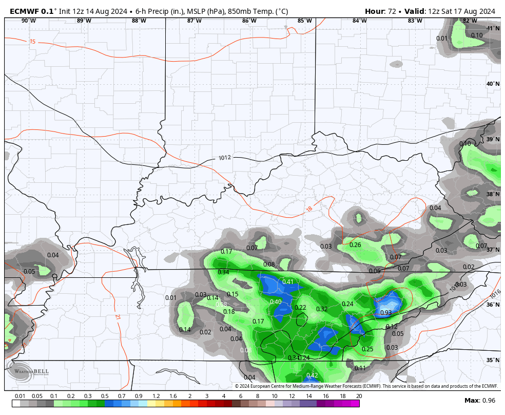
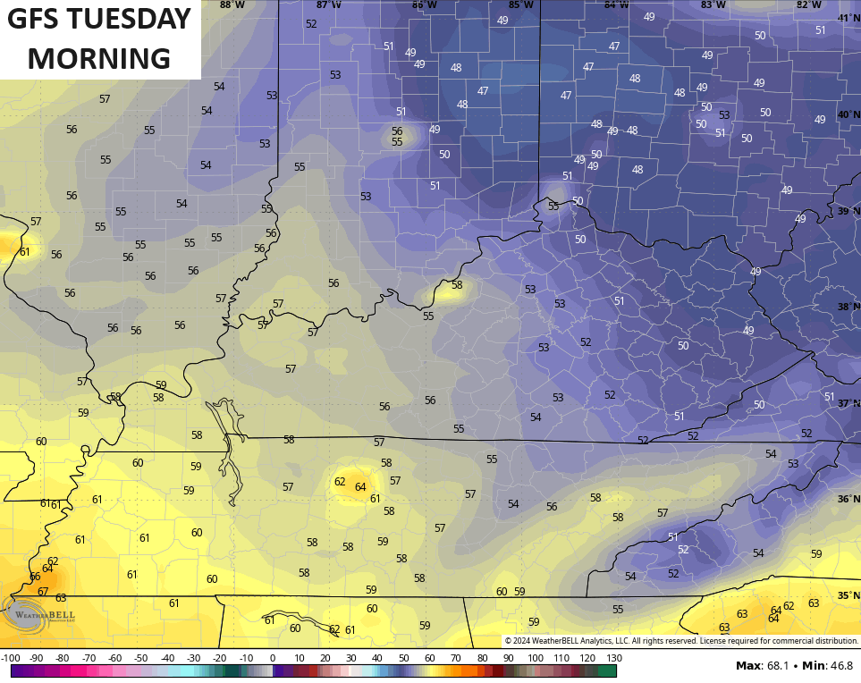
As an upper level low spins through the area this weekend, we will see more in the way of scattered showers and thunderstorms. Here’s the GFS from Saturday night through Monday…
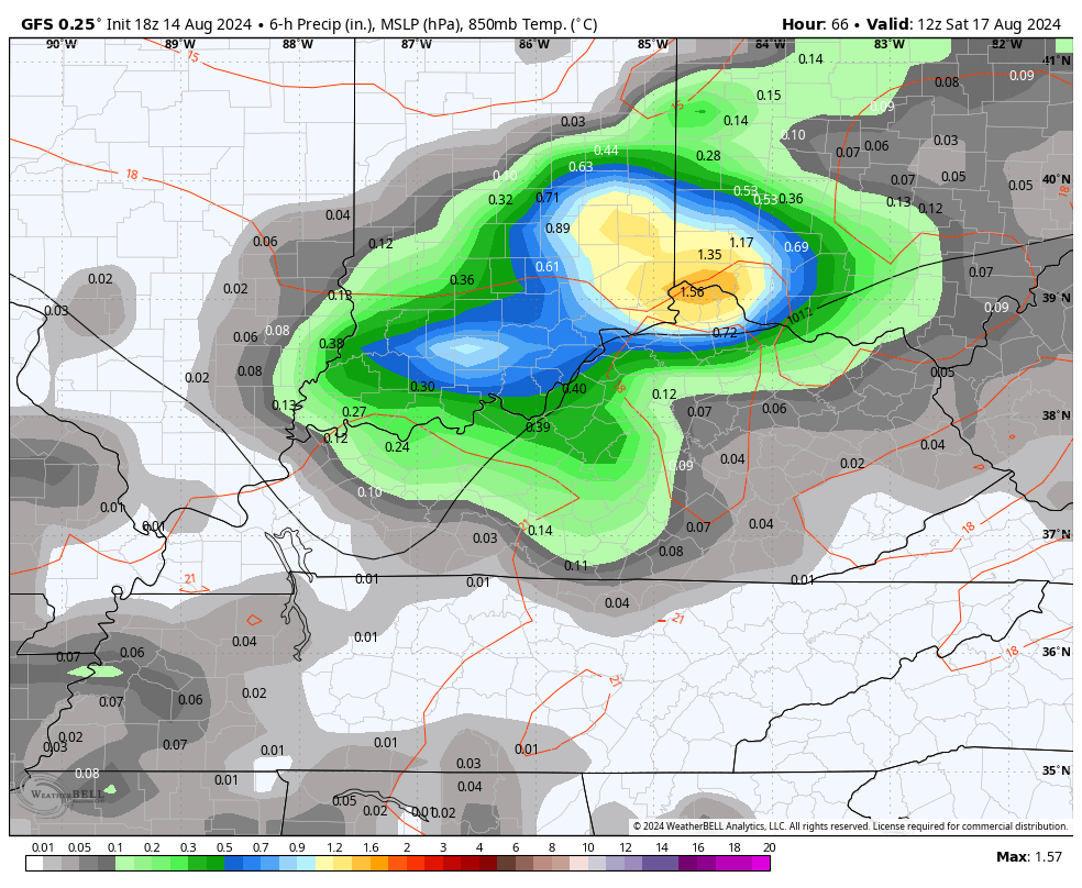
The Euro during the same time looks pretty similar…
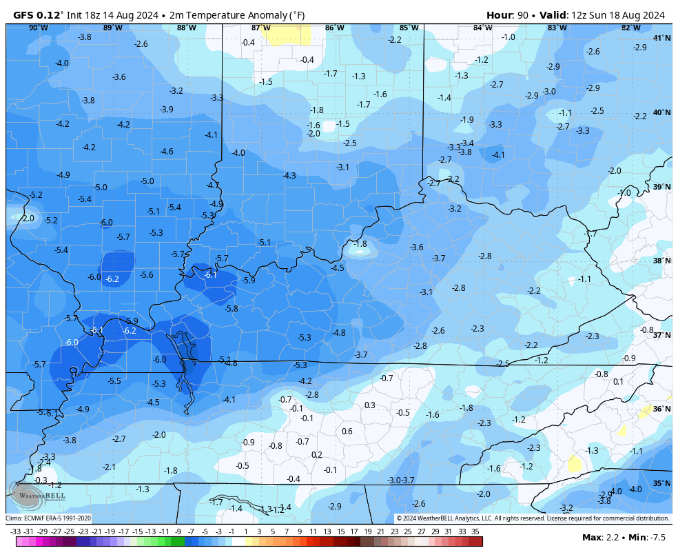
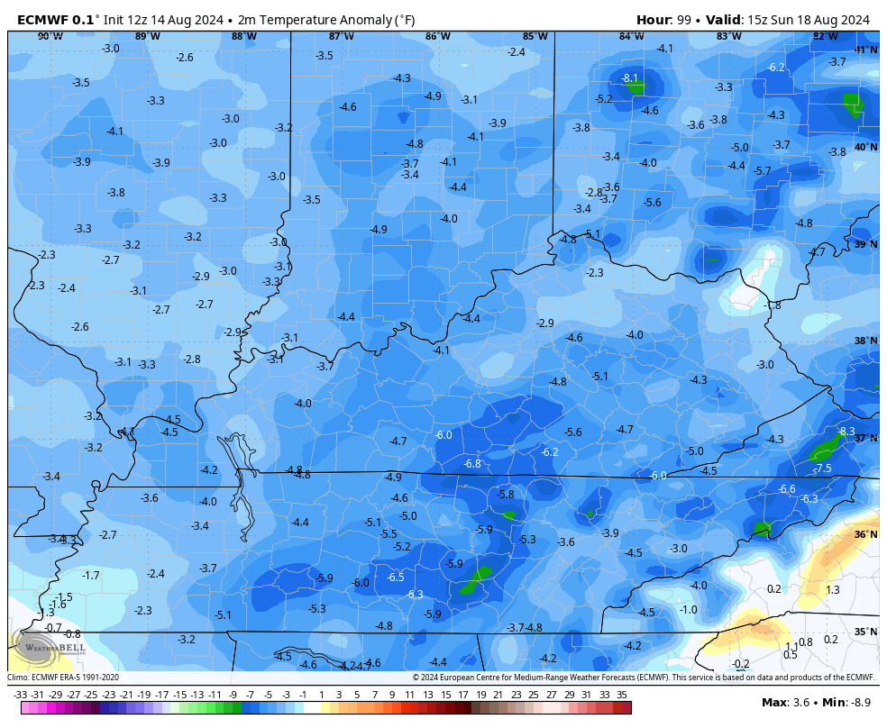
Temps start to drop during this time as we go back to well below normal readings from Sunday into much of next week. This is something else the GFS and Euro agree on…
GFS
EURO
Lows are looking cooler and cooler as we get closer, and there’s the chance for temps to drop into the upper 40s and low 50s by Tuesday or Wednesday…
As always, I leave you crazy weather kids with all your storm tracking tools…


Current watches

Possible Watch Areas

Have a great day and take care.

As always, we will see. 🙂
Several days ago the forecast suggested higher rainfall totals over the four day period. Now they’re way down. Chris chose his words carefully: “may,” “scattered,” “widespread,” and “low end threat.” The clinchers: “Damaging wind is the main threat from these storms;” “a few,” “local,” and then his pivot toward temperature departures from normal. We need several days of on-and-off rain, but it’s likely to be mostly cloudy, breezy, and periods of drizzle with a few minutes of real rain. ¯\_(ツ)_/¯
And probably much warmer than normal temps.
He also said not everyone would be getting the forecast that he mention. Temps have been below normal average temp average is 89 degrees for this time of year. It’s been below that average since heat spell has been broken.
89 is not the average for August.
Jeff it is here at western ,ky normal high is 88 and low of 67.
Ok, but not here in Central Kentucky.