Good Wednesday to one and all. We have yet another really nice weather day across the Commonwealth, but things are changing for the end of the week. That’s when showers and thunderstorms increase and a few of them may be on the strong side.
Temps today are back into the low and middle 80s with humidity levels that are still rather comfy.
The threat for a few scattered showers and storms shows up later Thursday as humidity levels jump up from west to east. This is ahead of a cold front dropping in here by Friday night and early Saturday. Additional showers and thunderstorms will be around on Friday, some with heavy rainfall.
Here’s the NAM from Thursday evening through early Saturday morning…
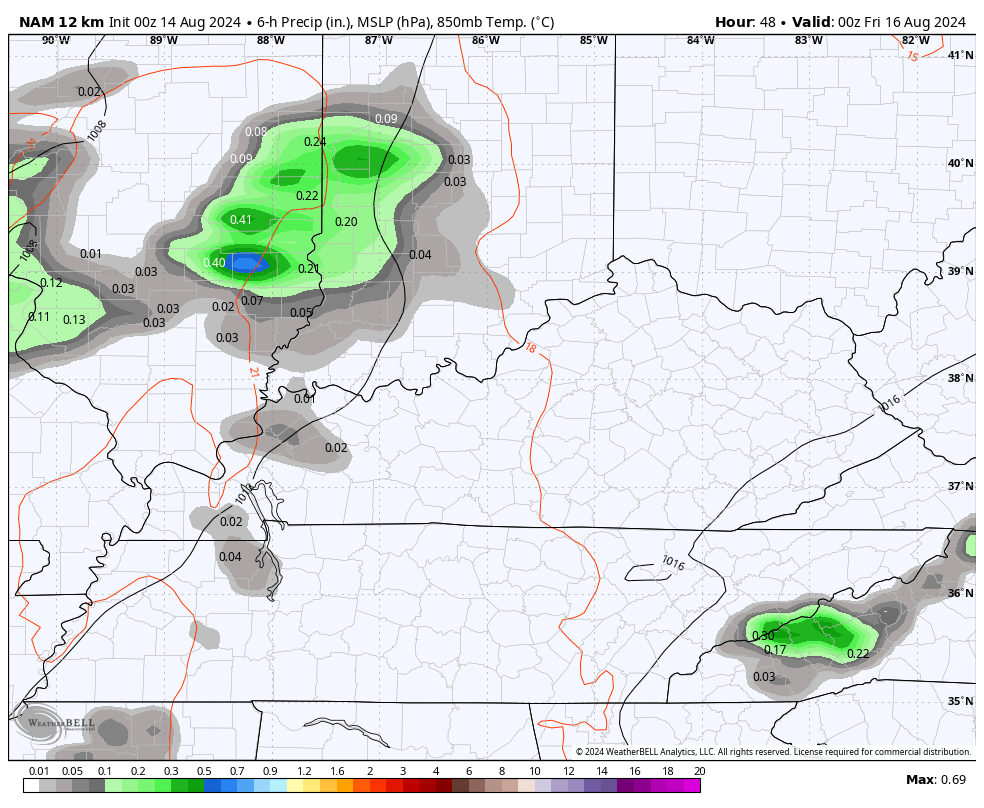
I mentioned how some of the storms may be strong or locally severe. The Thursday Severe Weather Outlook is largely to our west, but there’s a low-end risk across western Kentucky…

This threat may focus a bit farther east Thursday night and Friday. Here’s the Friday Severe Weather Outlook from the Storm Prediction Center…

This system is ahead of an upper level low spinning in over the weekend. The EURO shows this system cutting off and hanging around into much of next week…
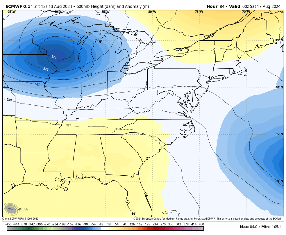
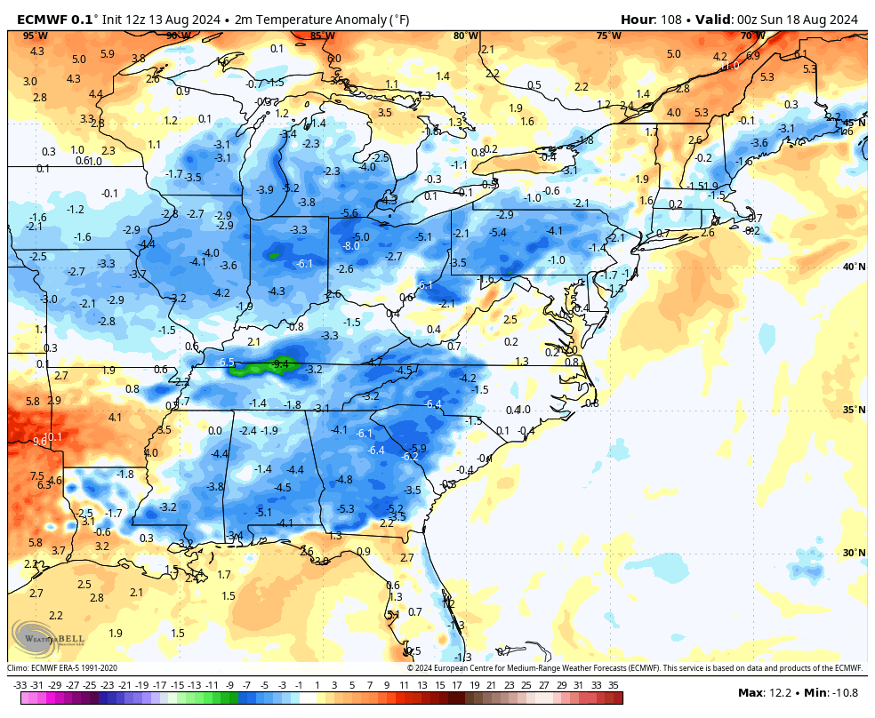
Cooler than normal temps show up this weekend and into next week…
Hurricane Ernesto is churning through the Caribbean and heading toward Bermuda, likely as a major hurricane. The track forecast from the National Hurricane Center keeps this thing well off the east coast…

I leave you with your storm tracking toys to follow any boomers that go up to our west today…

Make it a wonderful Wednesday and take care.

I hate this for Bermuda. The people who live there have no place to go to take shelter from this storm other than to evacuate the island, and they would have to do so very early.
Thoughts? Personally I don’t buy much into long-range predictions, but hey whatever entertains folks…..
https://www.almanac.com/winter-extended-forecast-farmers-almanac