Good Tuesday, everyone. Our much below normal temperature ride is now only a slightly below normal temperature ride for the next few days. All of this changes later in the week with a big increase in showers and storms that can put down heavy rains.
Before we look ahead, let’s look back at this big time blast of September air…
Today was the 3rd straight morning with temps deep into the 50s. The Kentucky Mesonet site in Lewis County even dropped a touch below 50.
Here’s a look at the Top 10 coolest readings from this morning. #kywx pic.twitter.com/Zzp7oTK11X
— Chris Bailey️️ (@Kentuckyweather) August 12, 2024
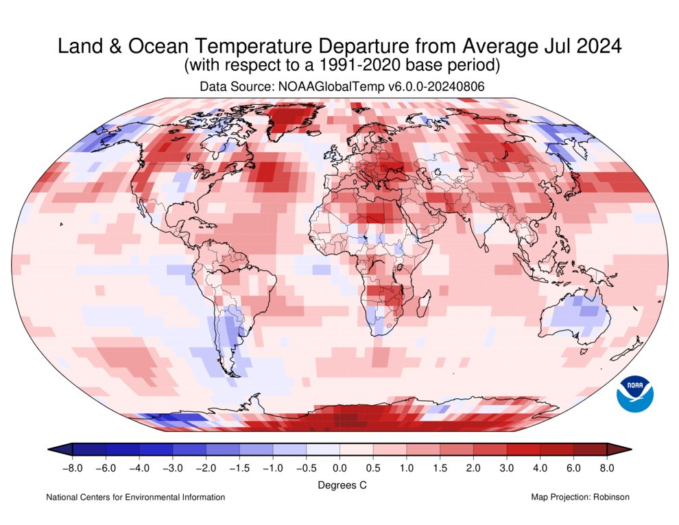
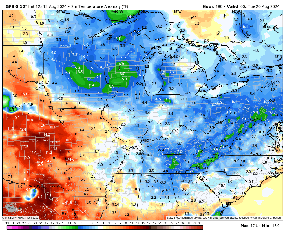
We’ve actually had numerous morning lows in the 50s this summer. A summer that’s really tame and lame in terms of any kind of heat in our region. A quick scan of the globe shows just what an anomaly we are living in around here.
The earth just recorded its hottest July on record, but our little part of the world was one of the few areas of below normal temperatures…
It’s looking more and more like August will average normal to below normal around here, too. Today’s temps are still below normal with low to mid 80s in many areas. There’s the chance for a shower or storm zipping through here, especially early.
Here are your Kentucky Weather Radars…

Similar temps will be noted on Wednesday with comfy humidity levels rolling on.
Speaking of rolling on, Tropical Storm Ernesto is churning through the Caribbean and is still expected to turn north and become a hurricane. The National Hurricane Center has the latest information and track forecast…

A big upper level system gets ready to spin through here by the end of the week into the weekend. This looks to bring rounds of showers and thunderstorms into our region and the Weather Prediction Center is highlighting the chance for heavy rainfall in our region…

This may be the first of two upper level systems that impact our region from late this week into next week.
The GFS shows this well…
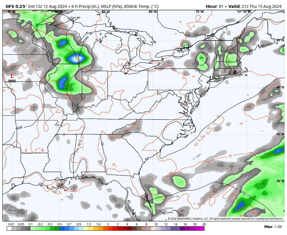
You can see the first arriving by late Thursday into Friday and lasting into the early part of the weekend.
The upper level setup also gives us a good look at these systems dropping in from the northwest…
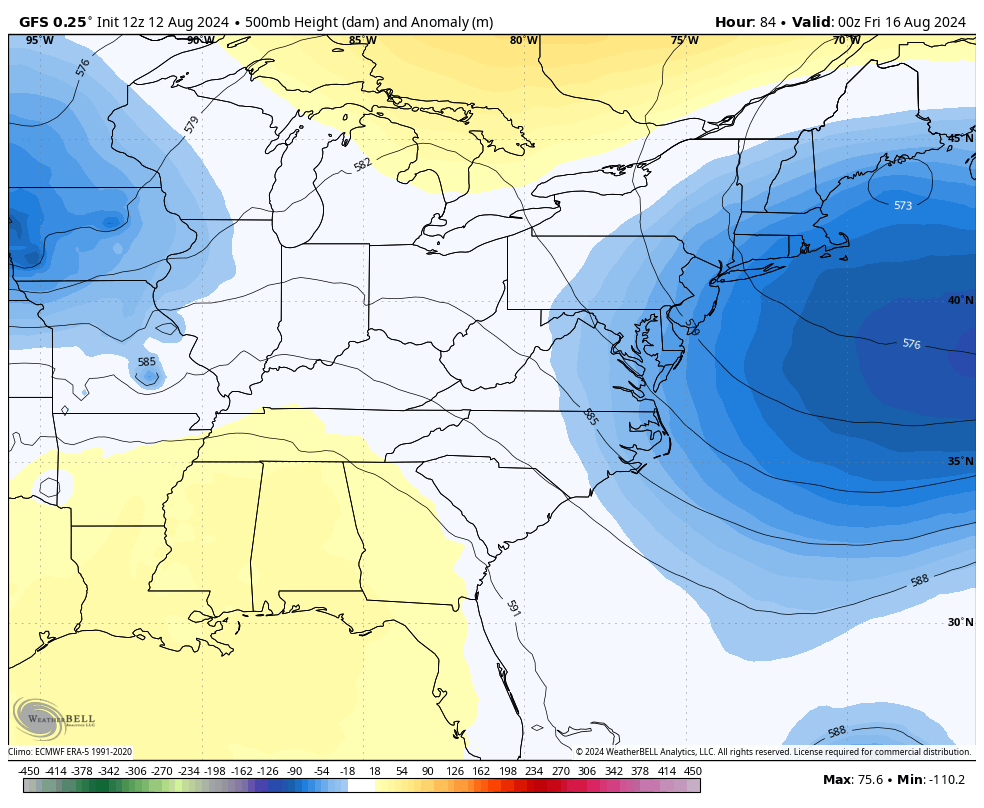
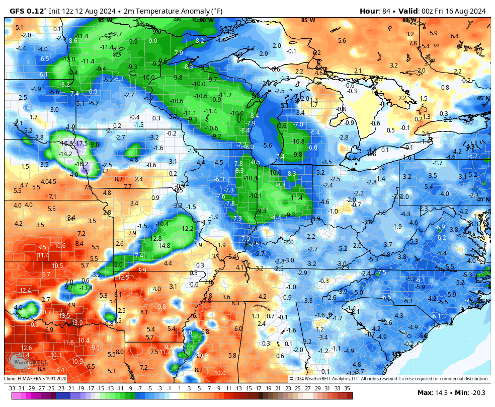
The initial system sweeps in with another shot of well below normal temps this weekend…
Those additional troughs next week would, if they do indeed show up, bring additional cooler than normal numbers…
Have a terrific Tuesday and take care.

It really hasn’t been tame nor much below normal. August averages about 85, so with highs of around 78 or 79, it’s not a huge departure, unlike when we had those days we’ll into the 90s, which were downplayed.
Although the weather has been MUCH better in terms of temps… I do not think it’s been a tame summer at all… I mean, haven’t we exceeded # of days we normally have in the 90s? For me this summer has been hot and boring in terms of weather.
You’re not wrong.
Weather it’s tame or not, I’ll be ready for some snow this winter,
Winters usually are tame unless we get lucky.
It comes in cycles, but we are due.