Good Sunday, everyone. After a severe storms filled Saturday, we have a blast of fall-like weather rolling into Kentucky and surrounding areas. This pattern may even deliver near record low temps in the week ahead. Wait… What? Yep.
Low pressure is wrapping up to our northeast today, giving us a very unusual flow for the middle of August. A northwest wind flow will bring all kinds of showers and embedded thunderstorms into central and eastern Kentucky today. While not a washout of a day, you will need to have the umbrella nearby if you’re heading out and about.
Here are your radars to track the action coming in from the north and northwest…

There could even be a little small hail that shows up with some of these.
Highs today range from the mid 70s to low 80s across central and eastern Kentucky with 80-85 where skies are brighter in the west.
This northwest flow becomes more northerly in time and this brings in one of the coolest air masses you are ever going to find for this time of year. Temps are well below normal through Thursday and the temperature departure forecast even shows some Barney colors…
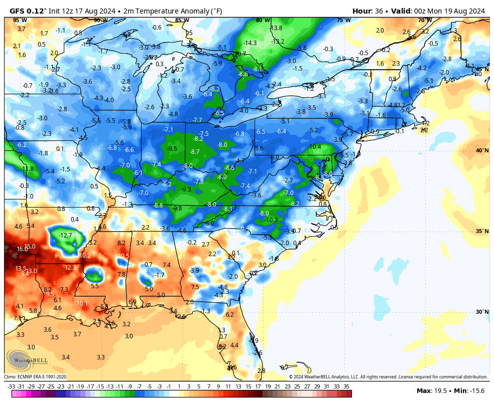
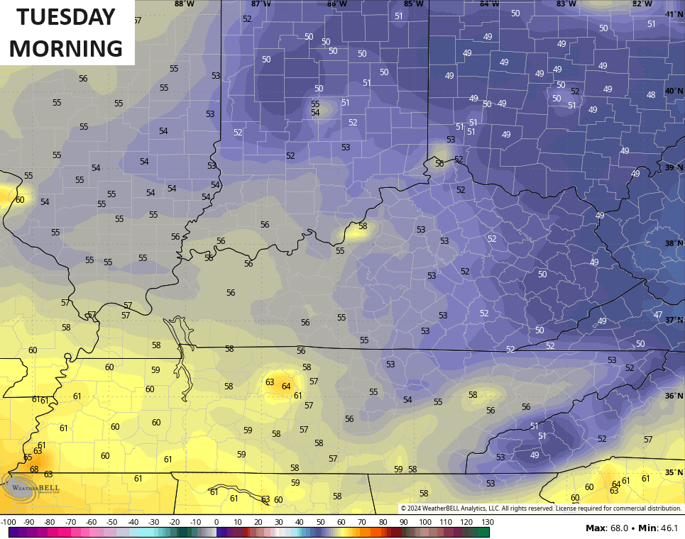
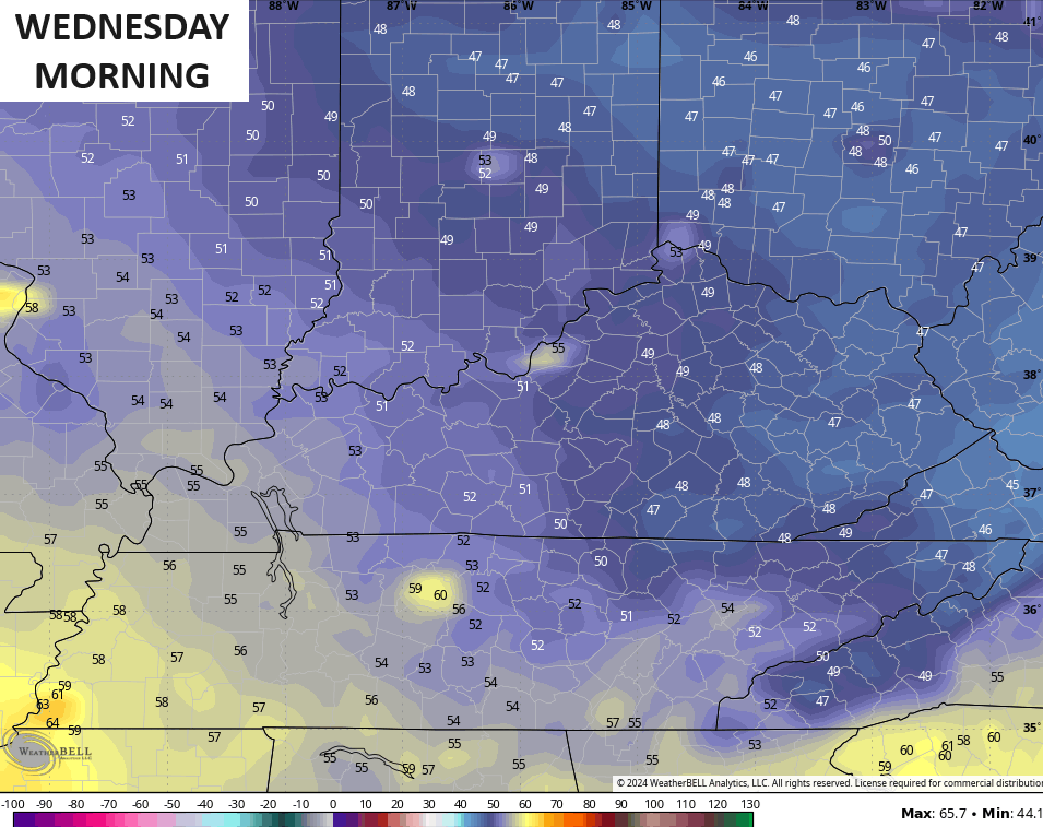
Highs from Monday through Wednesday may not get out of the 70s for many areas. Record lows for this time of year are generally within a few degrees of 50 for many and we are likely to give those a run for their money Tuesday and Wednesday mornings.
Lows during these two days are likely to drop into the upper 40s and low 50s…
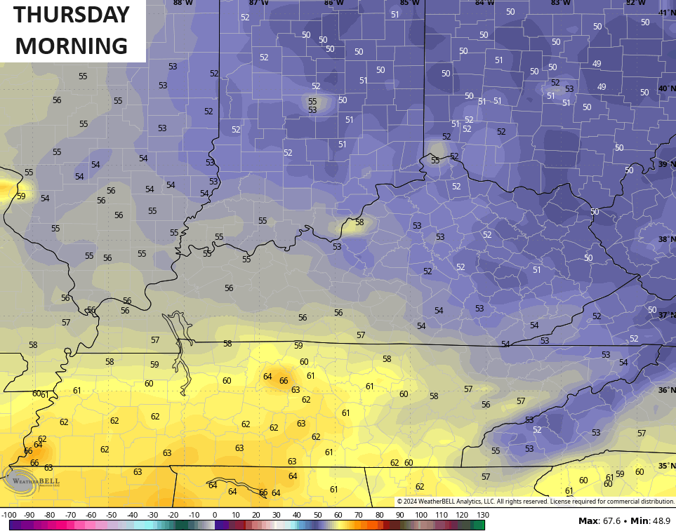
Lows on Thursday may still be close to 50 for some…
Temps will turn up next weekend and turn a bit toasty for the closing days of August. That said, we will need to watch the Gulf of Mexico during this time and into Labor Day Weekend. That may show up about the same time another trough tries to invade the eastern half of the country.
Make it a great Sunday and take care.

YES!! Refreshing air cooler temps and no drought in the middle of August…
We had 3 different storms yesterday.. Lots of wind..heavy rains
I predict at least one more hot spell before Summer ends.
Me thinks you’re wishcasting it
Nope
During the severe storms in Bowling Green yesterday, my PWS recorded 1.20 inches of rain, a peak wind gust of 47mph, and the temperature dropped 21 degrees in 8 minutes. Over 10,000 customers lost power for nearly an hour, and there were numerous downed trees. I find it strange that the SPC didn’t post a severe thunderstorm watch yesterday.
1.74 inches of rain on my side of Lexington yesterday. What was really nerve wracking was the wind blown hail. It sounded like it would break the windows it was hitting so hard. It also lasted longer than I ever remember it hailing before. I hope todays storms are on the tame side.