Good Monday to one and all. It’s a week that’s straight out of the start of fall as a deep trough takes up residence across the eastern half of the country. This trough means temps can make a run at record lows in some spots in the coming days. Bring. On. Fall.
Before we get to the fall-like forecast, I want to highlight what’s going on in the sky tonight.

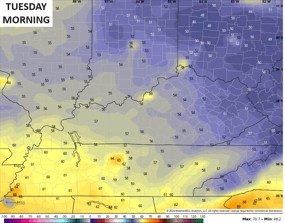
Skies clean up well tonight but we may see some areas of fog that keeps temps from really bottoming out. Many areas tonight reach 50-55…
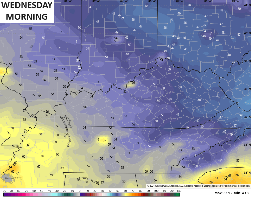
With a better chance for clear skies Tuesday night and Wednesday night, temps have a legit chance to reach the upper 40s across parts of central and eastern Kentucky. Here’s the GFS for lows…
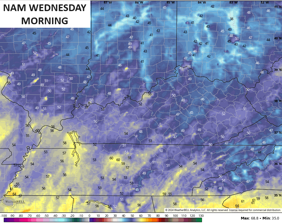
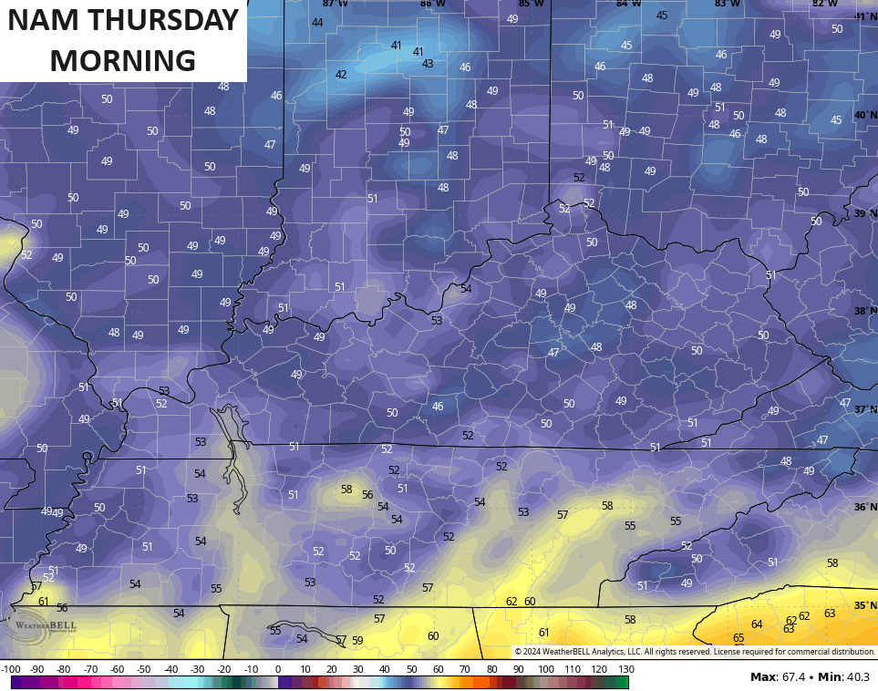
The NAM comes in a few degrees cooler…
Highs both days should generally hang out in the 70s once again. Humidity levels will be bone dry, too. Essentially, it’s some awesome fall weather!
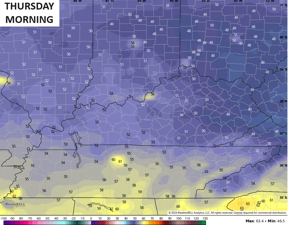
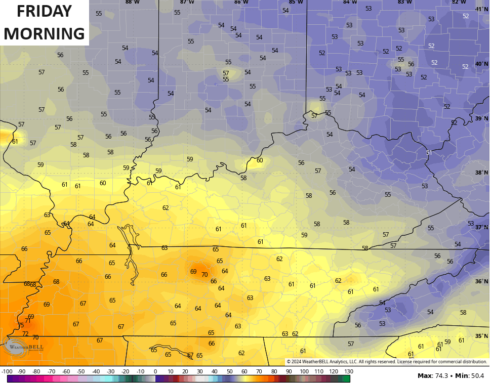
We should be able to squeeze out another low in the 50s across the central and east on Friday…
Much warmer temps press in over the upcoming weekend with real deal heat hanging to our west and going over top of us from the weekend into early next week. This happens as a ridge of high pressure balloons in to make it feel more like it should for this time of year.
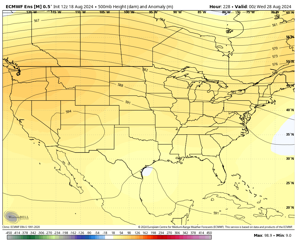
Just like what we have seen many times before this summer, this ridge gets kicked back toward the western half of the country later next week into Labor Day Weekend. Watch how the EURO Ensembles hint at another trough in the east during that same time…
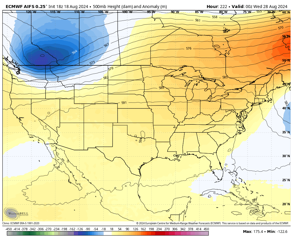
That trough shows up even better on the AI version of the EURO…
Make it a great Monday and take care.

We all get a little of what we want, if the ensembles verify.
Rain this weekend was great. 1.01” created a nice transformation in the plant world. There’s little to none in the 10-day. Hopefully, that’ll change.