Good Tuesday, everyone. It’s an absolutely awesome weather pattern we’re dealing with as temps take a walk on the fall side. This blast of fall may very well break a few record lows Wednesday and Thursday mornings. Wow!
Highs out there today are generally in the low and mid 70s across central and eastern Kentucky with low humidity. Skies will feature a mix of fair weather clouds and sunshine. This same temp pattern holds into Wednesday and I can’t stress just how hard this is to do in the middle of August.
Normally, if you get highs in the 70s it’s because of widespread clouds and rain. That’s, obviously, not the case this week.
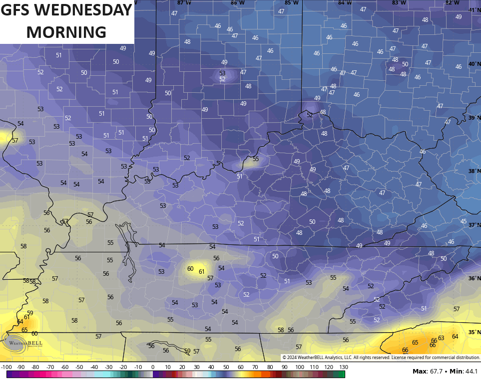
Record lows for the next few mornings are mainly in the upper 40s to low 50s. Overnight lows are likely to drop into the upper 40s and low 50s with the chance for a few spots to reach the middle 40s.
The model forecasts are pretty cool…

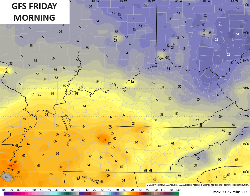
Lows are still in the 50s for Friday for much of the state…
Temps are going to rebound this weekend and will roll back toward the 85-90 degree range. There’s also the smallest chance for a shower or storm. Temps into early next week will be seasonably toasty, but just like what we have seen each time this summer, the core of any heat avoids Kentucky. This time the heat may build to our north before another trough tries to drop in later next week into Labor Day Weekend.
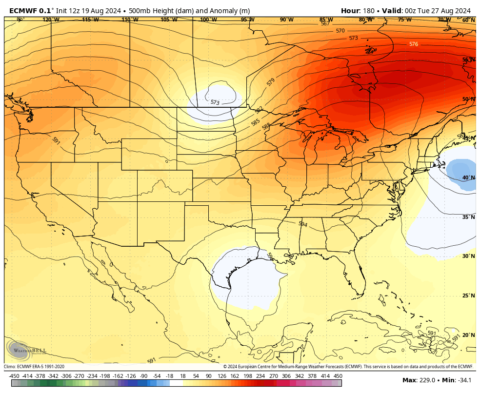
You can see the EURO going this way…
There’s a chance for something to pop down in the Gulf of Mexico during this time.
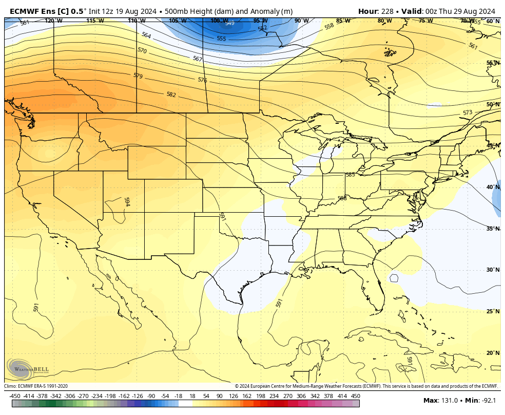
The control run of the EURO Ensembles also shows the main heat ridge going to our north and it tries to bring another cutoff low into our region…
Don’t be surprised if we don’t see a few showers and storms show up during the week.
Make it a great day and take care.

NOAA has updated their Winter outlook charts (Jan/Feb/Mar -2025) for temperature and precipitation. Over the years, I’ve found the accuracy of these maps to be on par with the Farmer’s Almanac, wooly worms and Punxsutawney Phil, but for snow lovers in our neck of the woods, it would be a nice-to-see lookq.
https://www.powder.com/news/noaa-weather-outlook-winter
Has anyone notice how aggressive the bees and wasp have been this summer. Makes me wonder if the weather has something to it.