Good Wednesday to one and all. If you’re asking yourself, what month is it? You’re not alone. This pattern is more like late September and early October than the middle of August. Still, we aren’t just going straight into fall as summer has a little fight left in the tank.
Temps this morning range from the mid and upper 40s in the valleys and where skies are clear. This may set a few record lows across Kentucky and surrounding areas. For those with some clouds or fog, temps will be in the low 50s.
By the afternoon, we are back into the low to middle 70s for much of the region. This is actually a bit above your Tuesday temps, where highs could barely get to 70 in some spots.
Thursday is a similar day with upper 40s and low 50s to start and 70s for highs.
Overall folks, this is one of the coolest all time air masses to ever impact our weather in the middle of August.
Friday is another really nice day as we kick off the high school football season. Temps in the morning range from the upper 40s in the east to the upper 50s in the west. Afternoon temps hit 80 in the east and mid 80s in the far west. Humidity levels will still be low with low humidity levels.
Temps come up this weekend with mid and upper 80s for Saturday into Sunday. The west can reach 90 and a 90 will be possible for many early next week, but some scattered showers and storms may also try to show up during this time.
As I’ve said, the core of the heat does not impact our weather as it goes to our north and zips through the Great Lakes into New England. This pattern looks temporary as many of the models are trying to put another trough in the east later next week into the Labor Day Weekend.
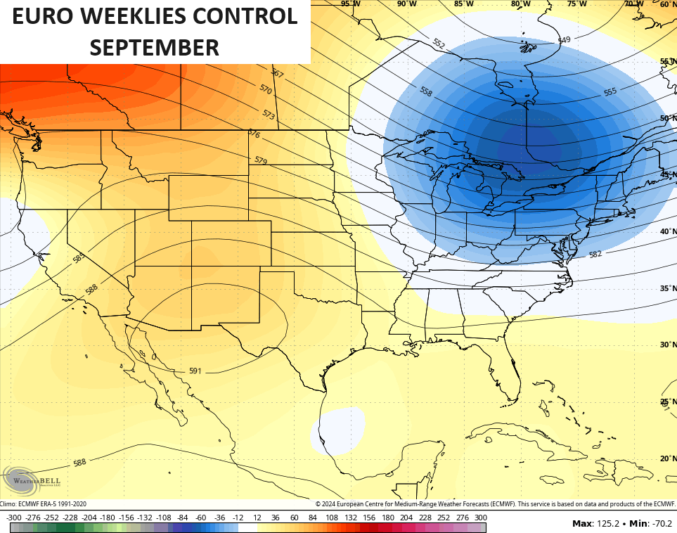
Here’s the EURO…
The Canadian is similar…
That could be a fairly active cold front ahead of this trough…
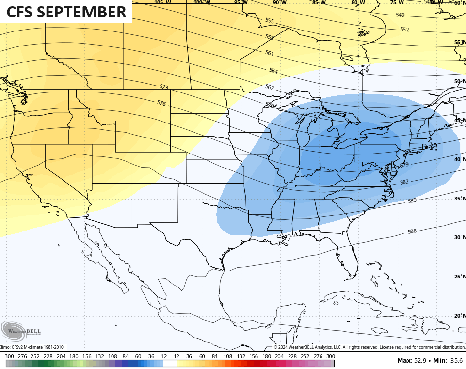
That trough in the east is something starting to show up on some of the seasonal models for September…
Have a wonderful Wednesday and take care.

Summer has more than a little fight left.
Opening the windows and turning off the A/C when the temps are like this is wonderful. It happens to coincide with college students returning to town, a few of whom ride street bikes and apparently enjoy getting together on our highways and byways after dark. Still, it’s worth the price for having fresh air waft through the house.
Jeff, the cool spells were getting could be an early indication of transition from summer to fall. Only 30 days left tell first day of fall.
I’m just saying Summer’s not over yet. I’ve seen 95-plus well into September before.
True and a snowstorm is forecast in the higher elevations in California tomorrow