Good Sunday and welcome to September. It’s the start of Meteorological Fall and we have a blast of fall-like temps settling in over the next few days. This looks like the opening act for a much bigger, and possibly wetter, fall feel late in the week and next weekend.
Our cold front doesn’t quite make it through here until later tonight, so that means humidity levels are up again today. This humidity will also be able to fire off more showers and thunderstorms, especially across the southern half of the state.
Just like Saturday, these storms will be prolific lightning makers and will likely interrupt a few outdoor activities.
There’s still the low-end risk for a few severe storms going up across the south and southeast. Here’s today’s Severe Weather Outlook from the Storm Prediction Center…

Here are your storm tracking tools for this first day of the new month…


Much cooler and drier winds settle in for Labor Day, so make sure to get out there and enjoy the holiday!
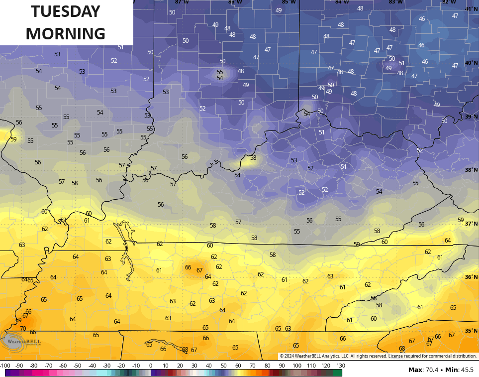
Lows by Tuesday morning may drop into the upper 40s and low 50s across parts of central and eastern Kentucky…
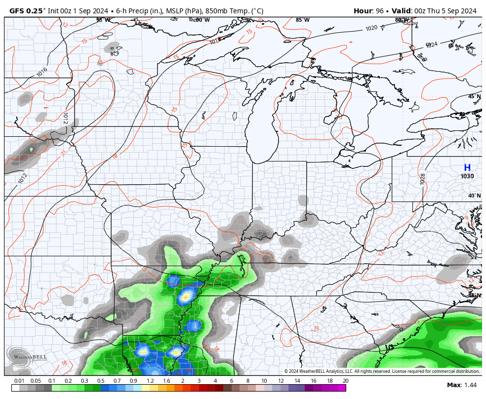
From here, we watch a southern system throw some rain and thunder at us starting later Wednesday and Thursday. This will be ahead of another big system dropping in from the northwest. The models still aren’t quite sure how these two systems get along, but we could very well be in for a prolonged period of rain and cool temps.
Here’s how the GFS sees it from Wednesday through the following Monday…
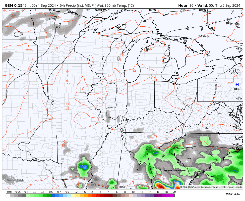
Here’s the Canadian for the same time…
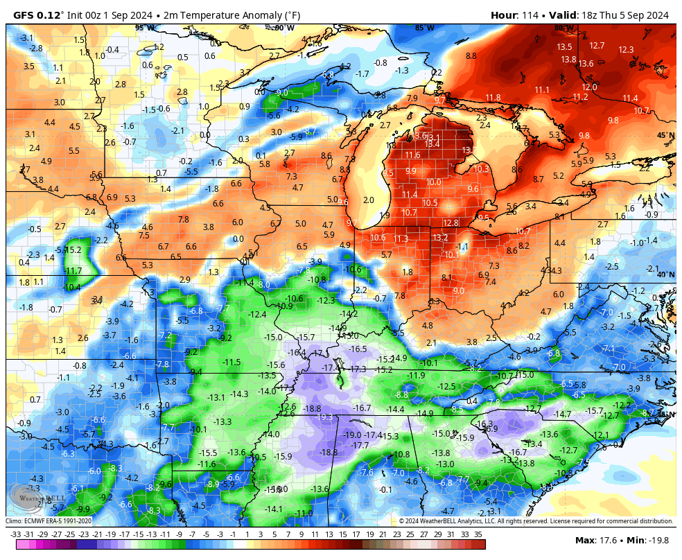
Below to much below normal temps look to show up during this period…
Bring. It. On.
Enjoy your Sunday and take care.

Thanks Chris. ” much bigger and possibly wetter ? ” I certainly hope so.
Have a Bless Sunday everyone.
Not sure about “much” below normal.