Good Tuesday, everyone. Our awesome touch of fall weather rolls on out there today, but the focus is on a much bigger blast of fall rolling in for the upcoming weekend. It’s a blast that may take our lows toward record low territory once again.
Given this and the fact that highs will be way down there, we are now in a full blown…

This Pot of Chili Watch means you should be planning ahead on what ingredients you want to include in your Pot of Chili. If this is upgraded to a full blown Pot of Chili ALERT, then it’s time to clean the store shelves.
Before we get to the chili/chilly weekend, let’s talk about the pattern out there today. Temps are very pleasant once again as some clouds roll through here from the west and southwest. These clouds shouldn’t produce any showers, but there’s the slightest chance for a shower across southern and western parts of Kentucky.
Here are your radars just to be safe…

Highs over the next few days will come up a bit and be deep into the 80s for some areas. A mix of clouds and sun will also be noted with just a slight chance for a shower or stray storm in the south and west.
Things change starting on Friday as a cold front sweeps in from the northwest. Scattered showers and storms will be noted along and ahead of this front with a blast of chilly air coming in behind it…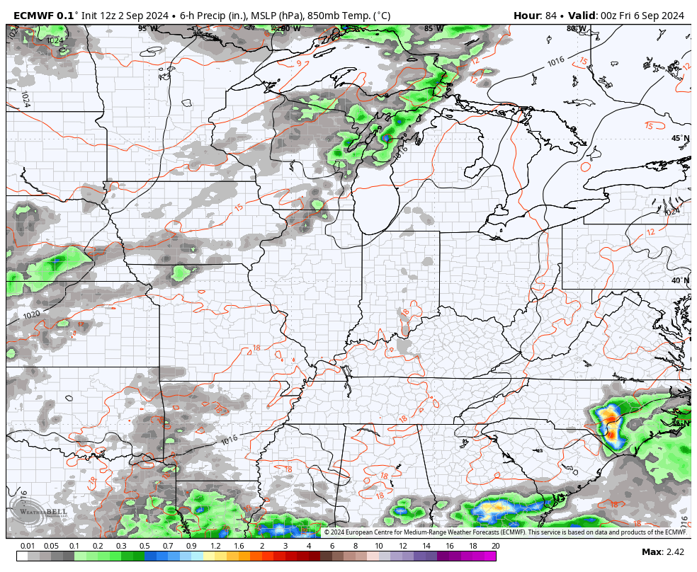
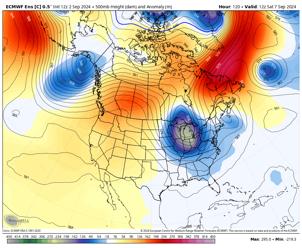
This is a very anomalous air mass for this early in September…
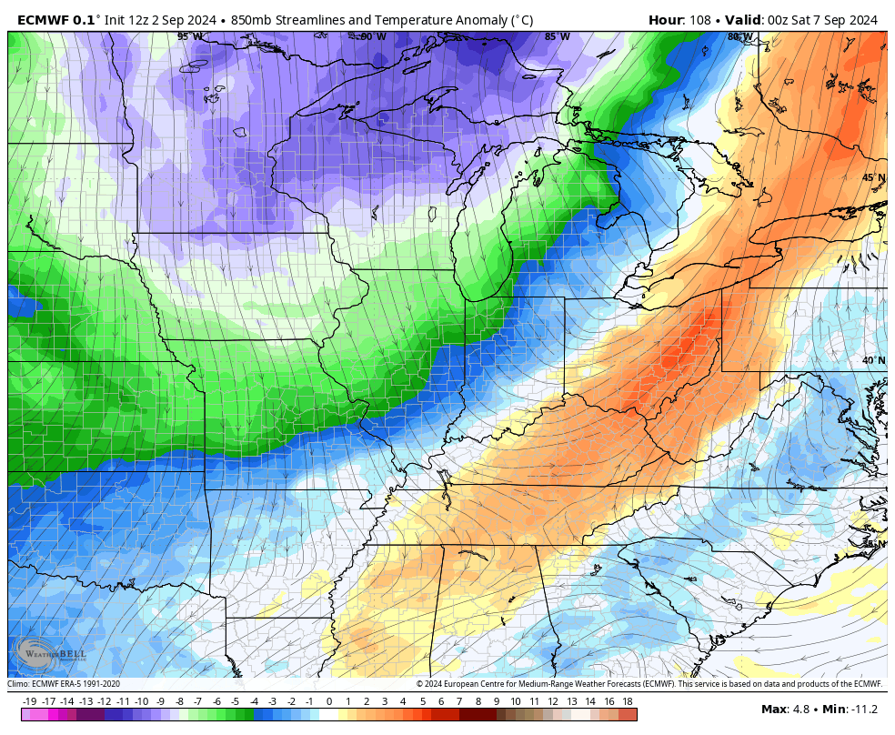
This marks the second time over a three week span for us to have this kind of setup that can threaten record lows.
Record low temps for Sunday and Monday are mainly in the middle 40s. There’s a legit chance we hit these marks or go a touch below…
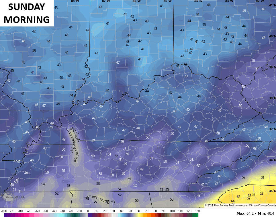
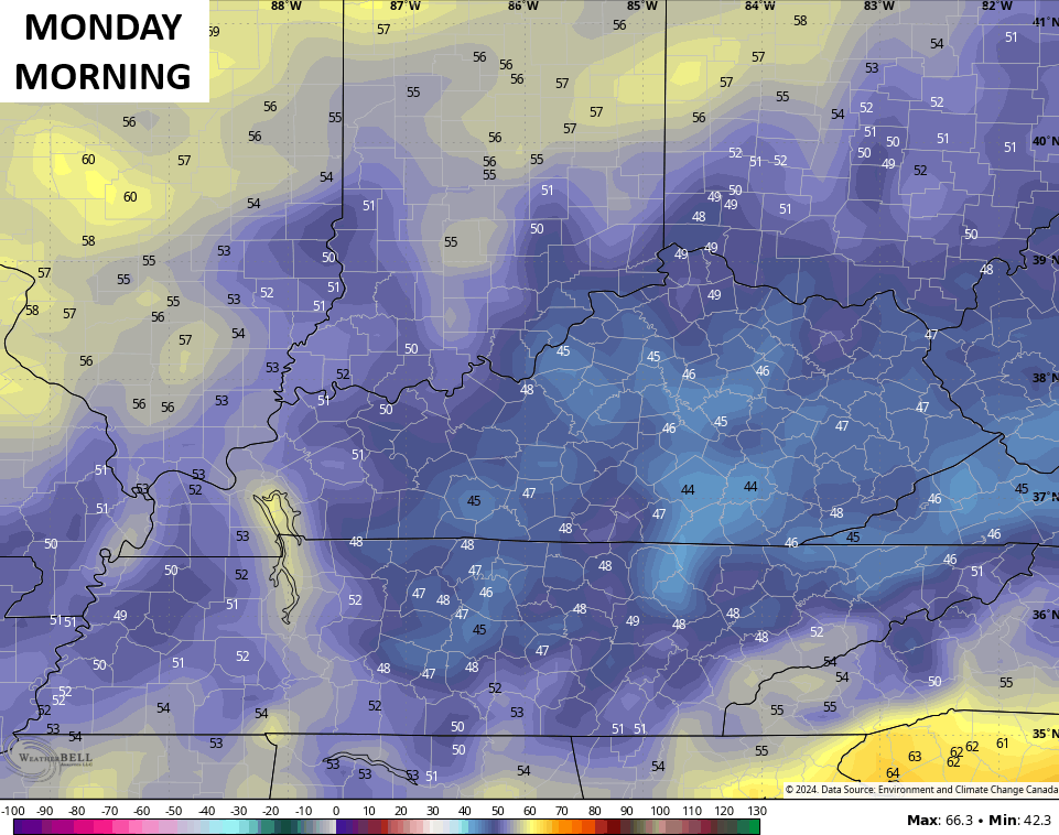
Highs over the weekend and into Monday may range from the upper 60s to low 70s.
That trough lifts out by the middle of next week but we may try to get another trough to sweep in here. This is something showing up more and more on the operational models and the Ensembles.
The Control Run of the EURO Ensembles…
Can we finally get something tropical to develop during this time? I think it’s possible for something to get into the Gulf. The National Hurricane Center is watching two systems of interest…

Have a terrific Tuesday and take care.

I’ll be sure to grill steak this weekend.
Traveled westward toward Western Kentucky last week. Back roads and farmland. Pockets of beautiful corn and green hayfields, but also farms dealing with the effects of inadequate moisture. Variation is normal, yet seeing the stark contrast between one valley and the next is a reminder that the elephant in the room so often isn’t temps, but rain (or lack thereof).
Crops look great here in Taylor county. Farms are south of where I live. Rains must have been timed right during the growing season. Tulip Popular are beginning to turn bright yellow here, and Red Maple are beginning to turn red. Due to the drought we had this Summer, Fall foliage may be early.
I love the pot of Chili watch. What does everyone put in their chili ?? Spicy hot or no ???? I enjoy the cooler days so much. It’s been nice. We also got some good rain.