Good Friday, everyone. We’ve made it to the end of the week with the first weekend of September ready to kick off. Things start with some booming thunderstorms later today as a major fall cold front sweeps in. This front brings a full-blown blast of mid-October air into Kentucky.
Temps today come at us from the southwest and will be rather gusty as highs reach the 80s. Showers and storms fire up later this afternoon and sweep across the state late this afternoon into tonight, likely causing delays at some high school football fields.
The future radar from the Hi Res NAM starts at 2pm today and ends at 8am Saturday…
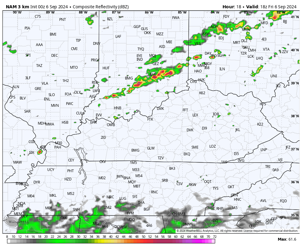
There’s even the chance for a few strong or severe storms and the Storm Prediction Center has a low-end risk for severe weather…

Temps by Saturday morning drop into the upper 40s and low 50s for central and northern parts of the region. Morning clouds and showers in the east will move away as sunny skies take control on a strong northerly wind flow. Highs Saturday range from the upper 60s to low 70s.
This sets the stage for record or near record lows Saturday night and Sunday morning. Lows hit the low to middle 40s for many and that would be good enough to break some records. Can some of our coldest valleys reach the upper 30s? That’s a possibility and one the Nam Fam is seeing…
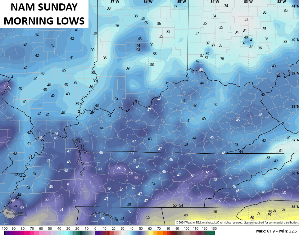
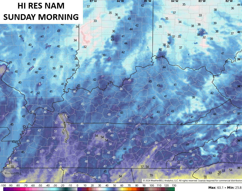
If we can drop to 40 or below in some areas, it would mark the earliest such recordings on record for Kentucky. That’s insane, Y’all.
Sunday is another gorgeous fall day with temps on the chilly side.
Monday looks very nice before temps begin to rebound for the middle and end of next week. Temps in the 80s are likely during this time. What happens after this may hinge upon something trying to develop down in the Gulf of Mexico.
The National Hurricane Center is currently watching a number of systems over the next week…

While none of those appear to be close to developing in the short term, there’s some indication of something in the Gulf or along the southeastern seaboard showing up in the ensembles.
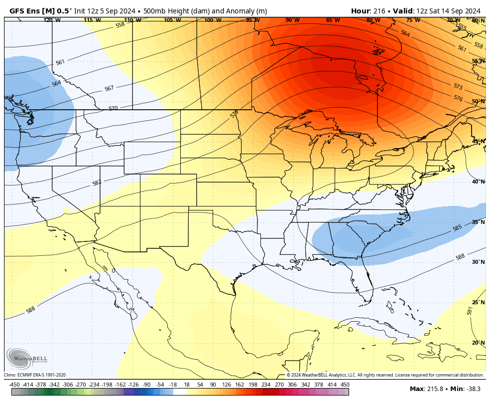
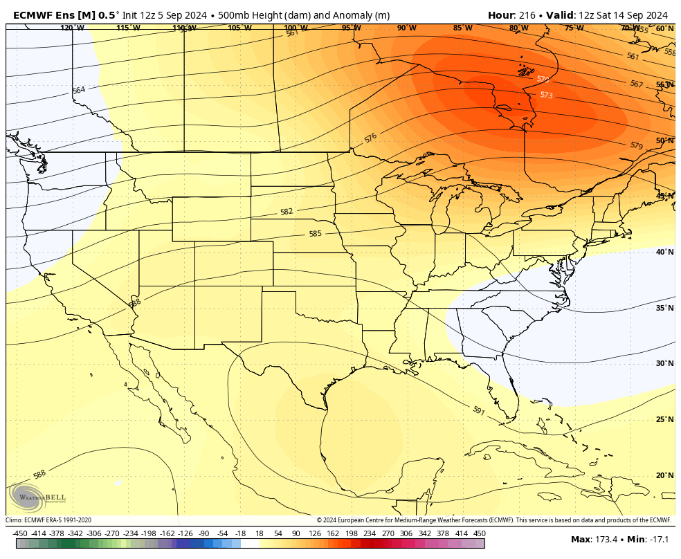
Notice how the GFS and EURO both show much lower heights in this area late next week into the following week…
GFS ENSEMBLES
EURO ENSEMBLES
We shall see.
As always, I leave you with your storm tracking tools for the day…


Current watches

Possible Watch Areas

Have a great Friday and take care.

Thanks Chris. We really need this break in the Summer like temperatures here lately. I just wish the Earth would cool some and we would receive our first frost of the season, followed by our normal Winter weather. My area of the state normally receives 13 inches of Snow each Winter. The dryness these past months needs to end. Hopfully, the tropical system in the Gulf will develop into a widespread rain maker and move our way. I am tired of these isolated showers that my area never receives.
Enjoy the day everyone !
“Temps today come at us from the southwest and will be rather gusty . . .” ¯\_(ツ)_/¯
I’m inclined to believe Schroeder when he writes about the relatively dry forecast for the fall and winter and his rationale. However, hearing Chris’ thoughts would be enlightening as well.
The approaching front will have a considerable temperature gradient, but is moisture-starved, and will likely leave the south high and dry. We’re in our 3rd week without any rainfall, and the local forecast for the Bowling Green area says “… the start of an extended period of dry weather.” Exactly what I didn’t want to hear. It’s tinder dry in my neighborhood, and some trees are beginning to lose their leaves, uping the fire danger. It’s very likely that Warren County’s Burn Ban will remain in effect at least through the third week of September.