Good Thursday, everyone. It’s another nice weather day across the Commonwealth as temps jump back up a bit. This is ahead of a major blast of mid-October air sweeping into the state over the weekend, bringing the potential for record lows.
Now that we are just about to the weekend, it’s time to upgrade to a full blown…
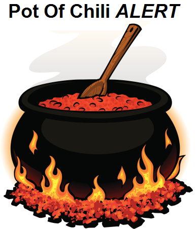
This is not a drill. I repeat… This is NOT a drill!!
If you’re like me, there’s not much that can beat that first pot of chili during the first blast of chill in the falls eason!
Before we get to all that, let’s talk about the weather out there today. Highs are into the 80s with a partly to mostly sunny sky with humidity levels up just a bit. This can help fire out an isolated shower or storm going up during the afternoon or evening hours. Isolated is the name of the game on your Kentucky Weather Radars…

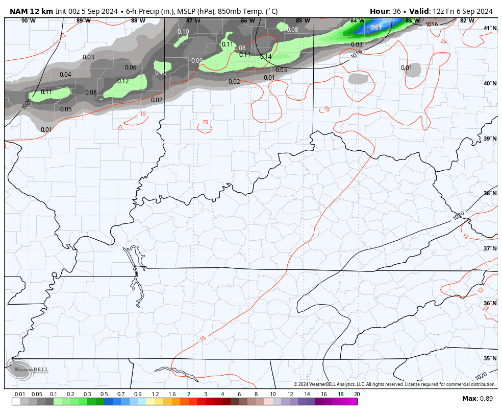
The fall cold front bringing the chill arrives Friday evening and Friday night with windy and warm temps ahead of it. This front will have a broken line of showers and storms along and ahead of it and those may impact high school football games…
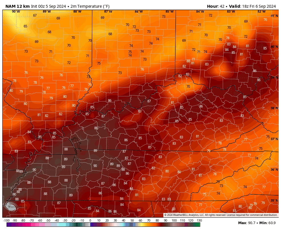
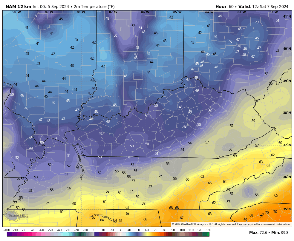
This is a pretty dramatic temperature drop showing up with this front. Temps reach deep into the 80s Friday afternoon then crash into the 40s for some by Saturday morning…
Temps for Saturday likely stay in the upper 60s to low 70s for much of the state. Here’s the NAM temp forecast animation from 8am Saturday through 8pm Saturday…
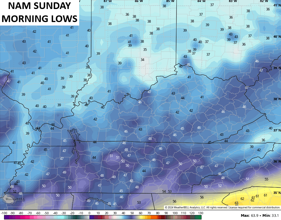
This sets the stage for a very chilly night with the potential for record lows Sunday morning. The current records are mainly in the middle 40s and those are in jeopardy. Temps in the low and middle 40s should be rather common. Can we hit 40 or even sneak into the upper 30s in some of the coldest valleys? Maybe.
The NAM sees the potential…
Sunday is another day with upper 60s and low 70s for central and eastern Kentucky with low to mid 70s in the west.
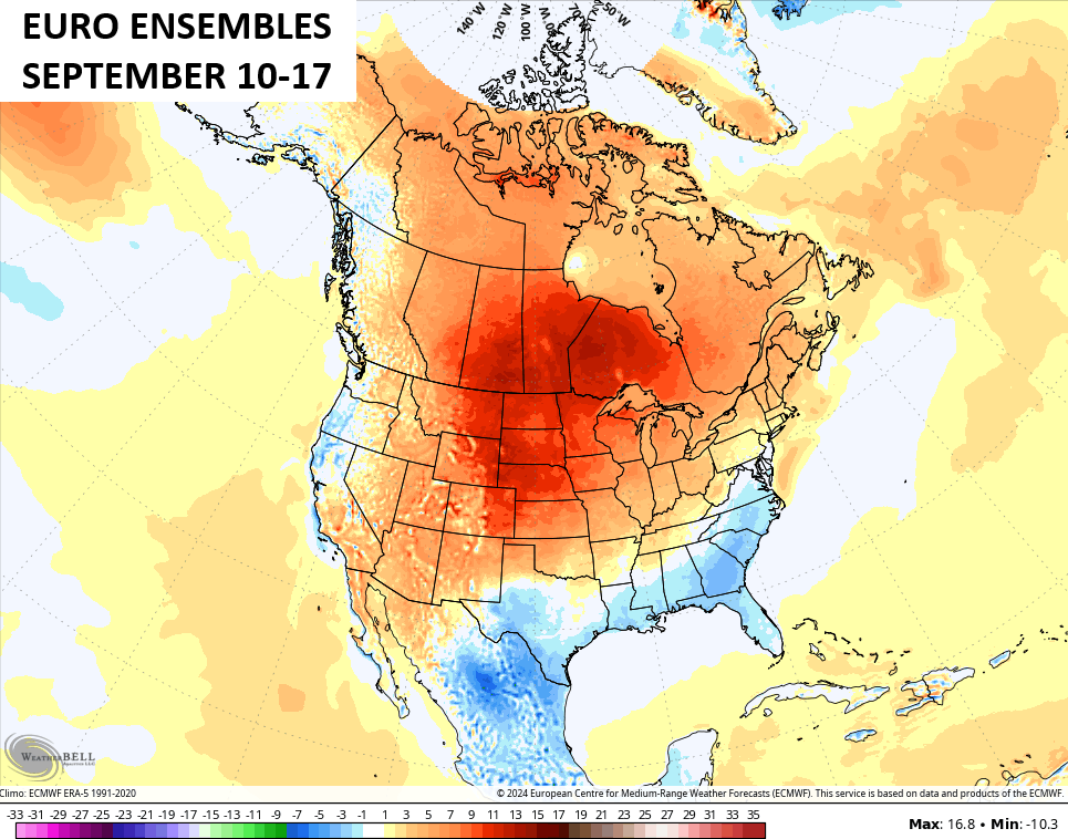
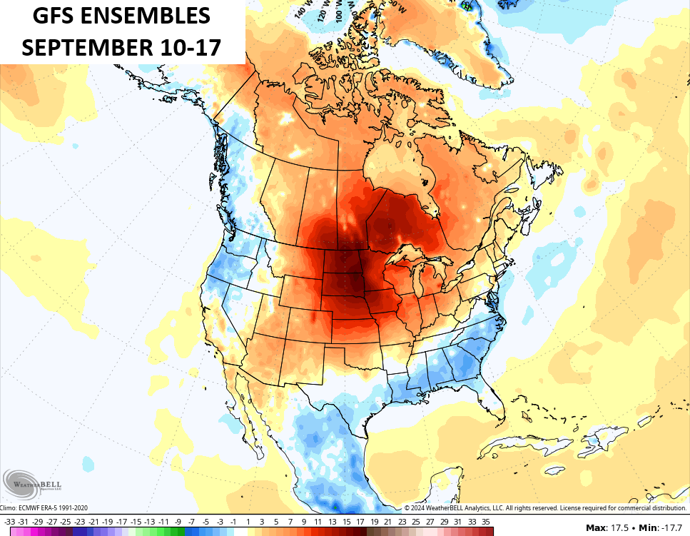
Next week starts very pleasant but things get back to normal fairly quickly by the middle of the week as temps rebound deep into the 80s. This comes from a pattern we’ve seen many times already this year. It features well above normal temps centered well to our north with cooler air to the southeast of us. Kentucky finds itself in between the two with the numbers skewing above normal…
Moral of the story is that fall will not hit and hold just yet. As a matter of fact, don’t be surprised if temps don’t skew a little above normal through the first half of October. I’m also expecting drier than normal weather during this same time. That combo may set us up for an active fall forest fire season.
The one thing that could change it all is if something from the tropics comes calling. That doesn’t look likely any time soon…

The heart of the Atlantic hurricane season is historically quiet. Here’s hoping the second half of the season doesn’t try to make up for lost time.
Enjoy your Thursday and take care.

The ensembles and I agree for once, lol!
I love chili any time of year as well as grilling steaks. 😉
The front will be moisture-starved, which is bad news for the Bowling Green area. We’re in our 3rd week without a drop of rain, and it’s like a tinderbox down here. Warren County has enacted a burn ban, and I expect that it will remain in effect for the foreseeable future.
Just came in from the yard. Soaking wet. Localized shower. Hand-to-hand combat with an aging, creaky oscillating sprinkler. Trying to confine the “rain” to the median strip without watering the street and sidewalk. Darting in and out, adjusting flow rate and length of arc. Neighbors are enjoying the spectacle – waving gaily as they head off to work or wherever. Some summers the sprinkler never leaves the shed. It’s been in regular use since Memorial Day.
Oh no you did not say “drier”
Mark, did you notice that Schroeder used the prohibited word yesterday? “Drought” I ran outside to see if I could hear someone’s head exploding.
Here’s the latest on the drought :
https://www.weatherstreet.com/drought-map-us.htm
Thanks Chris. The August PDO reading came out today. The reading in July was a negative 2.99 and the reading in August was negative 2.88, so it is getting closer to the positive. This is encouraging, as the closer we get to positive on the PDO, the precipitation pattern will change to the wetter.
Enjoy the day everyone !
Drought conditions prevail in South Central Kentucky.
I know, I know, I used the D-word…
Okay, localized drought conditions prevail in South Central Kentucky.
It’s still a drought…
I would really like to Know why the Meteorlogical term Drought is not premitted on Chris’s weather Blog ?
I think Chris has a problem when people hear the word drought and immediately think catastrophe, ignoring that like everything else in this world, there are variations in levels of drought intensity, especially in terms of how long a particular drought persists. The other thing is that drought can’t be boiled downn to a single definition. NOAA uses several tools to determine drought intensity, such as the Standard Precipitation Index (SPI), the Palmer Drought Severity Index (PDSI), and the Group Moisture Index. These tools plus long range precipitation forecasts are used to determine drought.
It’s complicated!
https://drought.unl.edu/ranchplan/DroughtBasics/WeatherandDrought/MeasuringDrought.aspx#:~:text=Drought%20Measurements&text=A%20drought%20event%20occurs%20any,month%20that%20the%20event%20continues
Thanks Joe for explaining that to me. For now on I will refer to D word as just plain Dry and we need rain ! Also thank for the link.