Good Sunday to one and all. It’s another amazing fall weather day across the Commonwealth as temps run well below normal. This pattern is about to take on a more typical early September look for the week ahead and it may be complete with the leftovers of a tropical system impacting our weather.
Temps to start the day are in record setting territory in many areas with low and middle 40s. Some upper 30s may very well show up in some of the colder valleys. If this happens, it would mark the earliest date on record for temps of 40 or below showing up in Kentucky. That’s pretty extreme, folks.
Highs this afternoon are in the low 70s east with upper 70s in the west as skies stay sunny. Overall, this is another awesome weather day.
Monday looks good as the temps continue to climb some with the normal 80s back in here for the middle of the week. It’s at this point we have to watch what’s happening down in the Gulf of Mexico. This is where we have Francine developing. This is one of, at least, 3 areas of interest to the National Hurricane Center…

Here’s a look at our developing system on satellite…

This storm likely heads toward Louisiana and could very well become a hurricane before making landfall. The remnants of this storm will then roll to the north and northeast, potentially impacting our weather with wind and rain by Thursday and Friday. This system may try to slow down and hang around into next weekend.
The AI version of the EURO was the first model to really pick up on this system and it continues to do so…
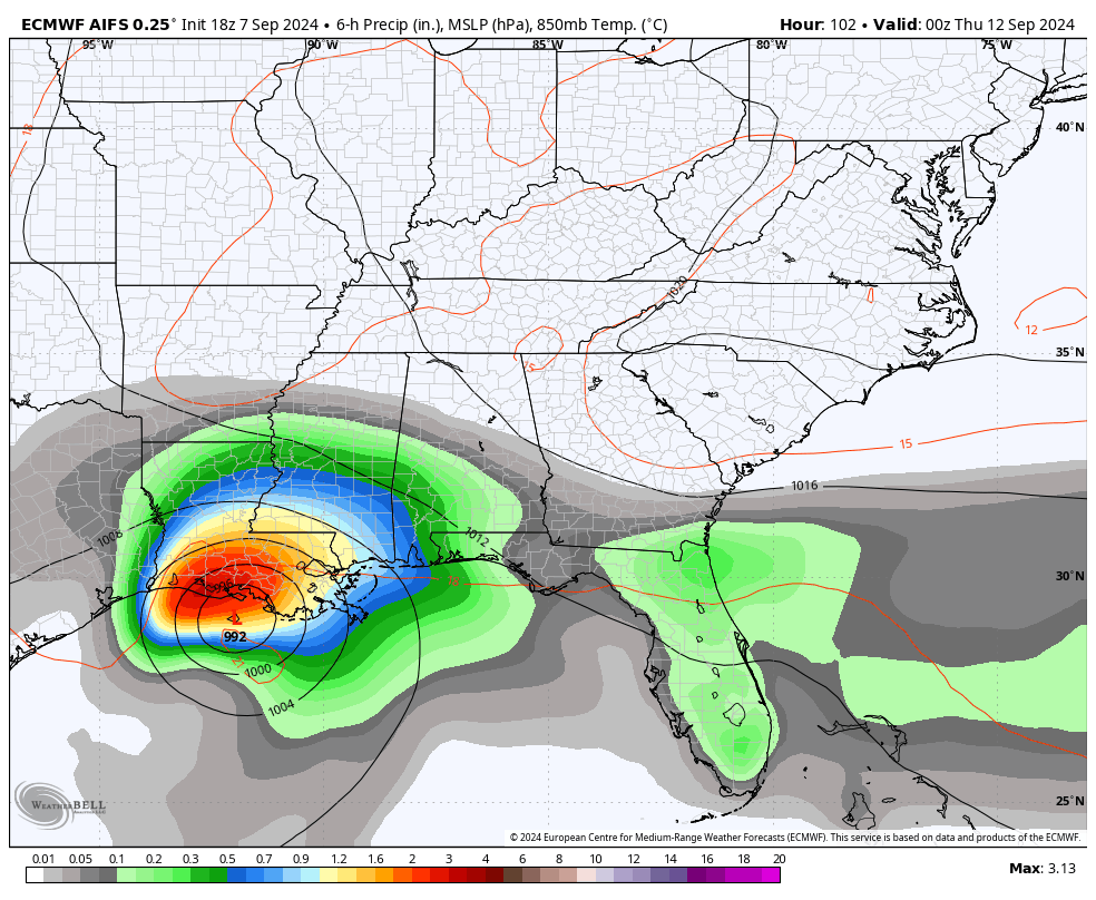
The regular run of the EURO didn’t see it until the latest run and now looks like the AI…
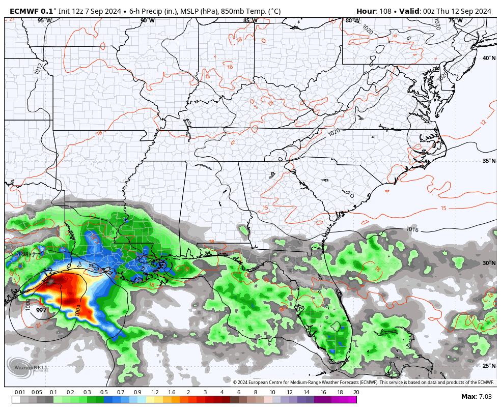
The GFS and Canadian Models are also on board with this system impacting our weather.
Since the EURO AI has the hot hand, it develops another deep trough in our region in the longer range. You can see that bowling in here around September 18th through the 22nd…
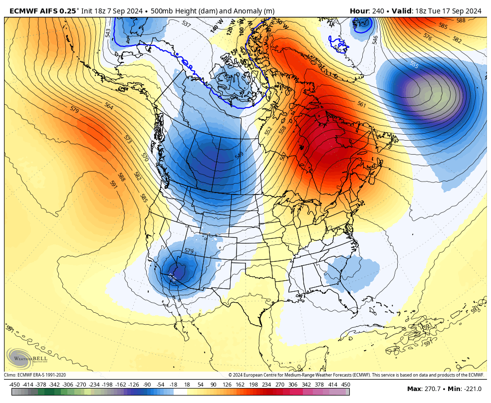
If it works out that way, it would mean another well below normal temperature pattern around here.
Have a great Saturday and take care.

The EURO AI won’t be right.
Looking at the AI and the Euro, it appears like Kentucky may be on the windy side ( dry slot ) rather than wet side. The good soaking Rains or Snows are always on the north and west sides of any low pressure system.