Good Wednesday to one and all. All eyes continue to be on powerful Hurricane Milton that will be making landfall tonight near the Tampa area of Florida. This won’t impact our weather as we continue with a seasonable brand of air. Next week is a different story as temps take a massive dip.
Highs today range from the upper 60s to low 70s for many with plenty of sun. Similar highs will be noted Thursday into Friday as overnight lows coming down just a bit. Lows by Friday morning may be just cold enough for a kiss of frost in the coldest valleys.
Hurricane Milton is churning toward the Florida Gulf Coast with a landfall expected late this evening or in the wee hours of Thursday morning. Here’s what this system looks like on satellite…

The National Hurricane Center edged the track a bit farther south, matching up with the spaghetti plots of the hurricane models. But many of the traditional models like the NAM and GFS are still focusing on the Tampa area.
Just a few miles will make a huge difference for some of these cities. Here’s the latest information and track forecast from the National Hurricane Center…

The peak storm surge is still likely to reach 10-15 feet along a healthy stretch of the Florida Gulf Coast…
![[Image of cumulative wind history]](https://www.nhc.noaa.gov/storm_graphics/AT14/refresh/AL142024_peak_surge+png/152801_peak_surge.png)
Back here in the Bluegrass State… Temps spike into the 70s this weekend ahead of a major fall cold front slamming in here late Sunday and Sunday night. This won’t bring much moisture with it, but it can spawn a shower or thunderstorm.
Notice the flakes in the Great Lakes…
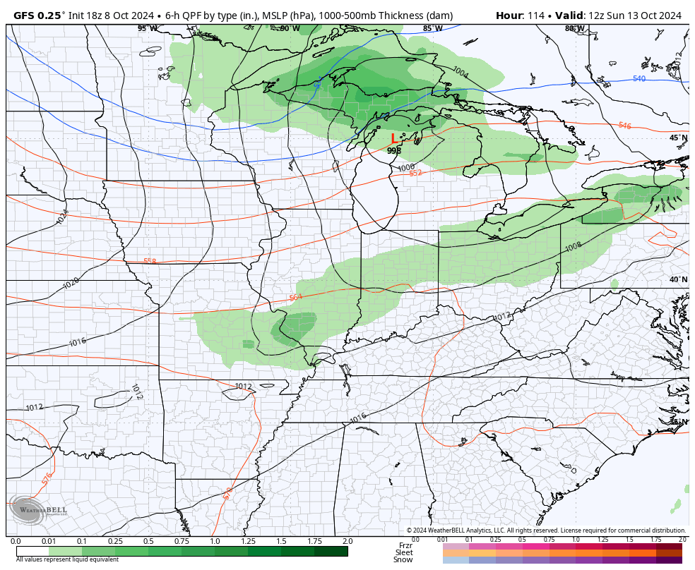
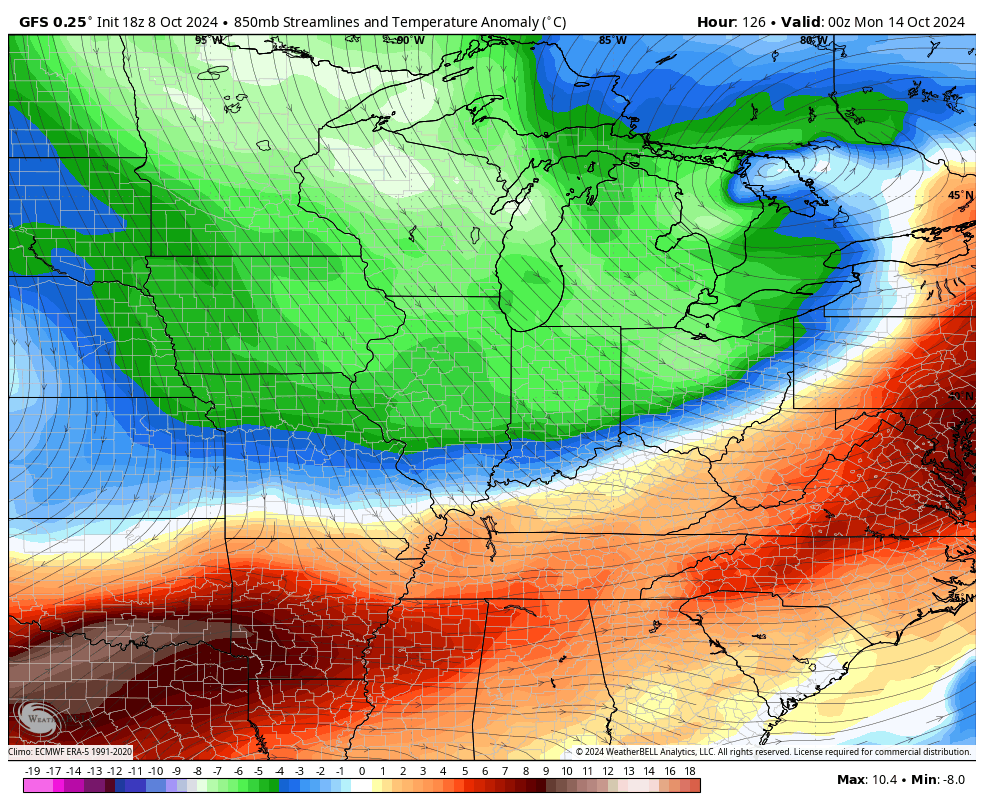
The cold coming in behind this is stout, folks. Check out those Barney colors…
GFS
EURO
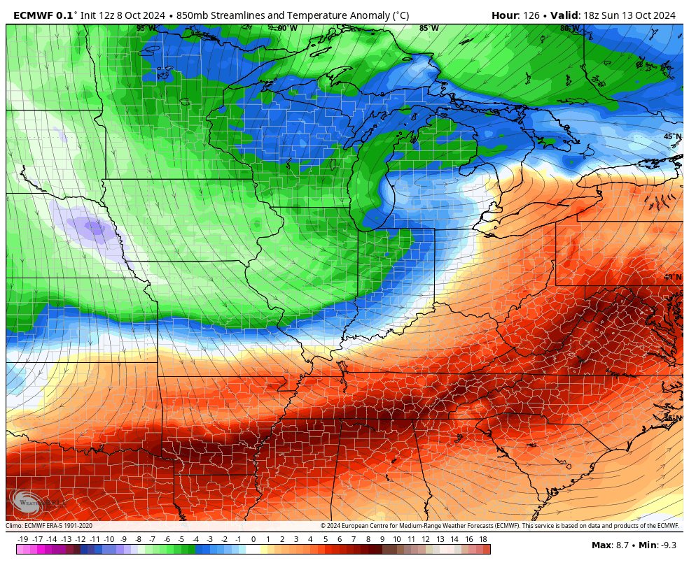
Lows can go below freezing by Tuesday or Wednesday with widespread frost or a light freeze. I think you will see the models trend colder than the current lows they’re spitting out…
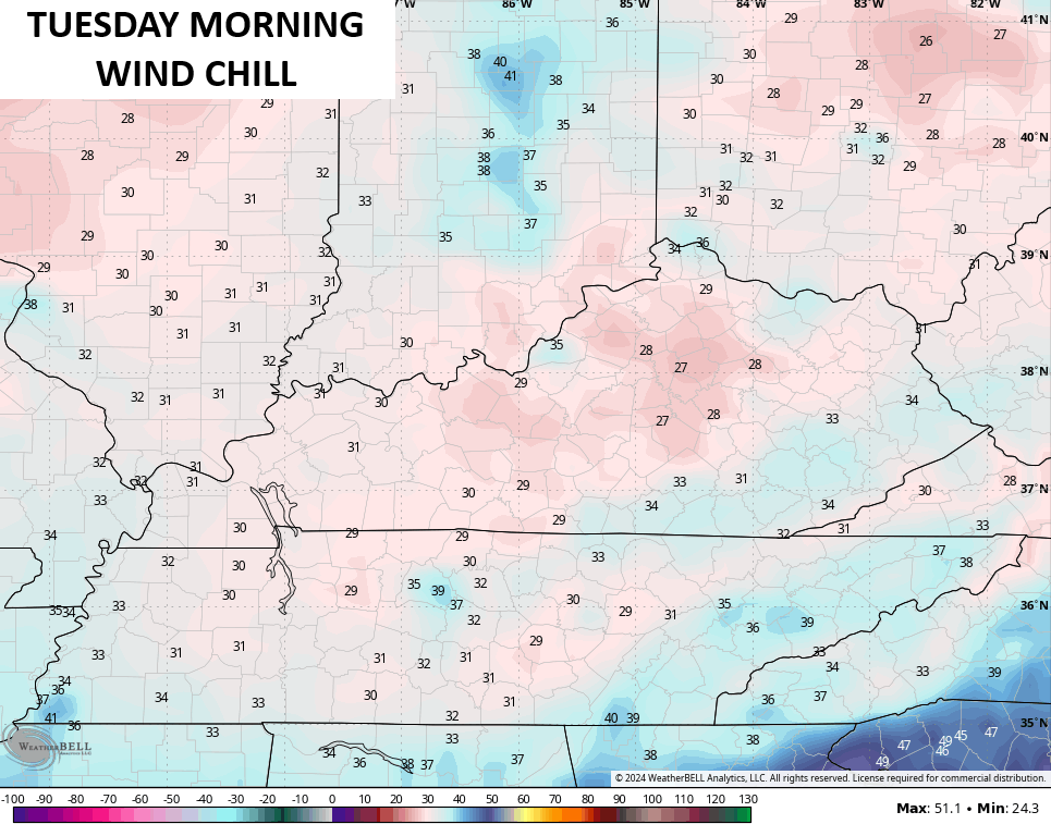
Wind chills may be an issue early on as a gusty northerly wind cranks…
Highs will likely be in the 50s for several days next week.
Oh yeah… The GFS Ensembles have a little something for the eastern mountains…
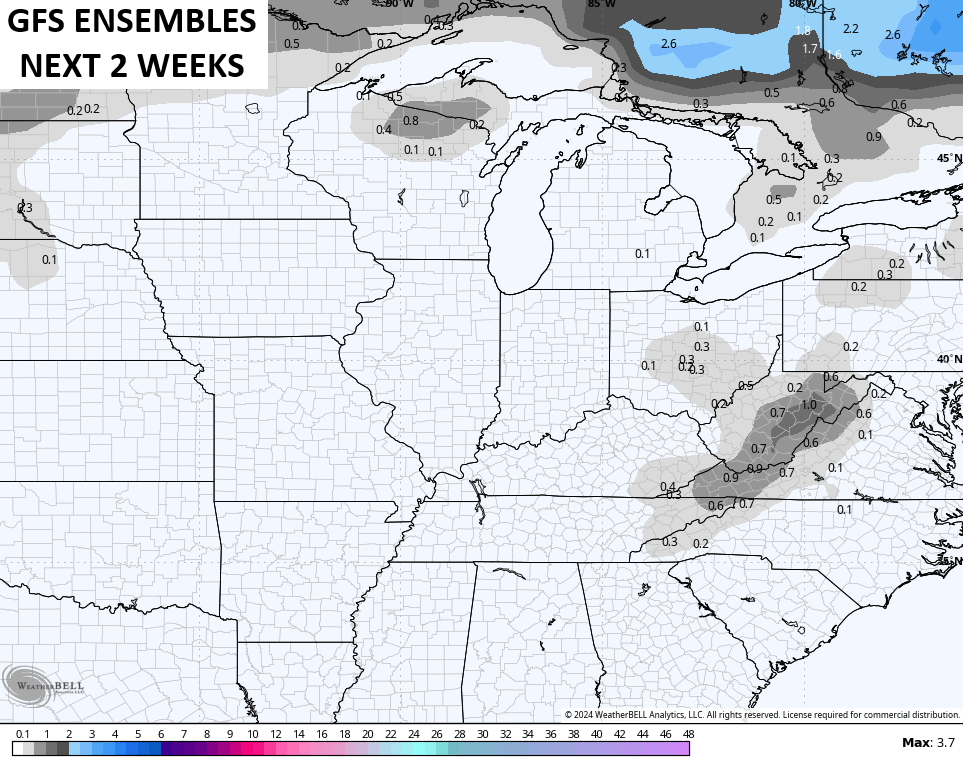
Hmmmmmmm. That happens because the model cuts off a big upper level low in our region. There’s even a hint of this showing up on the GFS. Something to watch going forward.
Enjoy the day and take care.

Thanks Chris, for the update on this potential disaster. I appreciate all your coverage on Hurricane Milton, as it get closer to the West Coast of Central Florida. Will be glad when all is said and done, and we can study our weather here in Kentucky. Happy to see the first flakes of Snow on the maps you presented this morning, even though it’s not in my area. A hard frost and maybe a freeze next week, will bring in Autumn big time.
Have a Great Day Everyone, and please Pray for all the Folks in the path of the Hurricane.
The latest update on Milton predicts that it will make landfall as a Ctg 3 storm, with an area of strong shear and an influx of drier air interrupting the moisture flow. But that can be misleading because even though the peak winds will come down a bit, the storm surge will remain at life threatening levels. The shallow water depths off of the Florida coast will tend to amplify the surge effects, the worst of which will be in the east-southeast quadrant of the storm.
Talked to my Brother in Law this morning and he doesn’t expect that he will have a home after Milton. I told him that it’s better to be your home than your life. I been studying the weather across our Nation, and around the World for over 50 years and I Never seen a Tropical season like this one. I wish the PDO would go to the positive phase, because it would end this. The PDO has been negative since 2019.