Good Friday to one and all. It’s another gorgeous weather day across Kentucky as a mild wind gets ready to kick in for the weekend. This mild wind is ahead of a big blast of mid-October cold crashing in early next week.
Before we get there, I hope you guys had the chance to catch last night’s Northern Lights here in Kentucky. It was our second amazing night since May and that’s almost unheard of. Go to my Twitter/X feed to see all the pics from last night.
Temps this morning are in the upper 30s to mid 40s with a kiss of frost possible in the cold valleys. Highs this afternoon range from the upper 60s to mid 70s.
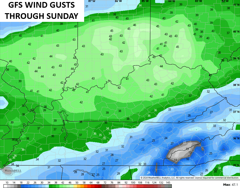
Winds crank this weekend as temps hit deep into the 70s. That southwest wind really gusts up ahead of the front on Sunday. Gusts of 30mph to 40mph will be possible. Some of the models are coming in above that…
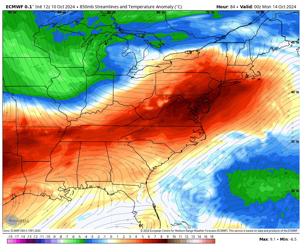
This is ahead of a huge push of much colder than normal air sweeping in Sunday night and Monday…
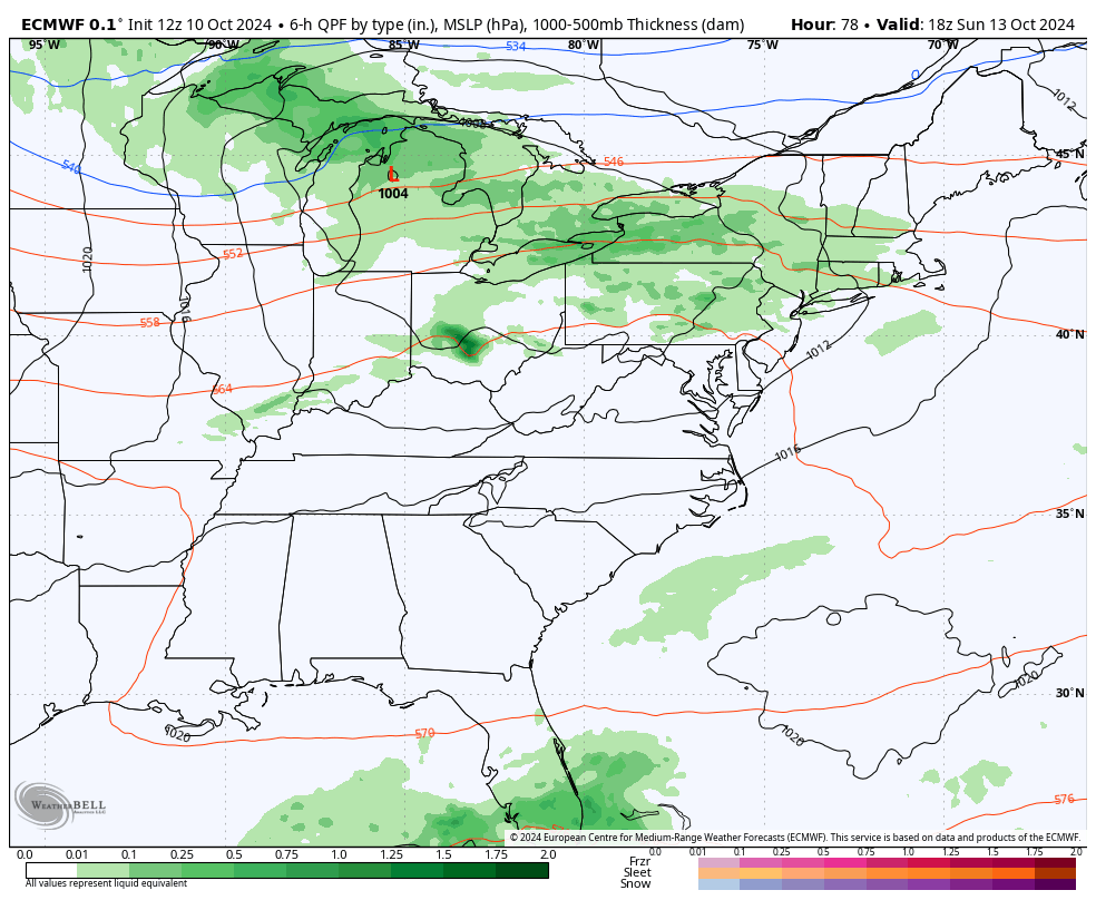
This will be accompanied by the chance for a few chilly showers on Tuesday, especially in the eastern half of the state…
The models continue to show some snowflakes across the high elevations of the Appalachian Mountains just to our east. That said, the EURO even suggests a wet flake in southeastern Kentucky…
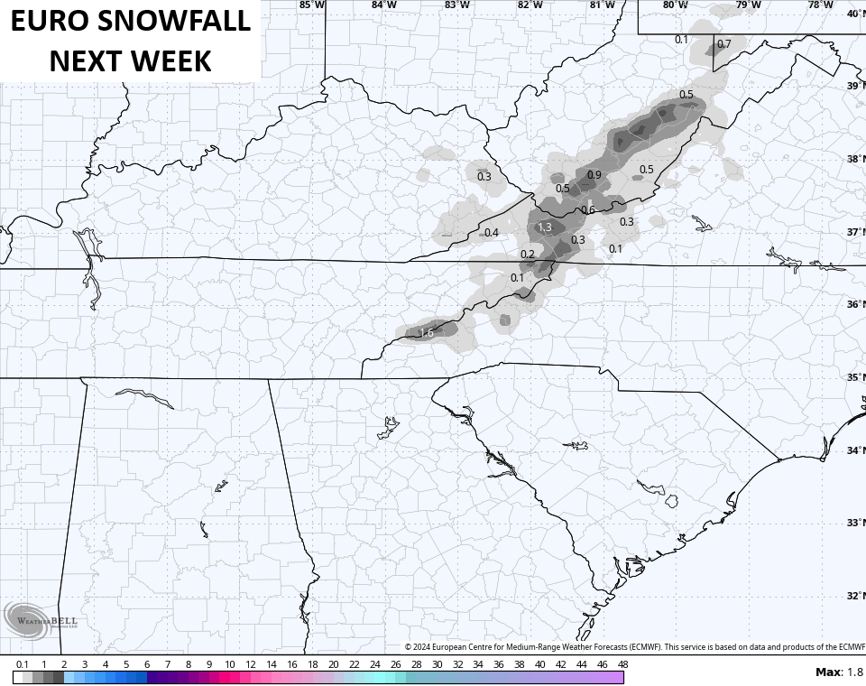
I’m not really down with that, but it’s interesting to see from a model this early in October.
Highs much of next week stay in the 50s. On nights with clear skies, lows can drop to freezing or below. That means frost and a light freeze will be possible.
The pattern after this is interesting to see as we may fire up another tropical system in the Caribbean. There’s a chance this gets into the Gulf of Mexico at some point.
This overall setup is also one that’s looking rather blocky again and that may cause additional big dips in the jet stream into the eastern half of the country. The models have been picking up on this from time to time and the EURO AI is pretty consistent with it…
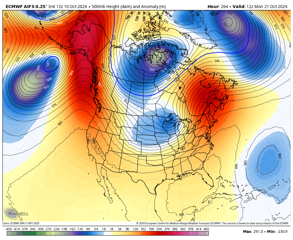
That looks more like a winter setup and is getting my attention.
Enjoy your Friday and take care.
