Good Saturday to one and all. We are kicking off a gorgeous weekend across the Commonwealth as gusty winds usher in some really mild air. This is ahead of a cold front dropping in here late Sunday that will unleash the coldest air since early spring.
Speaking of cold, the patchy frost we talked about showed up in several areas…
@Kentuckyweather frost on roof tops here in Goose Rock community of Clay Co. pic.twitter.com/Vv9mAmSaMD
— Allen B. Roberts (@abrkylaw) October 11, 2024
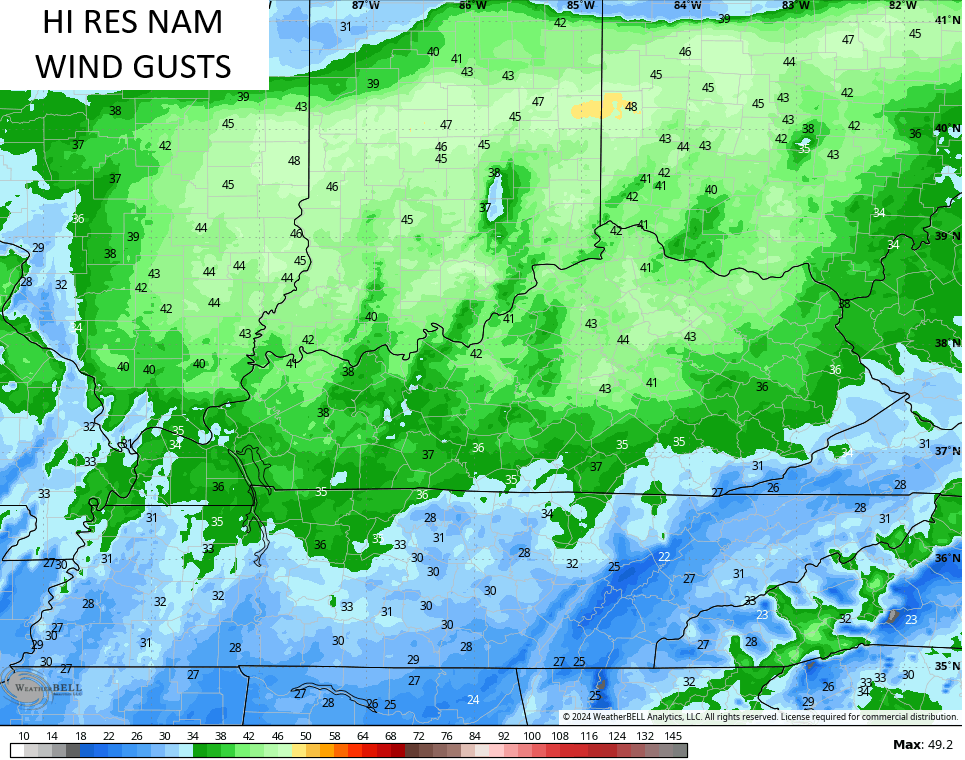
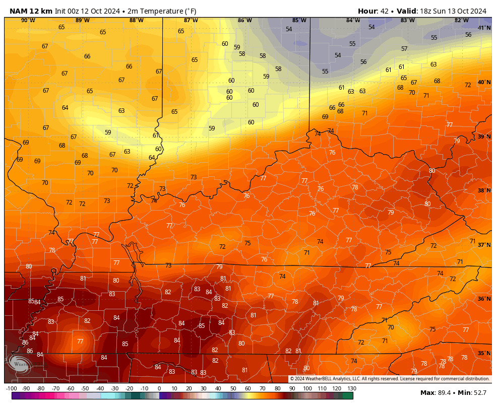
Temps out there today are deeeep into the 70s with an 80 in the west. Similar temps will be noted on Sunday as those winds really begin to crank. Wind gusts through Sunday night may reach 40mph at times…
This front is moisture starved so don’t expect much more than a passing shower. Temps behind this absolutely tank. Check out the difference from 2pm Sunday through 8am Monday…
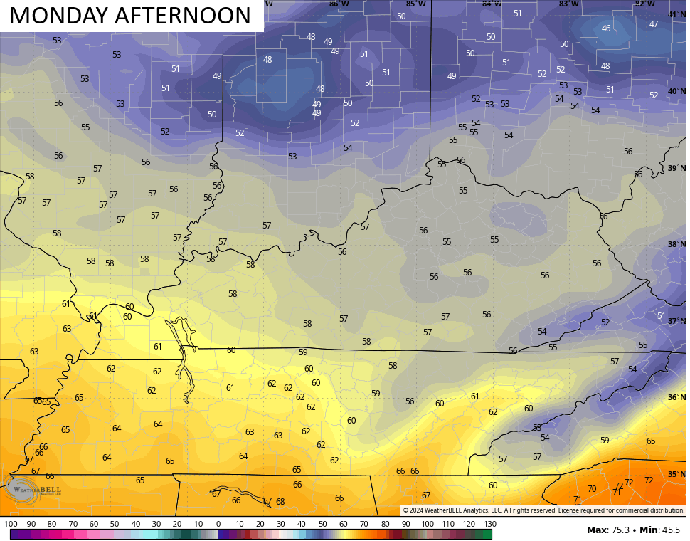
Temps on Monday stay in the 50s on a very gusty and chilly northerly wind…
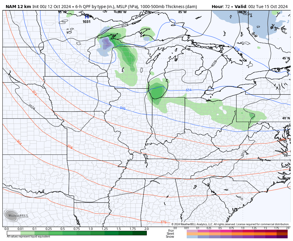
As a big upper level system dives into the Ohio Valley Monday night and Tuesday, it will likely bring a few chilly showers into our part of the world. This air mass is so cold, we are seeing all the models spitting out some flakes across the high ground of the Appalachian Mountains north through New England.
The NAM even suggests a pocket of flakes in Indiana at the end of its run Tuesday morning…
As this system pushes through Tuesday, eastern Kentucky may struggle to get much past the 50 degree mark for a high. This is a winter looking setup…
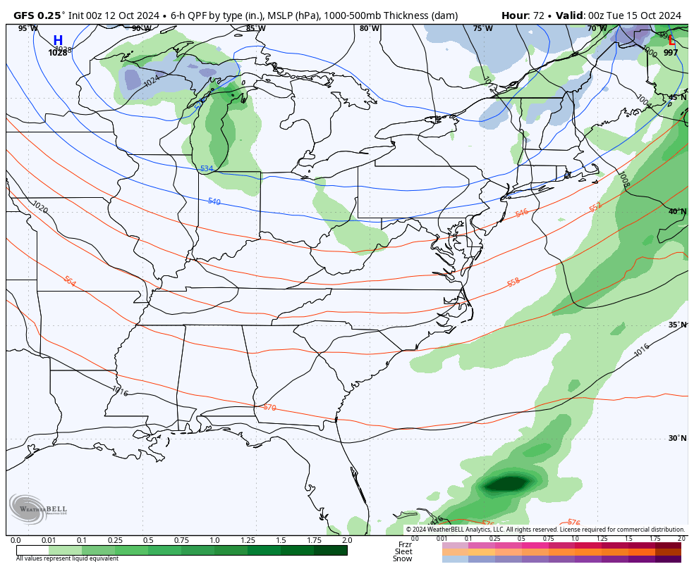
Clearing skies behind this allow temps to make a run at freezing or below for lows…
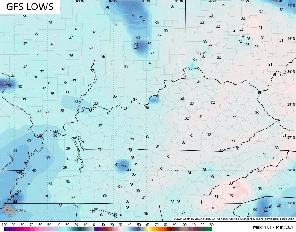
I think we get our first upper 20s out of this pattern, folks.
The tropics have calmed down for now with only a few systems well out there in the Atlantic…

Watch the Caribbean for development over the next few weeks. Anything that pops down there has a chance to get into the Gulf, eventually.
Looking longer range on the EURO Weeklies, they are trying to start winter off a little early in November. The latest EURO Weeklies snowfall numbers look like this through November 25th…
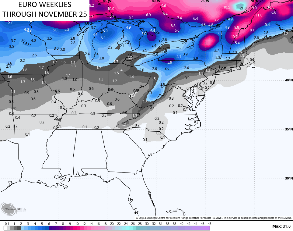
Hmm.
Make it a great Saturday and take care.

Not buying the EURO weeklies hype.