Good Monday, everyone. It’s a whole new ballgame in terms of the weather. The coldest air since early Spring has invaded Kentucky and may even bring the first flakes of the season to the highest mountains of the Appalachian Mountains. For the rest of us, we have to settle for frost and a light freeze.
Temps today are in the 50s across central and eastern Kentucky with low 60s in the west.
Skies will feature a mix of sun and clouds with more clouds entering the picture later in the day. That’s when a few showers sweep into northern Kentucky as a big upper level system drops in from the northwest.
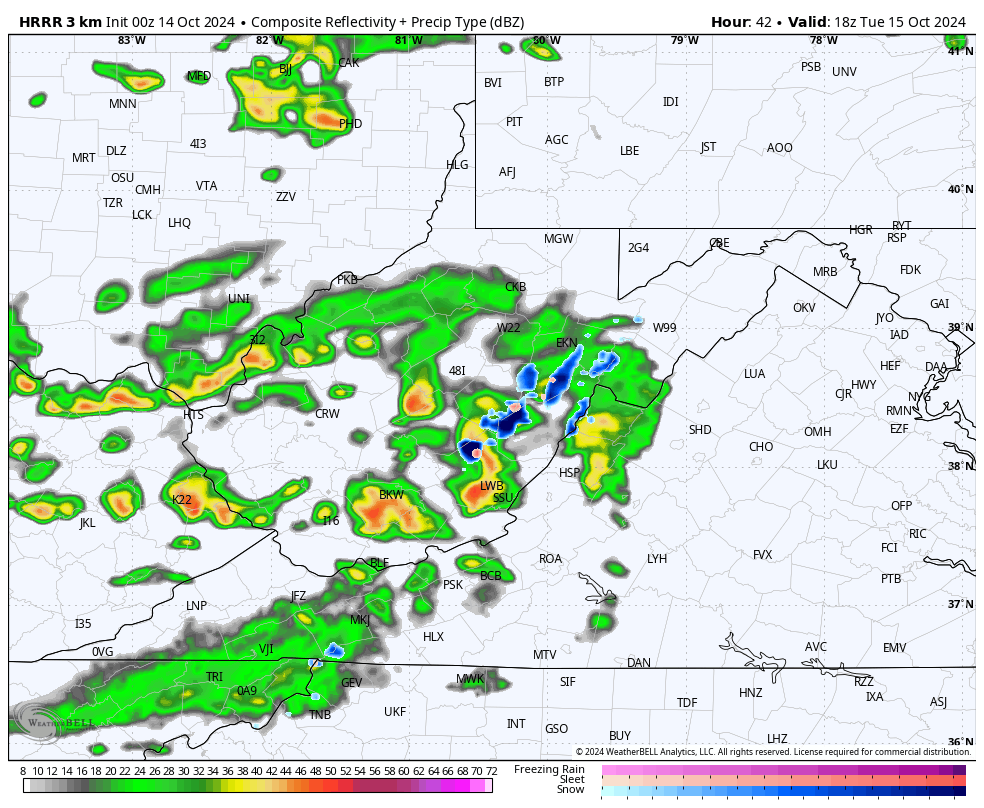
Here are your Kentucky weather radars to follow the progress of that action…

This upper-level system sweeps in here with chilly and gusty showers for central and eastern Kentucky on Tuesday. The setup is one more typical of winter so there’s the chance for snows across the high mountains from West Virginia down to western North Carolina. Some of these flakes may fly in the highest elevations along the Kentucky/Virginia border.
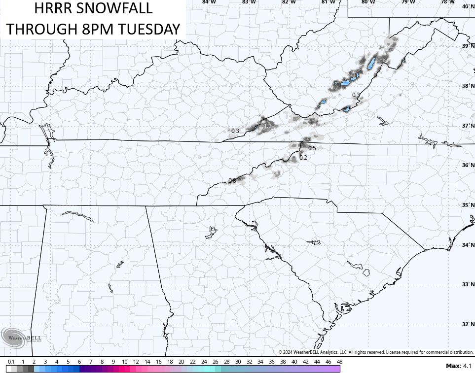
The future radar from the HRRR snows some late day flakes in far southeastern Kentucky…
Here’s the snowfall from that model run through 8pm Tuesday…
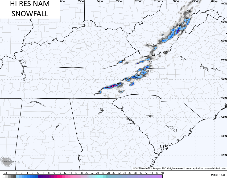
The HRRR isn’t alone in showing the chance for some flakes across far southeastern Kentucky. The Hi Res NAM has it…
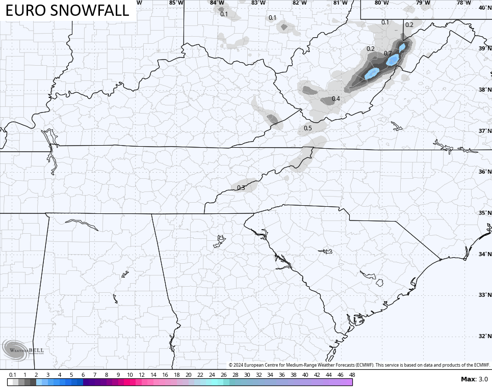
The EURO also sees the chance for some flakes…
With such cold air aloft and with the freezing line so close to the ground, some graupel may show up across central and eastern Kentucky Tuesday afternoon and evening. Graupel is considered winter weather, btw.
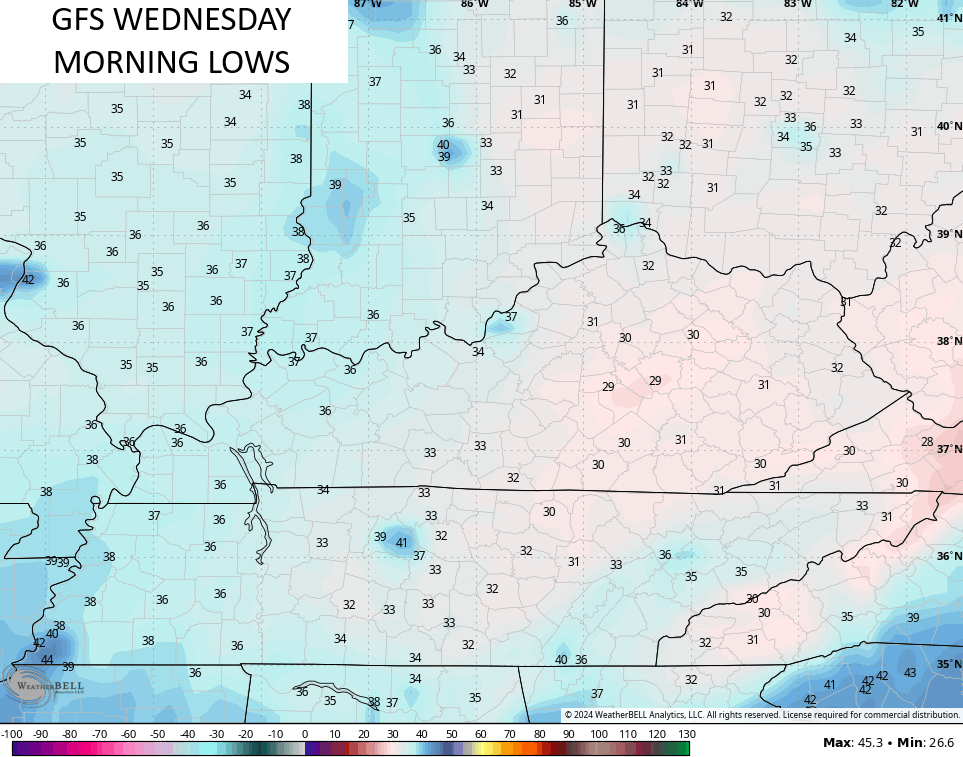
Cold winds continue to blow into Wednesday with the chance we wake up to a light freeze. Lows can reach the upper 20s and low 30s if skies are clear…
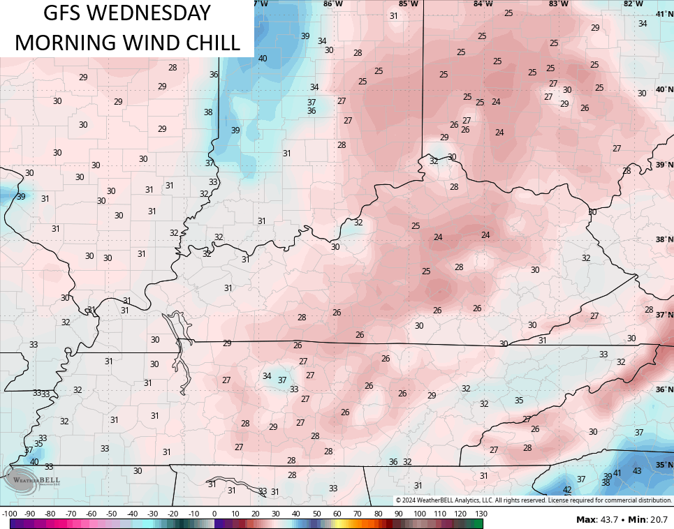
Gusty winds will make it feel even colder with a wind chill in the low and mid 20s at times Wednesday morning…
Frost and a light freeze would then be likely Thursday and Friday mornings.
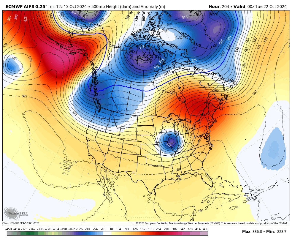
Looking longer range finds the potential for a slow-moving closed low to roll our way from the Plains later next weekend into the early the following week. That would be followed by a mild up ahead of a pattern trying to place a big trough into the east for the closing week of October.
The EURO AI has been doing a pretty good job with the overall pattern for a while now. Here’s what it’s seeing for the time I just outlined…
Can that first system bring some hefty thunderstorms into our region? That’s a possibility.
Of course, this time of year the pattern can be severely altered by what happens in the tropics. The National Hurricane Center is watching the system heading toward the Caribbean…

Make it a great Monday and take care.

Thanks Chris. Putting that all aside, I would like to experience a Winter where our first accumulating Snow is the week of Thanksgiving, and continues through December into mid March, with moderately Cold temperatures, and many wet Snow events throughout the Winter. I only experience this scenario once in 1969 – 70.
Hoping now that after this Frost / freeze, we have a week of Rainy weather, as the Wildfire potential is increasing once agin. UGH !
Enjoy Columbus Day Everyone