Good Tuesday, folks. It’s day straight out of mid to late November as a big upper-level system swings into the region. This is bringing cold winds and the chance for a touch of winter weather into our part of the world, especially in the mountains.
Today is a pretty neat weather day. Here’s a look:
- A big upper low spins in from northwest to southeast.
- Temps spike into the low 50s then drop into the 40s during the afternoon and go even colder under precipitation.
- Gusty showers roll through here with the chance for a little bit of graupel. Think of graupel like dip-n-dots. Yes, that qualifies as winter weather.
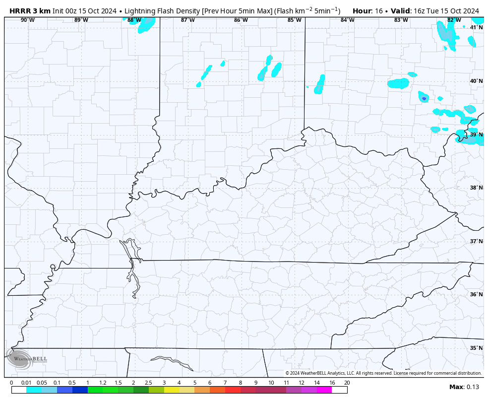
- Some thunder and lightning may accompany today’s action.
- Speaking of winter weather, far southeastern Kentucky can see some light snow in the high ground along the Virginia border.
I mentioned the thunder and lightning potential. Check out the HRRR lightning density forecast this afternoon into the evening…
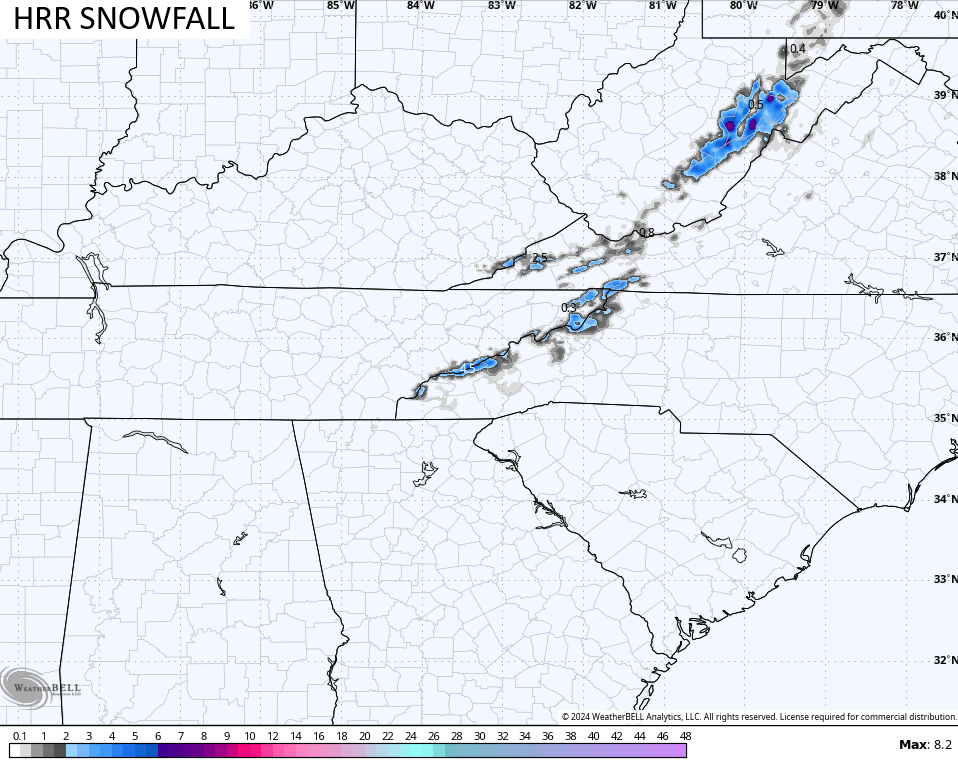
The snowfall forecast from the HRRR shows just a spot on the Virginia border with greater amounts to our east…
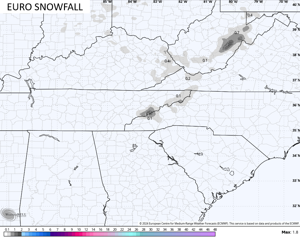
The EURO snowfall map is even seeing the graupel chance across central and eastern Kentucky…
Before we talk about the frost and freeze behind this, here are your Kentucky weather radars to follow today’s action…

Skies clear quickly overnight and that allows temps to drop into the upper 20s and low 30s, giving us a light freeze…
Winds are going to still be pretty gusty, leading to a wind chill reaching the low and middle 20s for parts of the region…
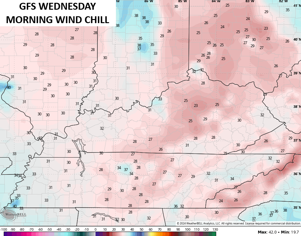
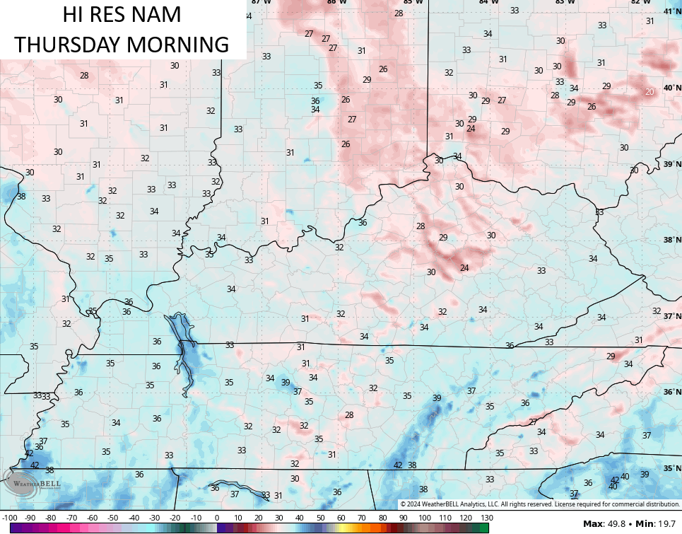
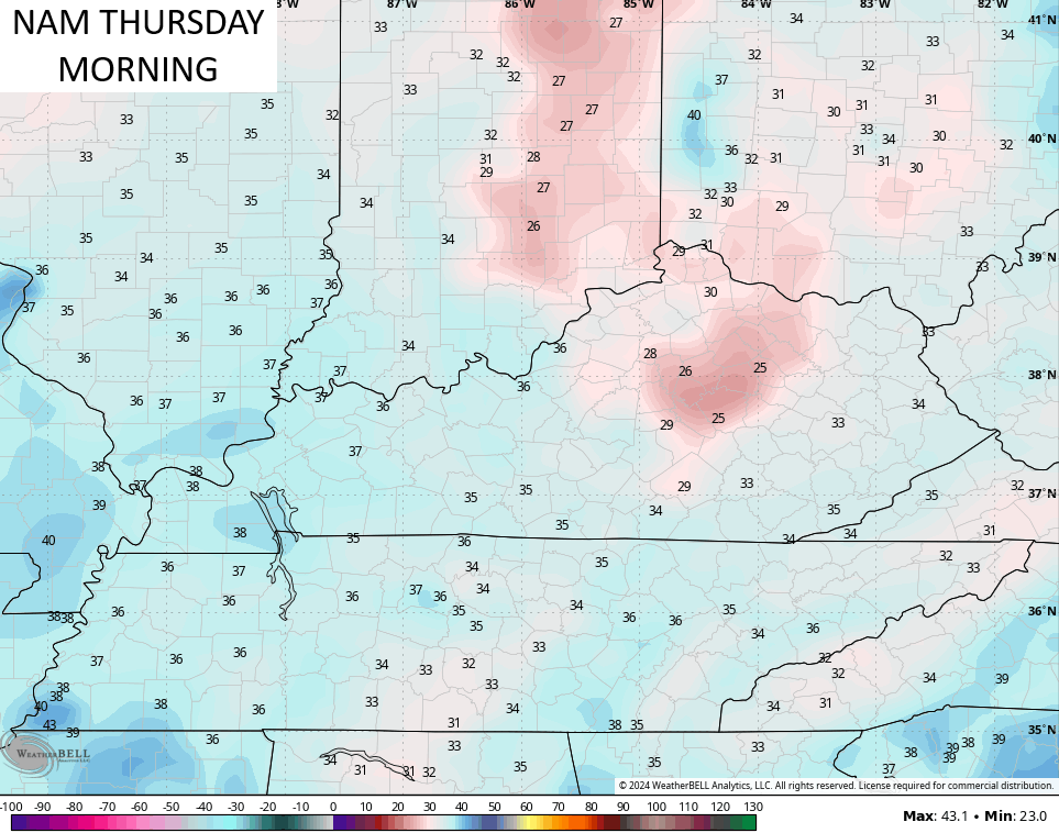
A widespread frost and freeze is then likely Thursday morning with temps that can fall into the mid and upper 20s. The models are just starting to see this…
I think we do that again Friday morning… The Green Thumb Alert is in full swing, foks!
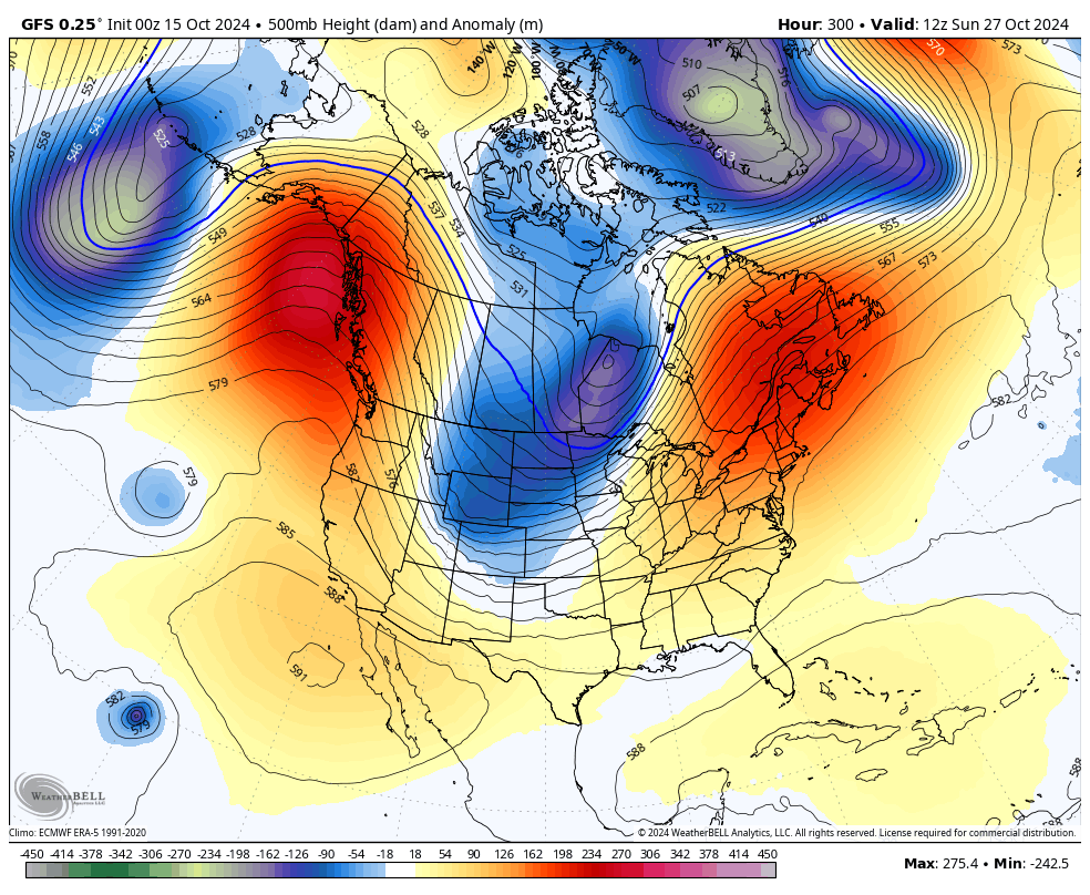
The weekend weather looks great as our numbers climb from the cold stuff of the week. We continue to watch for another cold front to sweep in here during the first half of next week. I continue to watch the closing week of October for the potential of another winter looking trough to invade the east.
The GFS has joined recent runs of the EURO AI in seeing this…
In the tropics, the NHC is still watching that system heading toward the Caribbean…

Have a terrific Tuesday and take care.

I eagerly await the impending annual mosquito hibernation and not having to mow for the next 5 months. 🙂
My old garden hoses become increasingly cantankerous and stiff as temperatures drop, but they’re essential when rain is MIA. It’ll be a while before winter truly pushes everything into dormancy.
It appears “graupel” is our new favorite word for the blog. Guess that means we should try to use it in everyday conversations to keep everyone abreast of the latest fashions in the weather forecasting vocabulary.
I never use the word ” Graupel ” to described ” Snow Pellets. ” I guess our new way to receive Rains are from remnants of Hurricanes. What ever happen to terms like the Colorado Low pressure systems, and the Texas Panhandel Low pressure systems. These systems use to be our primary precipitation producers, both Summer and Winter. Weather these past years has not been the same. I don’t know if the weather / climate is being caused by the current Solar Cycle # 25, or if it is being artificially manipulated for Political gains ?
“Snow pellets” or “soft hail” has been good enough. Descriptive. Immediately understood.
I don’t think it will be long.