Good Monday, folks. It’s Halloween week and things are starting off on a super nice note, but that doesn’t look to hold the entire week. As a matter of fact, the threat for gusty showers and a few storms is there for trick-or-treating on Halloween. Boo!
Temps today are upper 60s to low 70s with a mix of sun and clouds. The 70s are back for Tuesday and Wednesday as we get set for the month-ending cold front set to arrive on Thursday.
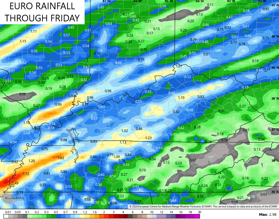
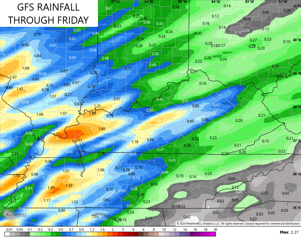
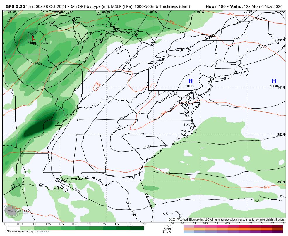
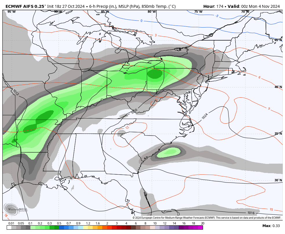
This front brings a pretty decent line of showers and storms with it from west to east on Halloween with most of the action clearing the start by Noon Friday. Here’s the EURO showing the progress of rain Thursday morning through Friday afternoon…
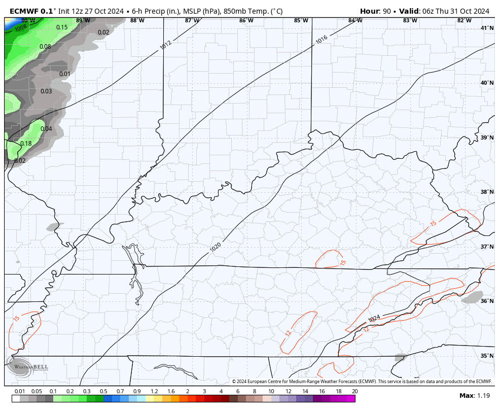
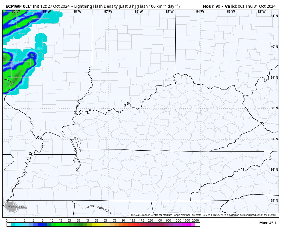
There’s even the chance for some thunderstorms with this and I can’t rule out some of those being strong across the west. You can see how the lightning forecast weakens these pretty quickly as they move into the eastern half of the state…
Much-needed rains are a good bet with these showers and storms. This will likely keep many cities from finishing in the top 5, or even top 10, driest Octobers on record. The models are seeing some streaks of 1″ rains…
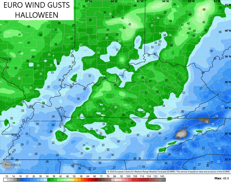
EURO
GFS
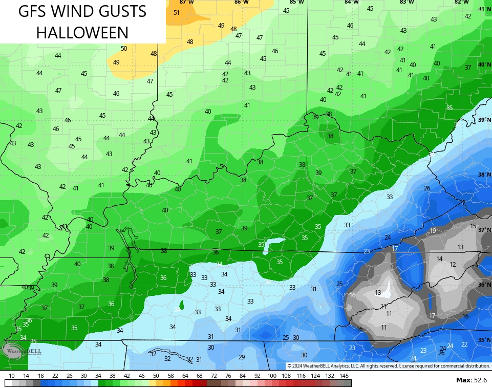
Gusty winds will be likely on Halloween with the models suggesting peak gusts of 30mph or greater at times…
EURO
GFS
Once again, much of what happens over the next few weeks will be dictated by what happens with a possible tropical system from the Caribbean. The National Hurricane Center continues to show the potential for late season development there…

The GFS continues to develop this system and takes it toward the southeastern seaboard next week. At the same time, it brings a series of systems through our region with the trough pushing this off to the east…
The AI version of the EURO isn’t as robust with this system, but appears to take something into the Gulf before a trough sweeps in and picks it up next week…
Ya know… This pattern has the chance to bring some flakes nearby late next week into the following weekend.
Have a magnificent Monday and take care.

Raked leaves Saturday and yesterday afternoon. Can’t remember when they have been so dry and light. Every little puff of wind sent them swirling about.
Thanks Chris. Next few days ( temperature wise ) will be like late September. We keep going back and forth with this long playing weather pattern. I am enjoying the mild Sunny days with clear blue skies, but the lack of measurable precipitation really has me worried.
Here’s and interesting and understandable article on weak La Nina Winters. What to expect this Winter here in Kentucky as far as Temperature and precipitation.
https://www.weather.gov/media/lmk/climate/Winter_Outlook_2024-25.pdf
Enjoy the Day Everyone and be Safe !