Good Friday, everyone. Some really nice weather is returning to the state following recent soaking rains for many. Guess what? Another soaker is on the way this weekend as showers and thunderstorms blow back in ahead of another potent storm system.
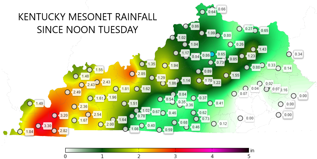
If we look back on the recent rains, check out the swatch of 1″-3″ for much of western and areas of central Kentucky, with barely a drop in the far southeast…
Temps today are into the 60s with a mix of sun and clouds.
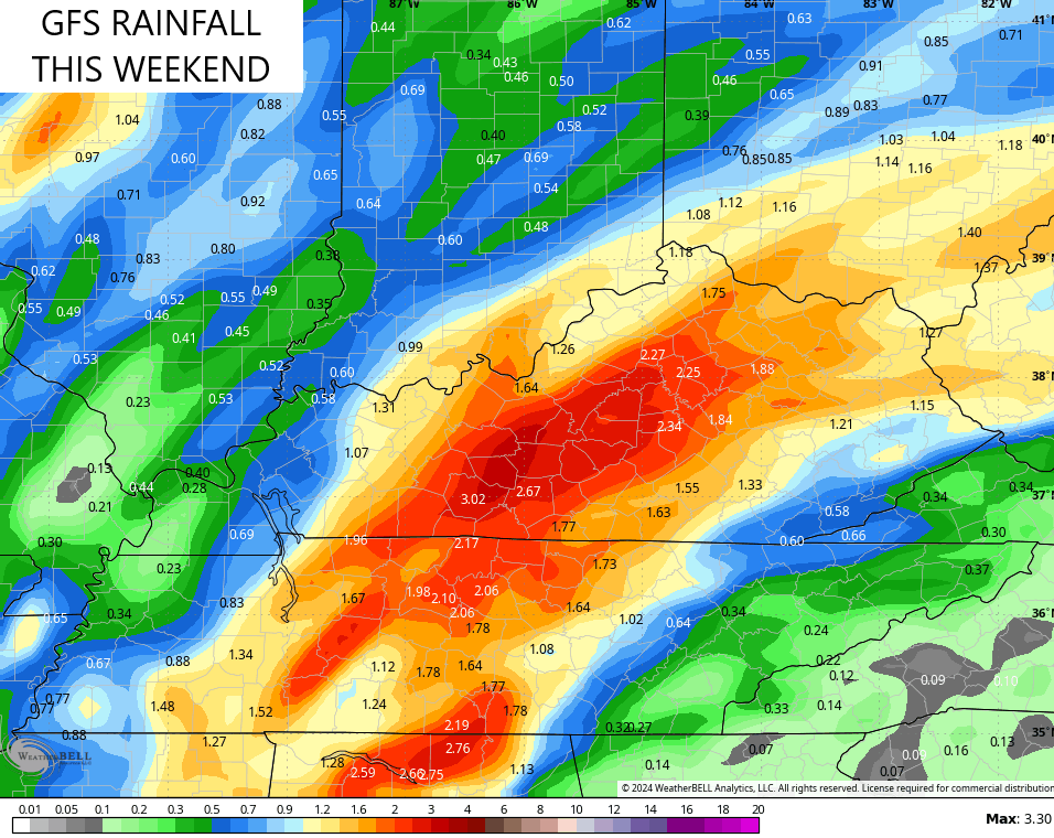
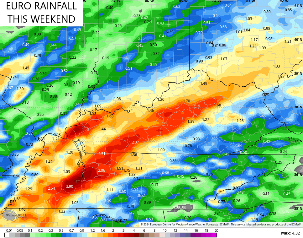
A big-time low pressure rolls from the Plains toward the Great Lakes this weekend. This brings widespread showers and storms spreading from west to east late Saturday through Sunday with heavy rains likely once again.
The models are showing another 1″-3″ rainfall swath setting up…
![]()
![]()
Gusty winds along and ahead of this front will also be likely Saturday night into Sunday. Gusts from 30mph to 40mph may show up.
Meanwhile in the tropics, Hurricane Rafael continues to slowly work across the central Gulf of Mexico and should stay there as it slowly weakens. That’s what the latest track forecast from the National Hurricane Center suggests…

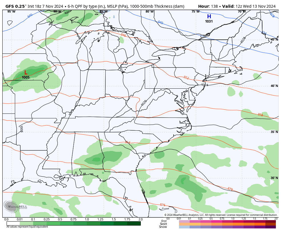
While Rafael likely stays a fish storm, we track another powerful system rolling in here by Wednesday and Thursday. This brings another round of widespread showers and storms with a quick-hitting blast of colder air behind it…
Temps should bounce right back up as that pulls out as we wait for the next system to arrive in similar fashion a few days later.
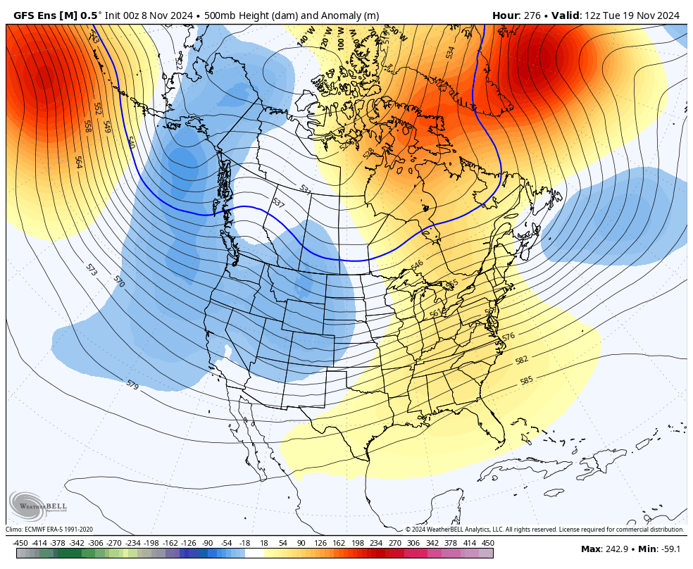
There’s some evidence that these short-lived, quick hitting, troughs could lead us into a more conducive pattern for normal or below normal temps once into the second half of the month. Watch how the GFS Ensembles build a deeper trough in here as we get into the week before Thanksgiving…
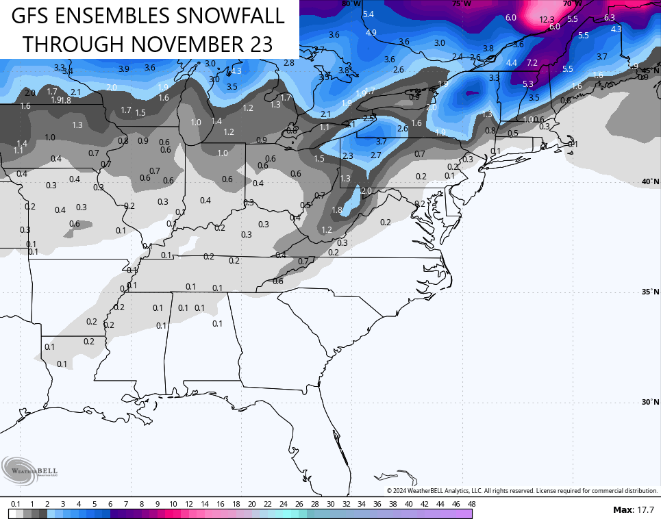
Those same Ensembles are also showing the chance for some flakes around the same time…
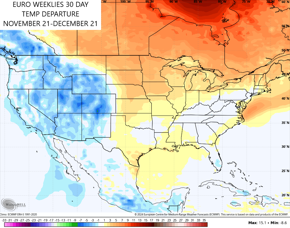
Looking longer range, we are now seeing the EURO Weeklies trending colder for late November through the days leading up to Christmas. The average 30 day temperature anomaly shows near normal temperatures for our region…
All things considered, that’s actually not a bad look for us.
Have a fantastic Friday and take care.
