Good Sunday and welcome to December. The month is opening up on a snowy note as a light snowmaker pulls away with another light one waiting in the wings. Does the portend a snowier than normal December?
For Lexington, this is only the 5th time in the past 60 years that we have started December with snow on the ground. The other years are 2000, 1976, 1974 and 1964. 2000 gave us a Christmas Eve snowstorm and then the ice storms later that winter. 1976 went on to become one of the worst winters on record. 1974 was warmer than normal with a few snows. 1964 was a cold winter with normal to slightly above normal snows.
Does any of that mean anything? Probably not, but it’s fun to look at.
Morning light snow continues to fade across the eastern half of the state with some lingering flurries through the day as some sun tries to show up on a very cold northwest wind.
Winter Weather Advisories that start the day will be allowed to expire from west to east…

Temps hit the teens tonight with gusty winds sending wind chills toward the single digits at times.
There’s another fast-moving light snow maker moving in Monday and Monday night. This one drops in from more of a northwest to southeast direction…
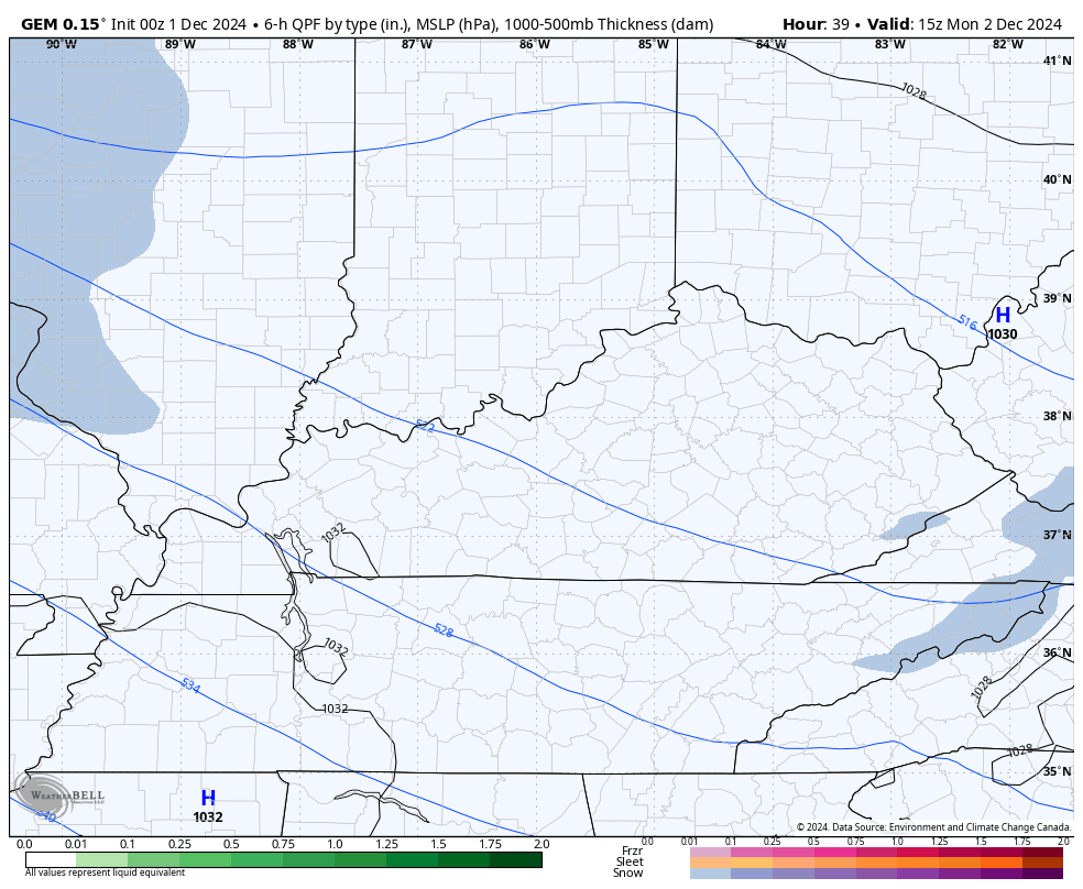
This puts down coatings to MAYBE an inch for a few areas. I may have to put a First Call map together for that one later today, though it’s even lighter than the light one we just had.
Temps rebound a bit by Wednesday as another arctic air mass gets set to push in from the north and northwest. As I’ve opined in recent posts, the operational models will struggle mightily with these and any potential snow systems that accompanies them.
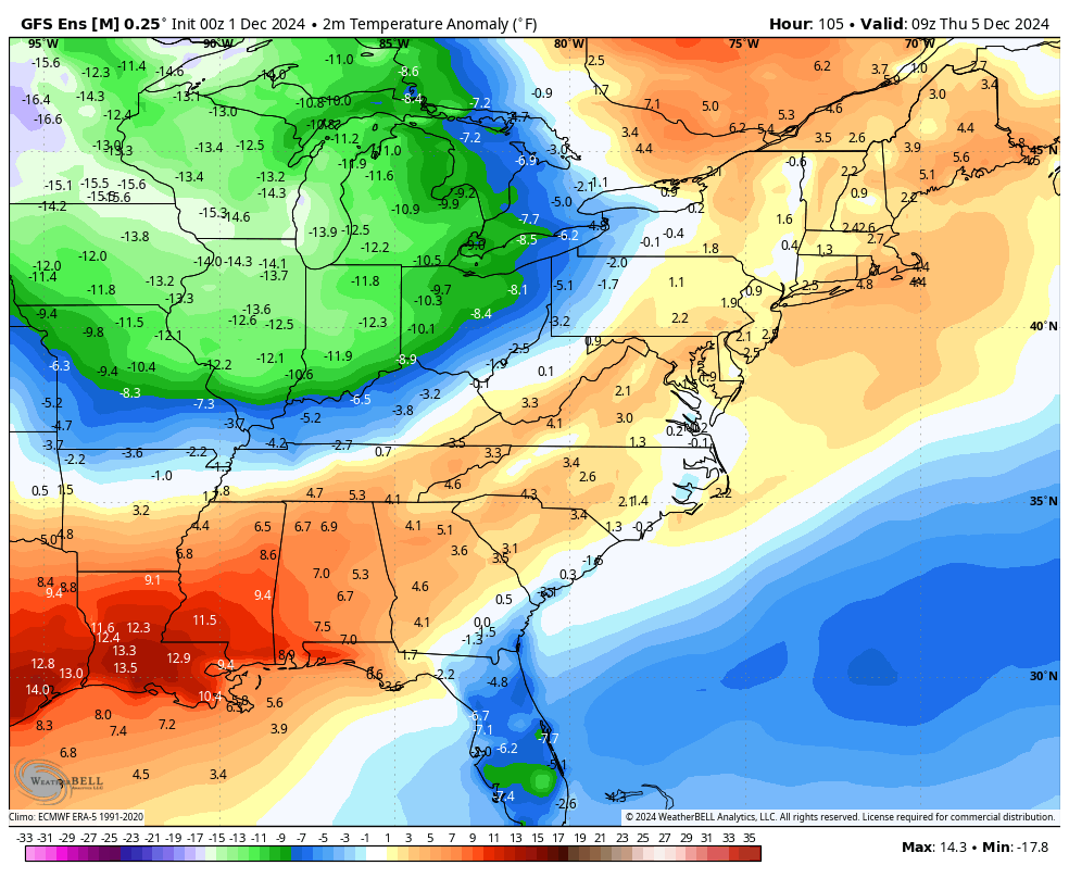
The GFS Ensembles, though, gives us a nice look at another big time run of much colder than normal temperatures. This animation starts Thursday and runs through December 11..
Looking at the month of December as a whole, we find the two most prominent extended models singing a similar tune. Both the GFS Extended and EURO Weeklies now have the month averaging colder than normal for our region and much of the eastern half of the country…
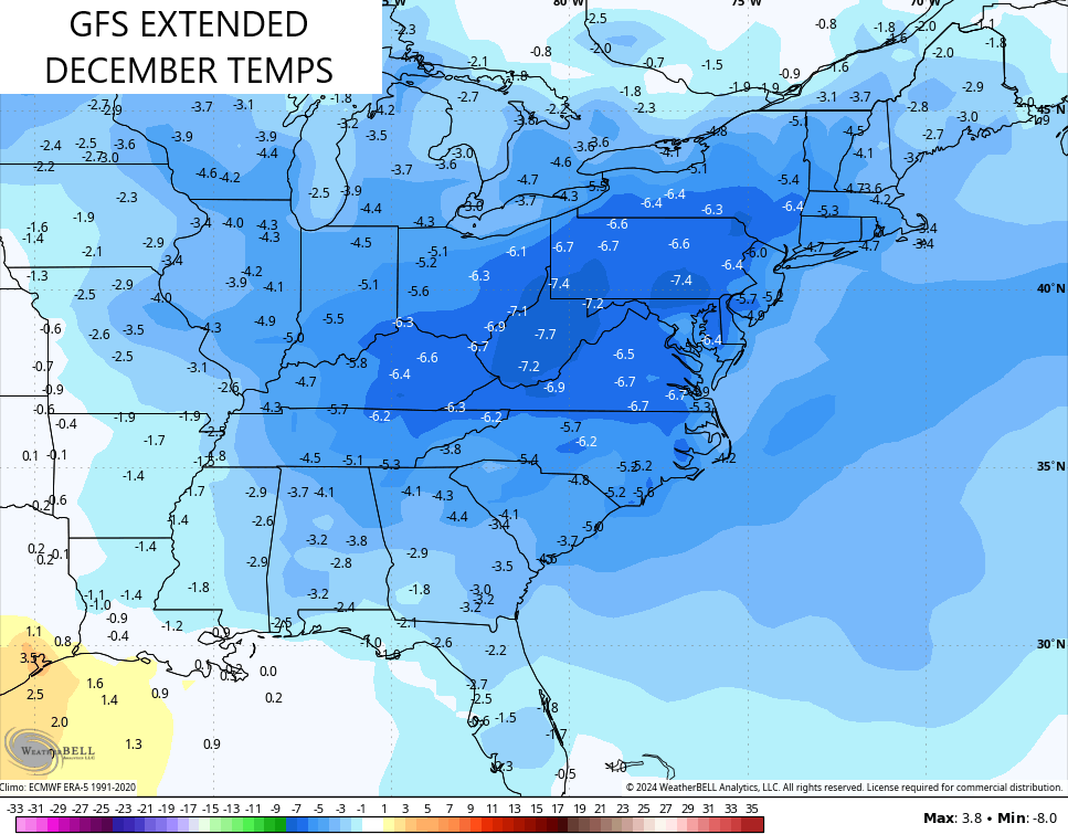
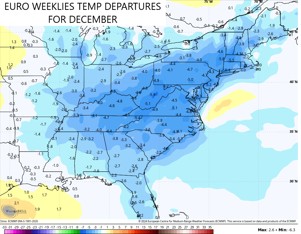
It’s been a long time since many of these areas had a colder than normal December, y’all.
What about snowfall? Both like the snow chances through the holidays…
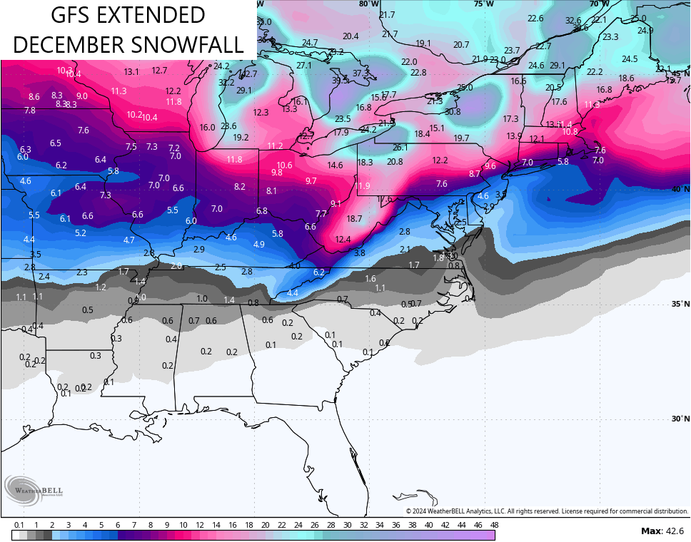
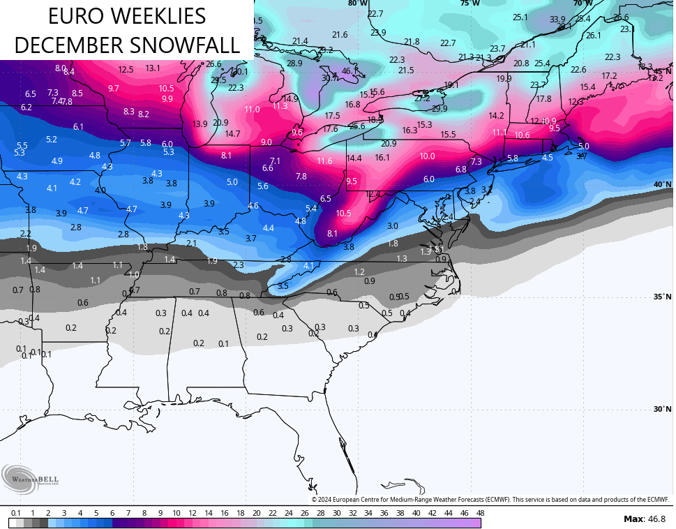
That doesn’t mean the month won’t have a few milder stretches, because it will, it just means those models have the entire month averaging colder than normal with above normal snowfall.
Updates coming later today. Until then, I have your tracking tools including our Kentucky Weather Cams to watch the flakes flying across different parts of the state.

Have a good snowy Sunday and take care.

Thanks Chris. My county of Taylor didn’t receive any accumulating Snow from this system, so your prediction paned out. I’ll view the weathercams later to enjoy the areas that did. Those years that you mentioned bring back fond memories for me, especially 1964 and 1976.
Have a Blessed Sunday Everyone.
I don’t foresee anything above normal for snow, but maybe colder.