Good afternoon, everyone. Rain continues to spread into the region from the southwest and will be followed by a blast of winter. Can this winter blast put some light snow on the ground for some of us? The answer is yes.
Our cold front arrives Tuesday with rain ahead of it and crashing temps behind it. A wave or two of low pressure develops along this front late Tuesday through early Wednesday. The exact location this happens will be the determining factor on who gets snow and how much can all.
The setup reminds be a bit of a much weaker version of what happened Christmas Eve and Christmas Day of 2020.
The Canadian family of models has been leading the charge with this system from the beginning and we are seeing these models become more emphatic on the snow potential. The Short Range Canadian shows a stronger low developing farther west, bringing the chance for accumulating snow to much of Kentucky…
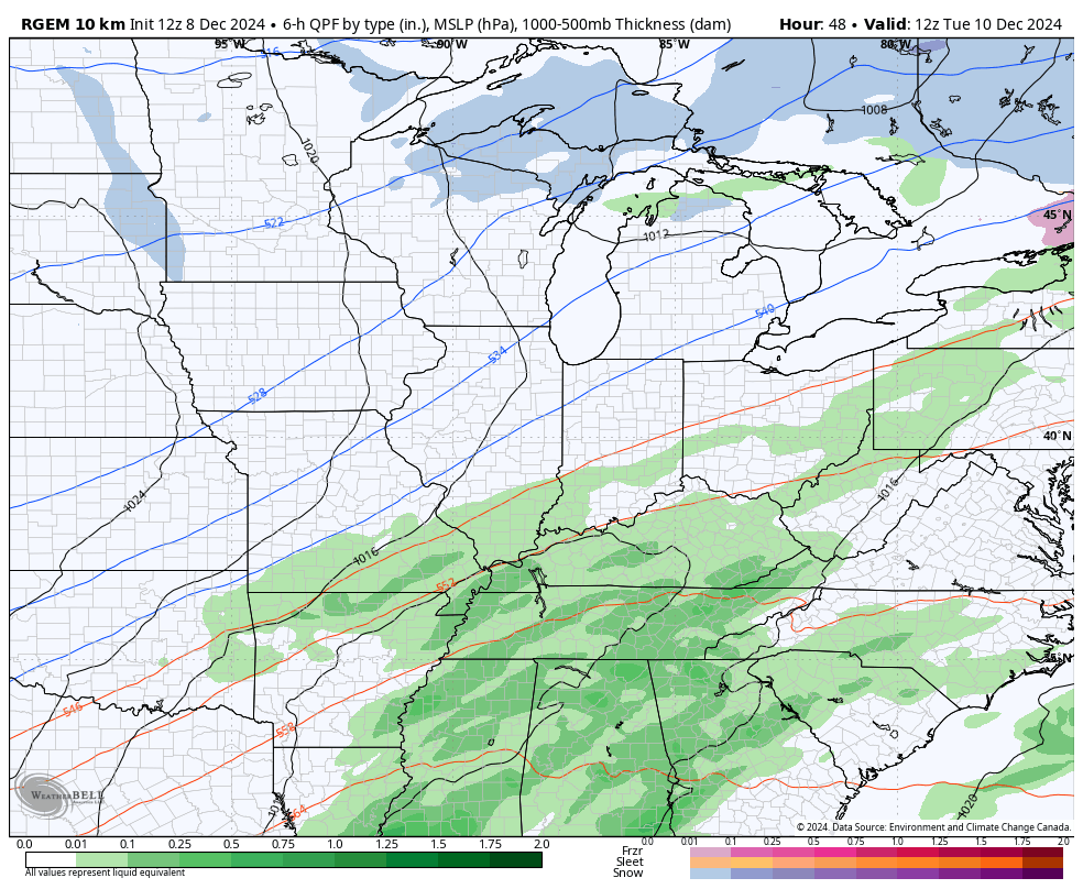
Here’s the snowfall map from that run…

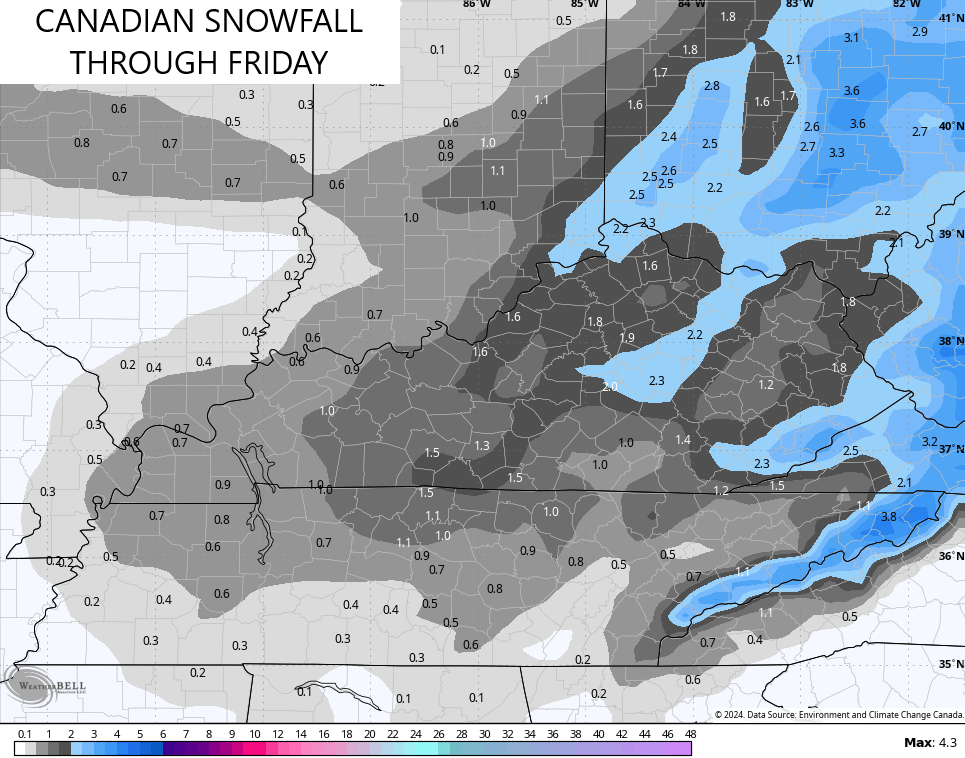
The Canadian Model has a similar look and end result…
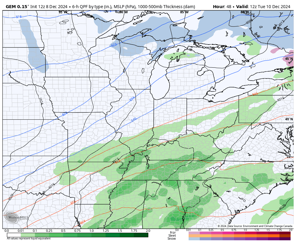
Here’s the snowfall map from the Canadian…
The GFS continues to move farther west with each run and that’s exactly what this model does. Every. Single. Time. Remember, this model didn’t have a flake even close to Kentucky just a few days ago..
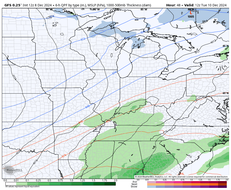
The snowfall map from the GFS has a nice look across eastern Kentucky…

Again, will that model continue to trend west?
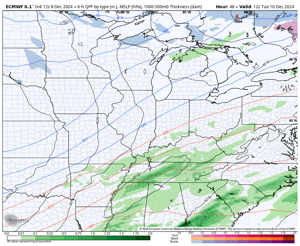
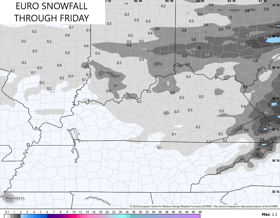
The EURO is normally the farthest west model regardless of any setup. That has not been the case with this setup as it is by far and away the weakest and farthest east…
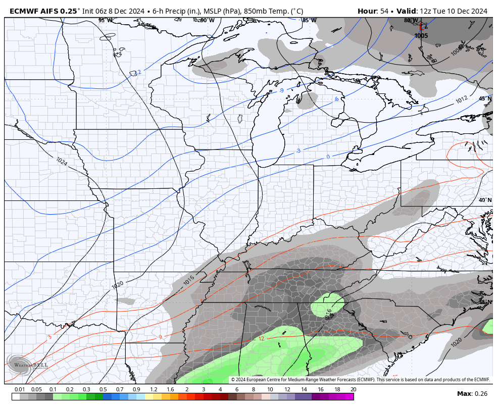
Now, that does NOT match up with the AI version of the EURO. This model has consistently been in the camp of what the Canadian is showing. Keep in mind, the AI does not show precipitation type or snowfall totals. Still, you can clearly see quite a bit of precipitation showing up behind the front in the cold air Tuesday night and Wednesday…
So, if you’re a snow lover in Kentucky, cheer on the Canadians!!

I will have another update later today. Until then, here are your Kentucky Weather Radars to track today’s rain across the area…

Enjoy the day and take care.
