Good Sunday, everyone. Rain is rolling toward the Bluegrass State today as our temps start to feel pretty good for a few days. This rain is ahead of another push of cold air on the way for the middle and end of the week and it looks to bring a little bit of winter weather along for the ride.
Temps out there today reach the 50s across the entire state as clouds thicken from the southwest. Rain will develop across western Kentucky during the afternoon and quickly overspread the state this evening through early Monday with lingering showers during the day.
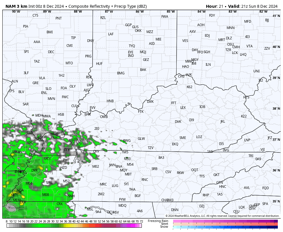
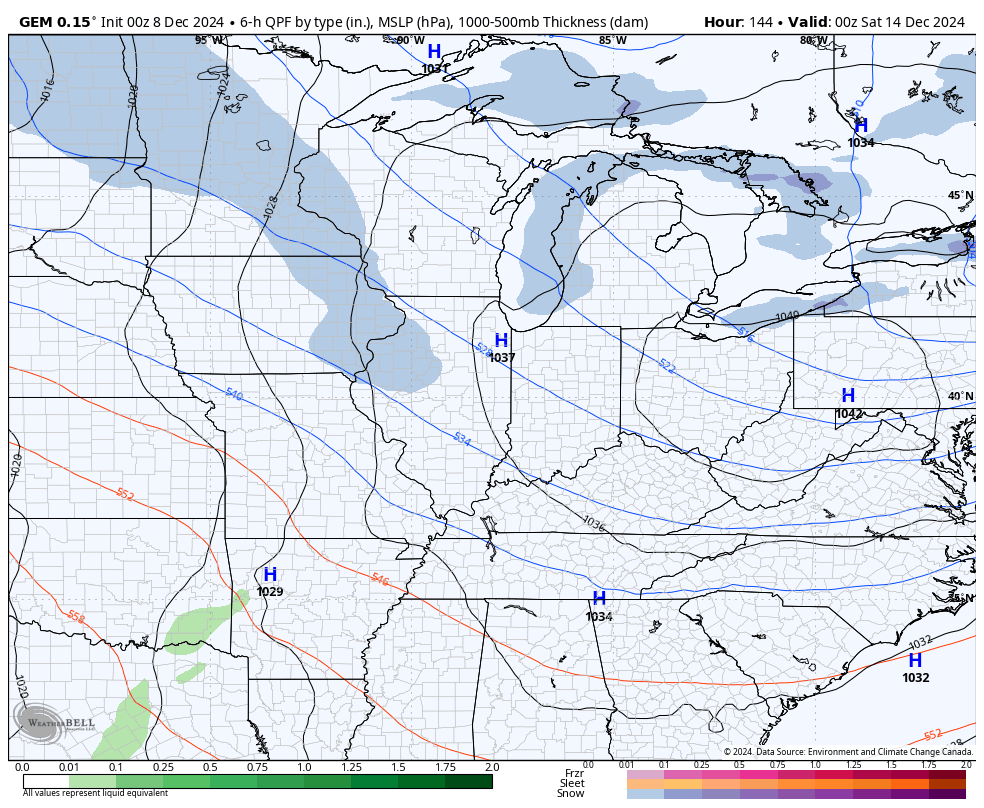
Rainfall amounts from a half to one inch will be likely as this shield of rain moves through. Here’s the Future Radar from the Hi-Res NAM showing our system…
Temps are in the 50s once again for Monday.
A strong cold front then moves in later Tuesday with temps rapidly dropping behind it. Numerous rain showers will be located ahead of it as a wave of low pressure pops along it. As the cold air surges in Tuesday night, a period of light snow and flurries may develop across central and eastern Kentucky. Lingering snow showers and flakes would then be noted on Wednesday with another light snow and flurries streak showing up by Thursday.
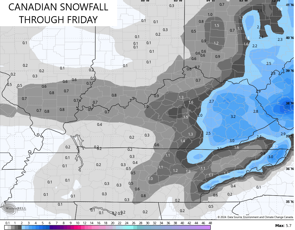
The Canadian Model has been all over this whole scenario and has a stronger signal with the latest run…

Here’s what this run of the Canadian sees for possible snowfall…
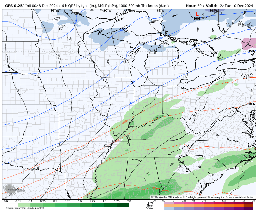
The bias of the GFS in being way too far east and too progressive has been on full display early this winter and it continues with this system. The model always adjusts west as we get closer to any event and that’s exactly what it’s doing right now. The latest run is starting to see some light snow in eastern Kentucky…
Here’s the snowfall forecast from this run of the GFS…
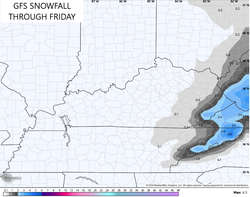
Watch for a little more of a westward trend with that model.
The EURO is a mix between the GFS and the Canadian…

Here’s the snow map from that run…

We will see how it all plays out, but there’s the chance for some light snow starting Tuesday night.
The systems for the weekend and early next week features a couple of systems coming our way and the models do have a bit of a colder look with the Canadian Model trying to bring a touch of winter behind each of them…
The Euro Ensembles are now within range to show what the beginnings of what the EURO Weeklies have been strongly suggesting for some time. Watch how our trough starts to develop across the east on the weekend before Christmas…
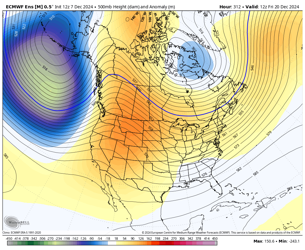
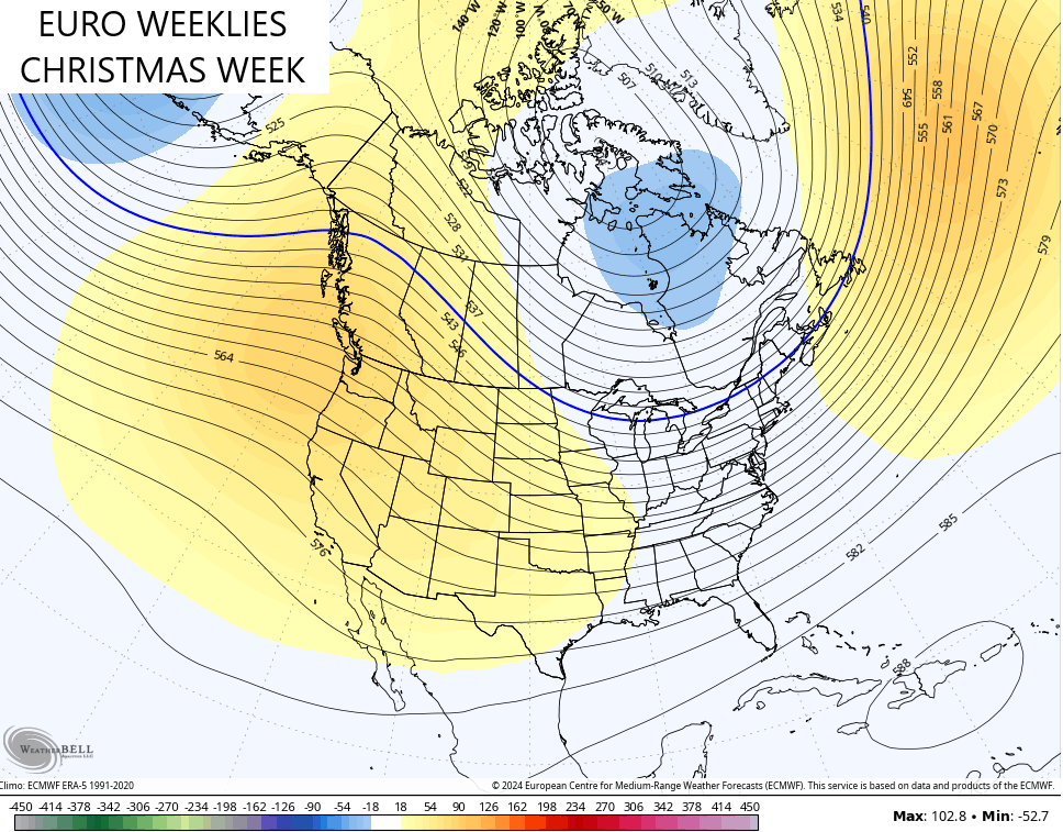
That big trough in the Gulf of Alaska retrogrades back toward the Aleutian Islands, allowing the ridge to pull back to the west coast and into Alaska. The Euro Weeklies for the 7 day period that is Christmas week shows this well…
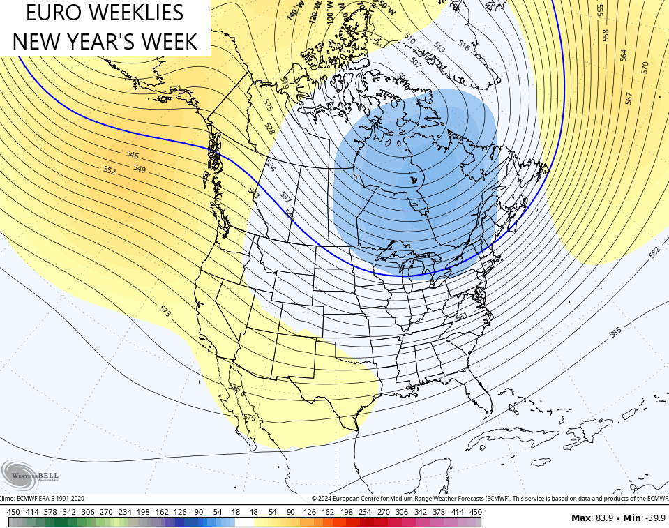
Now, watch how that trough deepens for New Year’s Week…
I’ll drop by for updates later today so check back. Until then, I have your Kentucky Weather Radars to track the rain in from the southwest…

Have a great Sunday and take care.
