Good evening, everyone. We have a cold front moving in and slowing down across the region right now. This slow-moving front will be accompanied by low pressure developing along it and that should be a light snowfall maker for the eastern half of the state.
Some headlines:
- This front has mild showers along and ahead of it tonight and much of Tuesday.
- This front moves eastward across the state Tuesday evening and night with crashing temps behind it.
- As low pressure starts to develop, watch for a band of light snow and flurries to first fire up across the west and central.
- The light snow will expand across the eastern half of the state by Wednesday morning.
- Light accumulations are a good bet, with the greatest chance being across eastern Kentucky.
- This looks like another Winter Weather Advisory type event for some.
- This light snow tapers quickly by afternoon as we watch a few bands of light snow zip in from the west.
- These bands may produce some light accumulations in a few spots.
- A few flurries linger into early Thursday as cold winds blow.
As far as the initial light snow system Tuesday night and Wednesday morning, here’s the First Call For Snowfall…

I’ll likely have a few updates to that later tonight and into Tuesday.
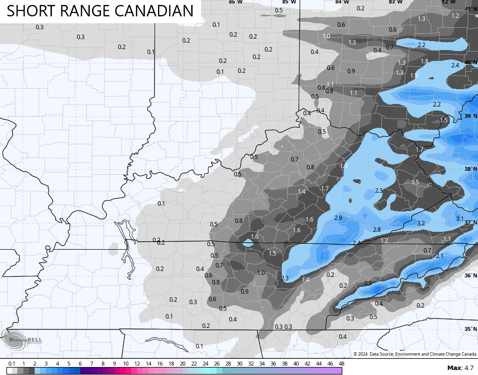
The Short Range Canadian continues to be most aggressive and farthest west with this whole setup…
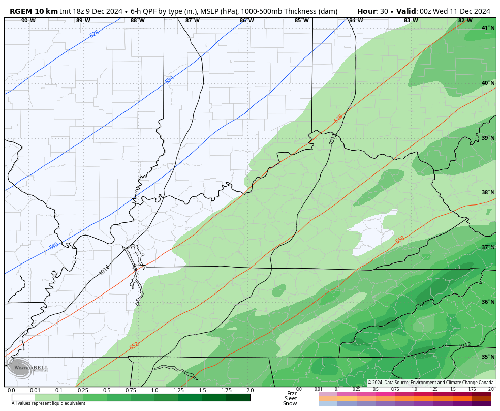
Here’s the latest snow map that has corrected a bit to the east…
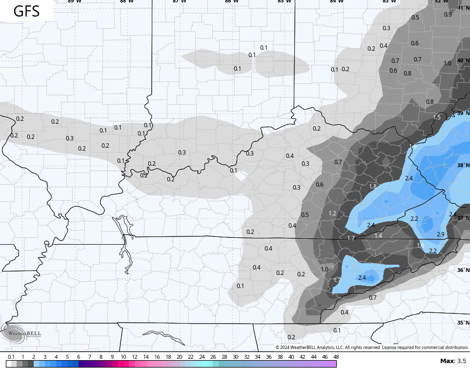
The GFS is highlighting an advisory type event for the east and southeast…
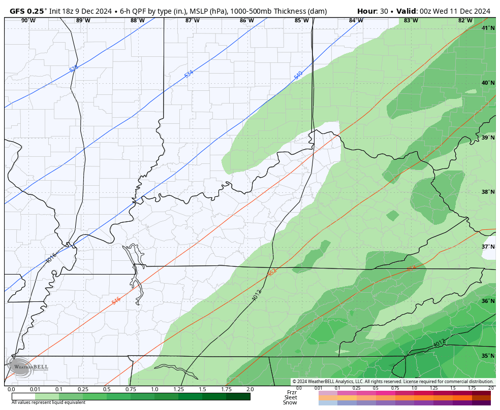
Here’s the snow map from that…
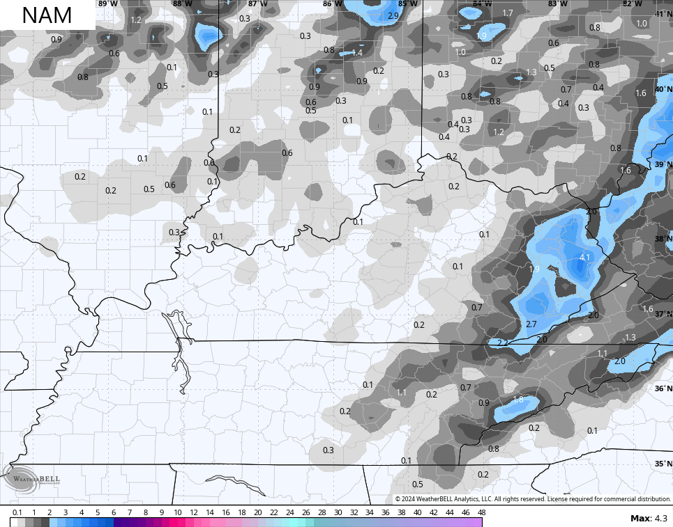
The NAM is in the process of figuring things out as it has had a rough start to winter. It’s now showing the light snow in the east and trying to pick up on the light snow pockets later in the day…
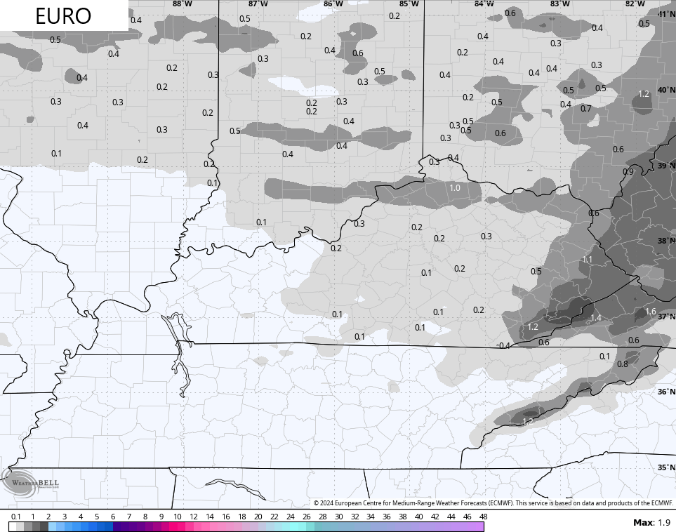
The EURO has also had a rough start to winter as it’s also just now seeing the chance of eastern Kentucky light snows. It’s also showing those light snow pockets and streaks later in the day…
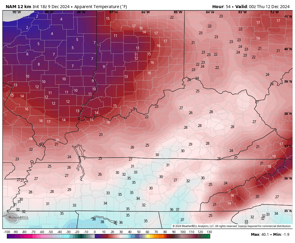
The cold coming in behind this is pretty stout and will combine with gusty winds to throw another morning of single digit wind chills by Thursday. This wind chill forecast goes from 8pm Wednesday through 8am Thursday…
I’ll see you guys back here for the full update later tonight. Have a good one and take care.
