Good evening and Merry Christmas Eve Eve, everyone. A few showers are rolling into the region tonight as a mild and wet setup continues to show up for the final week or so of the year. The big change to winter takes shape right about the time we flip the calendar to 2025.
A few showers are out there tonight across the north and west and these will carry us into Christmas Eve Day. This will become much more isolated during the afternoon and evening as Santa gets ready to fly into the Commonwealth.
Here are your radars to follow the Christmas Eve Eve showers…

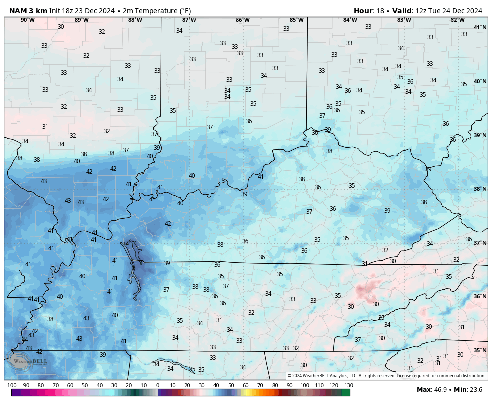
Temps for Christmas Eve will be much milder in the south than the north. Watch the temp forecast animation that goes from 7am Tuesday through midnight Christmas…
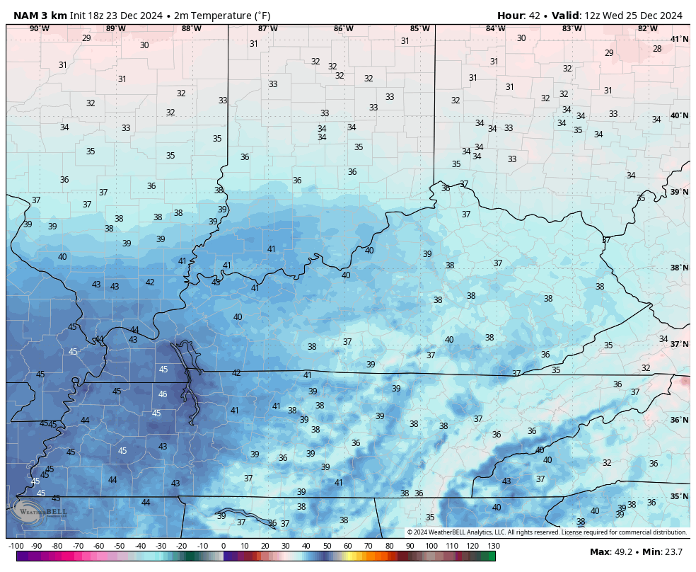
A similar temp trend will then show up on Christmas Day with the 50s in the south and west with 40s elsewhere. This animation goes from 7am to 11pm Christmas Day…
Temps continue to surge for Thursday and Friday as wet track two storm systems into the region for the final weekend of the year. Showers and a few thunderstorms are a good bet during this time…
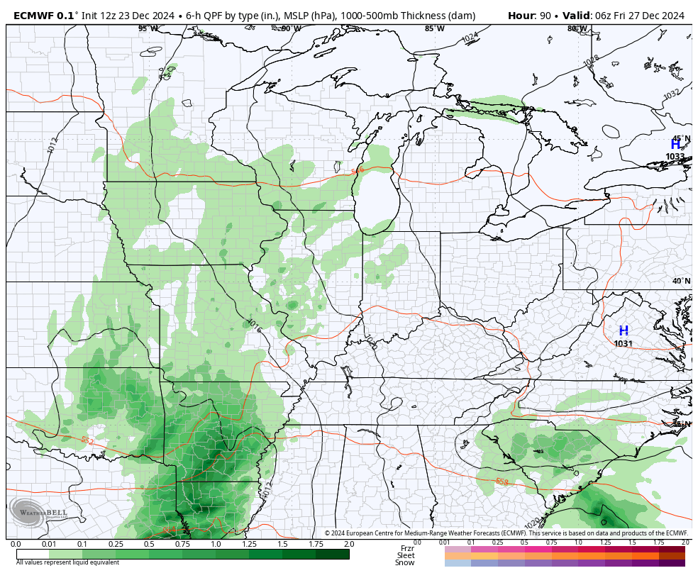
Another 1″-2″ of rain will be likely over the weekend.
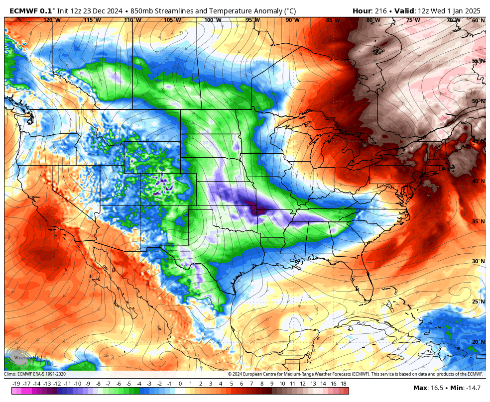
Another storm system should then roll right on top of us New Year’s Eve. That would should have more heavy rain with it and could be followed by some flakes on the first day of 2025. From there, we watch a cold pattern take shape and it may do so with an active southern storm track. This is exactly what the EURO shows…
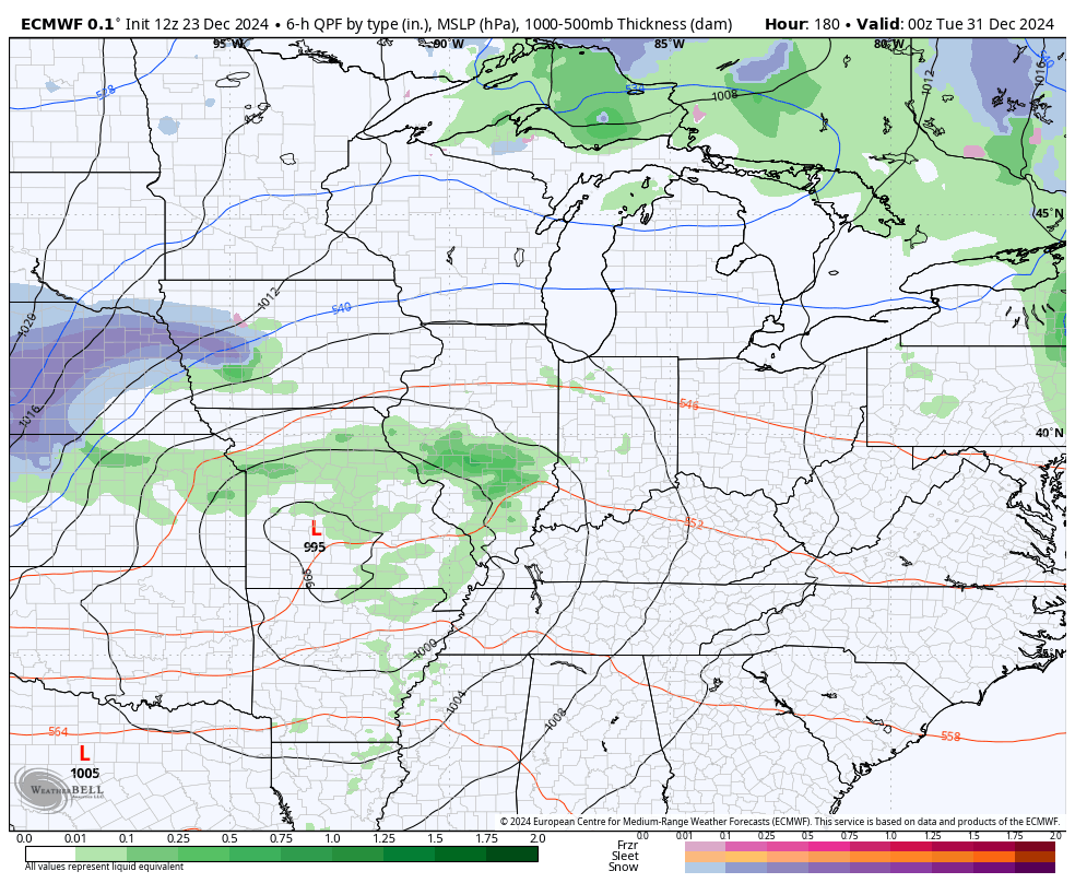
Check out the cold showing up on the EURO as we get into the first week of the new year…
This matches with what we’ve been seeing from the Ensembles and Weeklies for a while now.
The latest EURO Weeklies look very similar to the operational EURO from above…
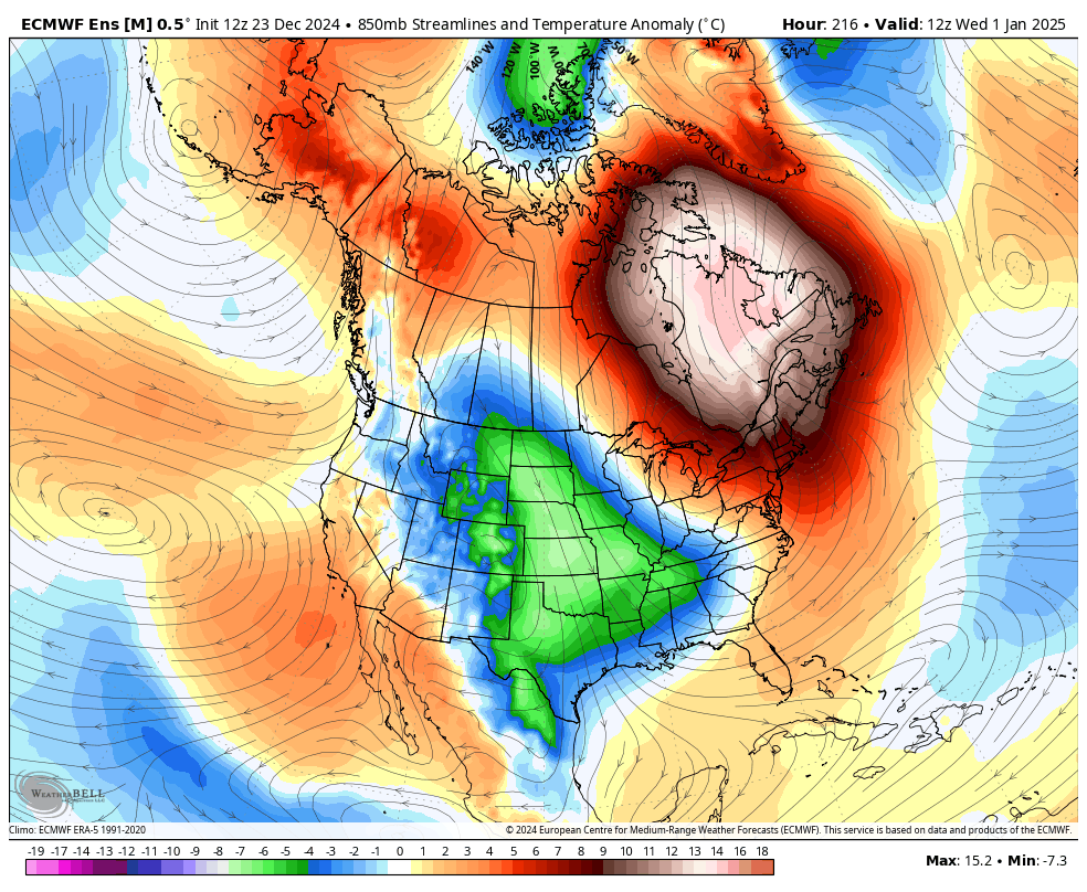
There’s a lot of winter waiting on us with this setup.
Enjoy the rest of the day and take care.

Hard to believe, 20 years ago today, the great pre-Christmas storm of 2004. Well forcast days in advance, just a matter of what you’ll get.
https://storymaps.arcgis.com/stories/ea9219fb012f426caedf479768adc2e2