Good afternoon, everyone. A major winter storm is still on track to move into Kentucky Sunday and Monday. This will bring an ice storm, a snowstorm, and a combination of the two for much of the Bluegrass state.
A Winter Storm Warning is out for much of the state with an Ice Storm Warning for a part of western Kentucky…
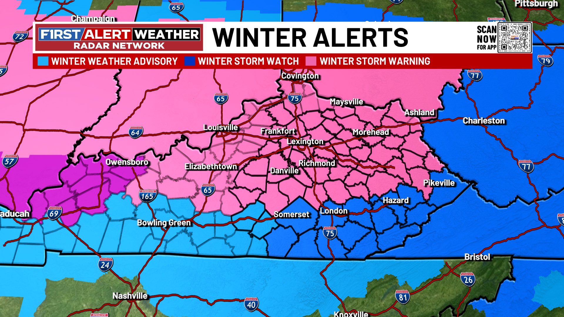
We will see additional counties added to the Winter Storm Warning and the new additions across the region will show up on this updating map…

I have no changes to my breakdown:
SUNDAY
- Snow, sleet and freezing rain work into western Kentucky before daybreak and this spreads eastward.
- A heavy band of heavy snow is likely to set up in an arc that lifts from southwest to northeast.
- That band has the potential to put down several inches of snow in a short amount of time. Pinpointing where this band develops is the key.
- Sleet and freezing rain take over across southern Kentucky and that slowly lifts farther to the north.
- The far south sees temps spike with rain taking over by late day.
SUNDAY NIGHT
- Significant icing is likely into a large swath of the area as freezing rain looks fairly widespread.
- Sleet and snow will be located to the north of this into far northern Kentucky.
- Far southern Kentucky stays mainly rain.
- Winds gust up to 30mph as the low spins eastward along the Kentucky/Tennessee border.
MONDAY
- The day starts with freezing rain and sleet across the with light snow elsewhere.
- Strong upper-level energy spins from west to east across Kentucky through the day.
- This spawns a large swath of moderate to heavy snow for much of central and eastern Kentucky.
- Several additional inches of snow will be possible from this.
- Winds will also be gusting to 30mph at times.
The amount of precipitation coming from the models is insane. If we take the GFS and melt all the precipitation down to liquid, we are seeing more than 2″ of precipitation…
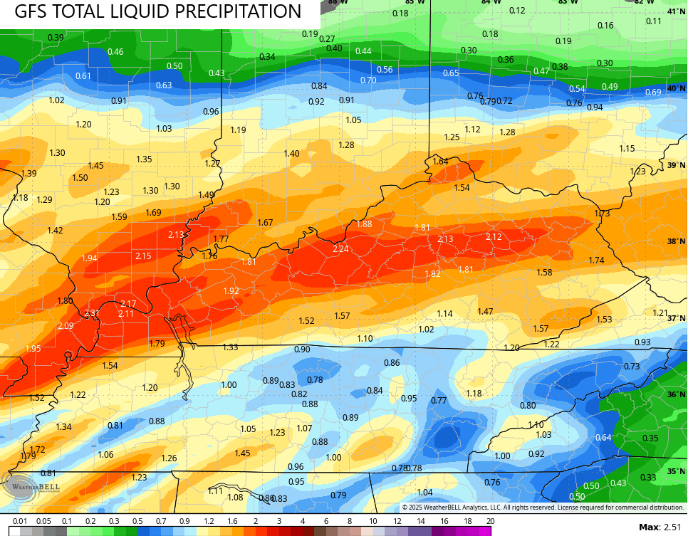
That is off the charts and we better hope no one location stays all freezing rain or they are in a world of hurt.
The latest GFS is coming farther south and has been doing so with each run. These totals represent everything that falls through Monday.
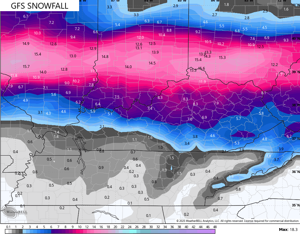
The snow forecast is much more expansive…
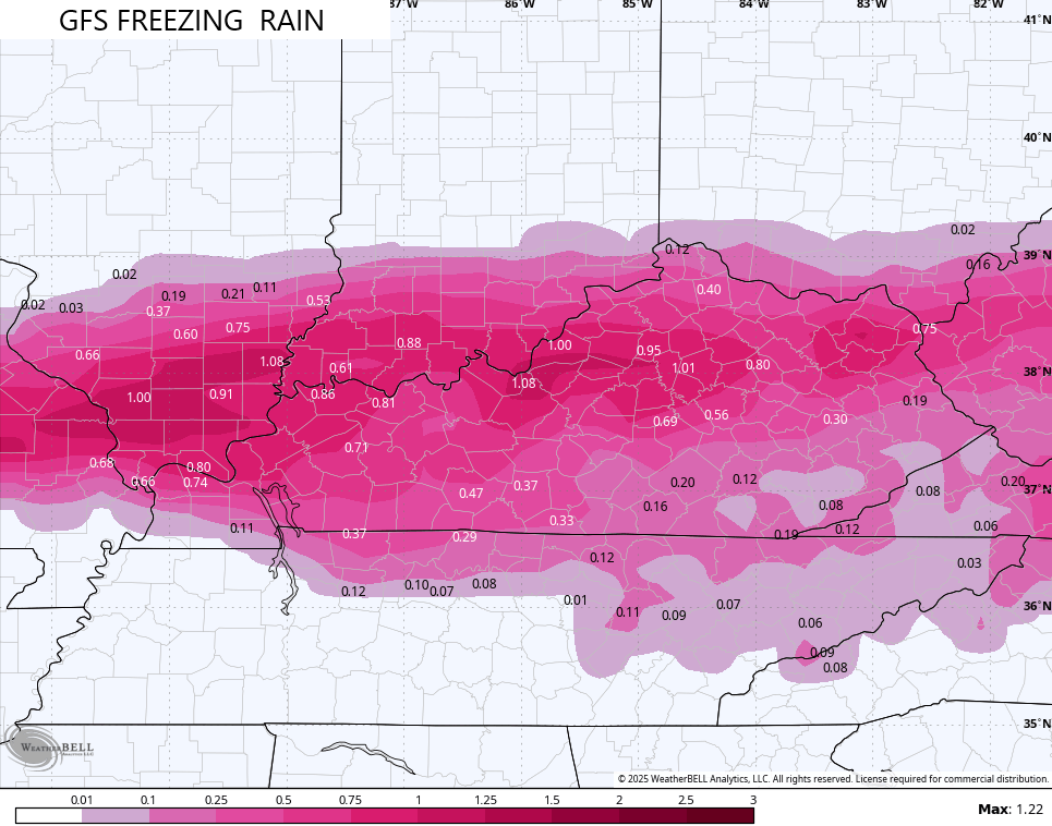
Now, check out the freezing rain totals…
Many areas get several inches of snow AND more than .50″ of pure freezing rain. That’s wild.
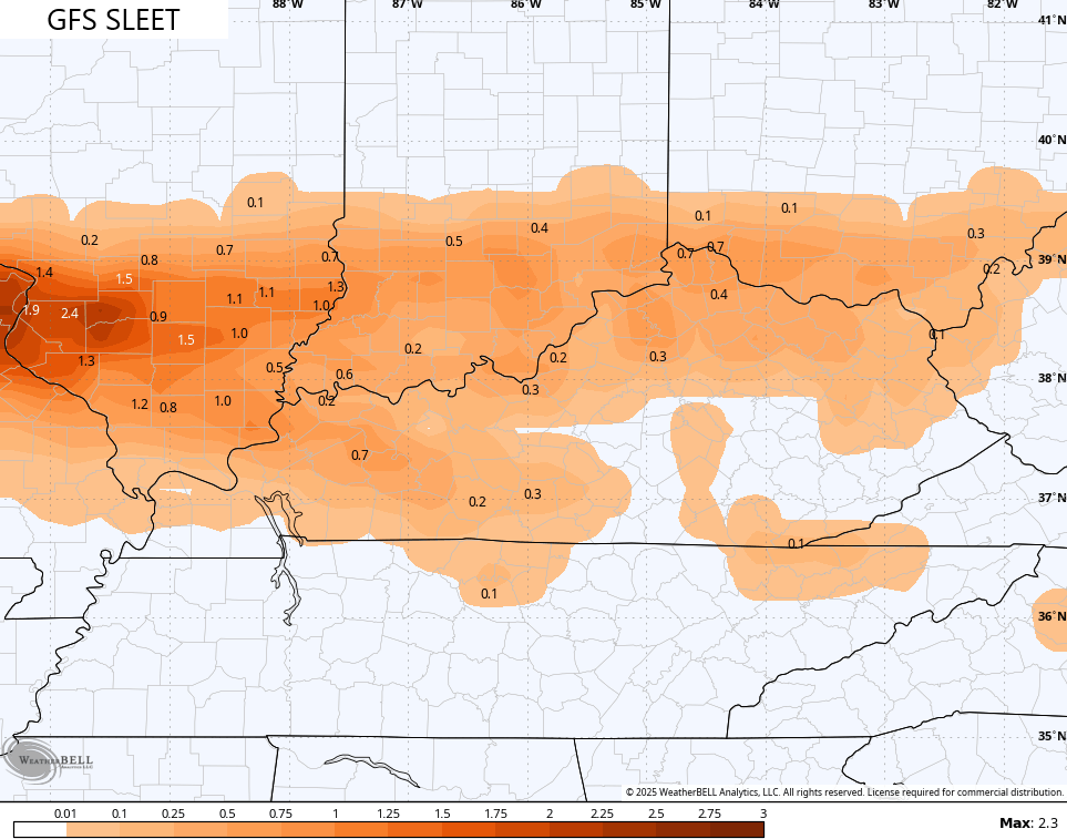
Here’s the GFS Sleet forecast…
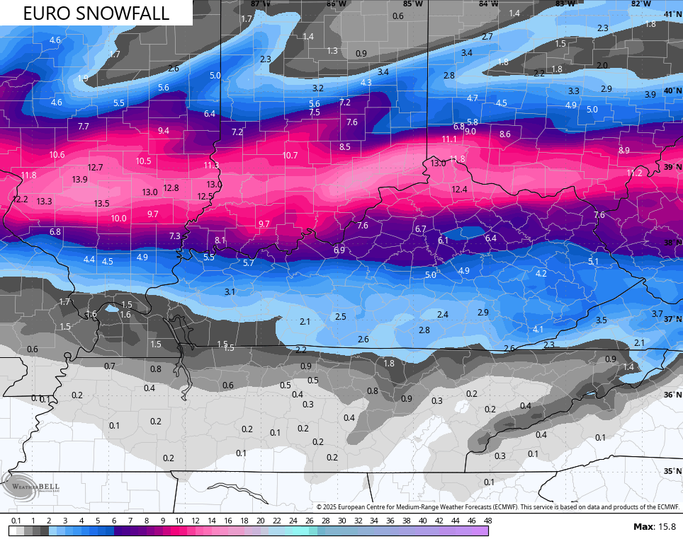
With the GFS slowly coming south a bit, we have better continuity with what the EURO is showing, especially in terms of snowfall…
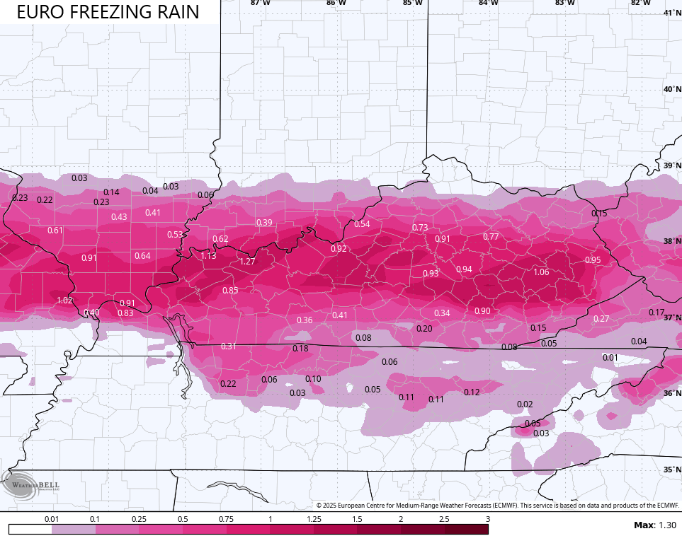
Obviously, the EURO is a little farther south still and this is very evident on the Freezing Rain map…
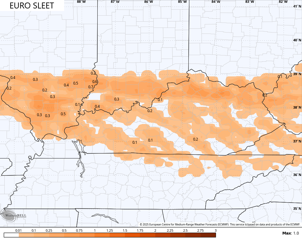
And the sleet map…
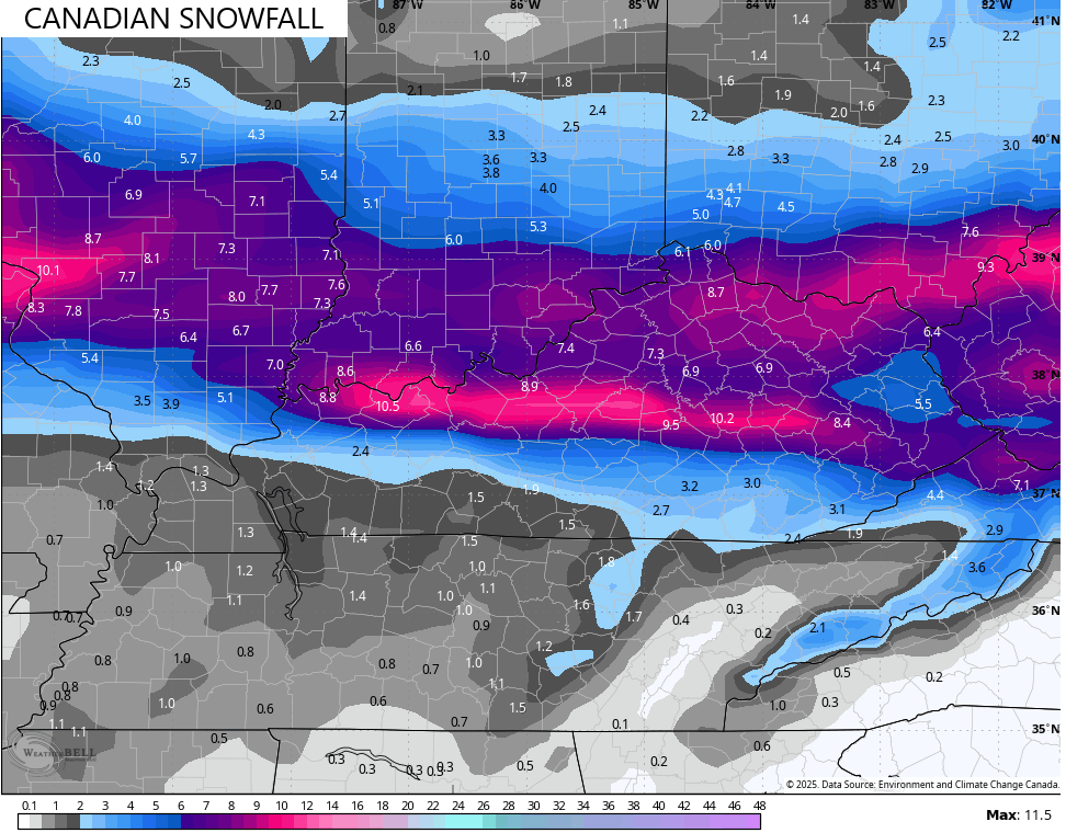
The Canadian Model has been significantly farther south from the start and that continues.
Here’s the snowfall forecast…
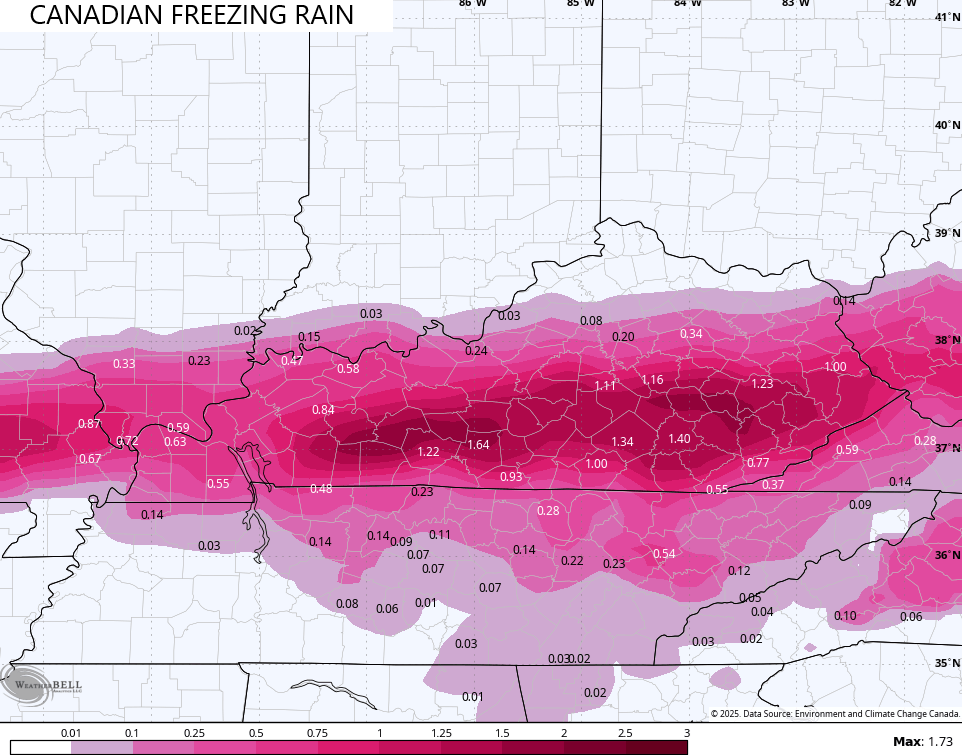
The amount of freezing rain is obscene…
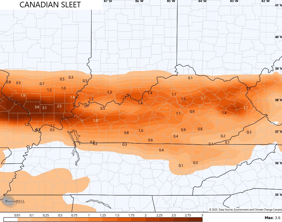
The sleet is higher than the GFS…
The ICON continues to be in on the southern trend…
![]()
![]()
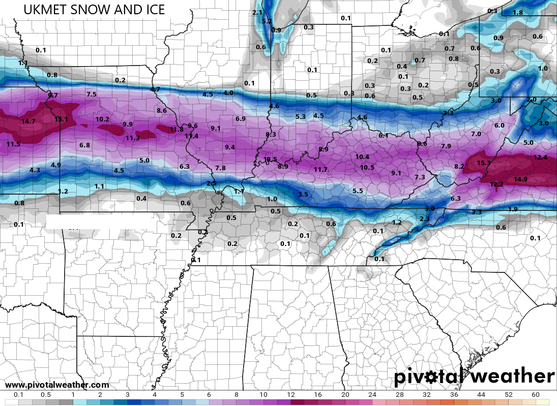
So does the UKMET…
I will be on WKYT-TV this evening and have additional KWC updates through the day. I leave you with your radars to follow our storm system in from the west…

Make it a great Saturday and take care.

Guess all areas in blue will be mostly rain..Rain coming down at a high rate will keep ice totals down according to NWS Jackson..Hard to know with some models south and some north..
Actually insane to see the differences in the RGEM and NAM. Kinda hard just to toss the RGEM, it’s usually pretty good
Ground still frozen here in Whitley, 31 now
Thanks Chris for the update. I’m ready for what ever falls. This is just a wish, the center of low pressure moves south and keeps the entire state of Kentucky in Snow and continues until it comes to a end. The Arctic air keeps the Snow pack on the ground until the next Snowstorm arrives with more. That’s the way Winters were where I grew up in South Central Indiana many years ago.