Good evening, everyone. Light snow and snow showers continue to press across the region, putting down enough snow to cause additional travel issues. This is ahead of a frigid night and a winter storm moving in Friday and lasting into early Saturday.
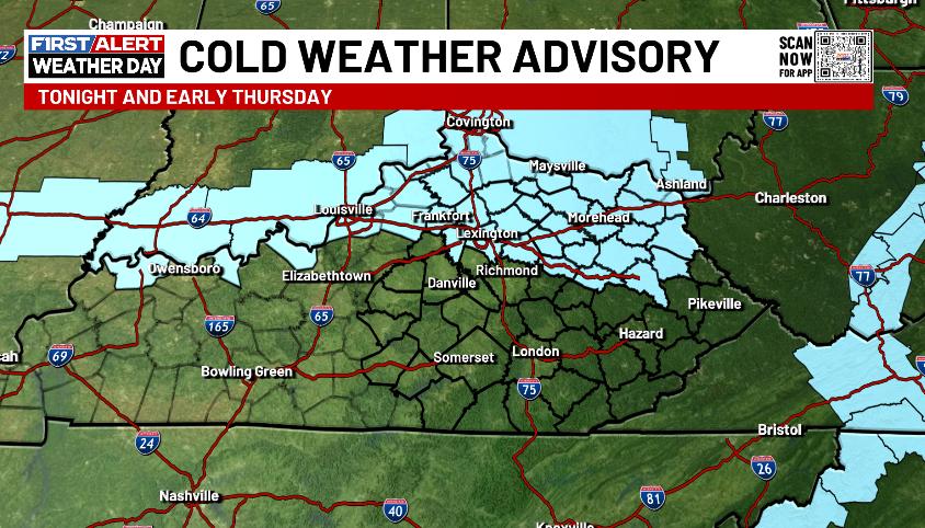
With the chance for some clearing over the deep snow and ice pack, there’s the chance for temps to hit 0 or below across the north and northeast. This is where we have our regions first ever Cold Weather Advisory tonight and early Thursday…
Far southwestern Kentucky has already been placed under a Winter Storm Warning for Thursday night and Friday. The Winter Storm Watch for the rest of the state did not change, unfortunately…

I continue to make the argument this Watch should be out for the entire state because everyone is at risk of getting 4″ of snow from this system. 4″ of snow during any time period from a single storm is the criteria for a Winter Storm Watch or Winter Storm Warning.
The NWS Louisville has a snow forecast showing the potential of 4″ of snow for the entire Kentucky portion of their region…
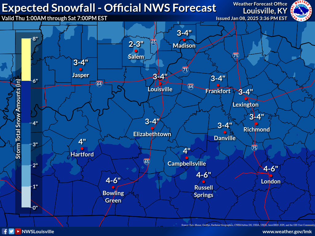
The forecast for Richmond, Danville and E-town is no different than the forecast for Lexington, Frankfort and Louisville yet Richmond, Danville and E-town are under a Winter Storm Watch while the other cities are not.
I’m not trying to be overly critical by any means, just pointing out the mixed message. If your criteria is 4″ and there’s a chance for everyone to hit that number… You get the idea. ha
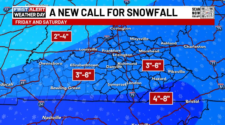
That forecast really isn’t much different than my forecast of a widespread 3″-6″ snowfall…
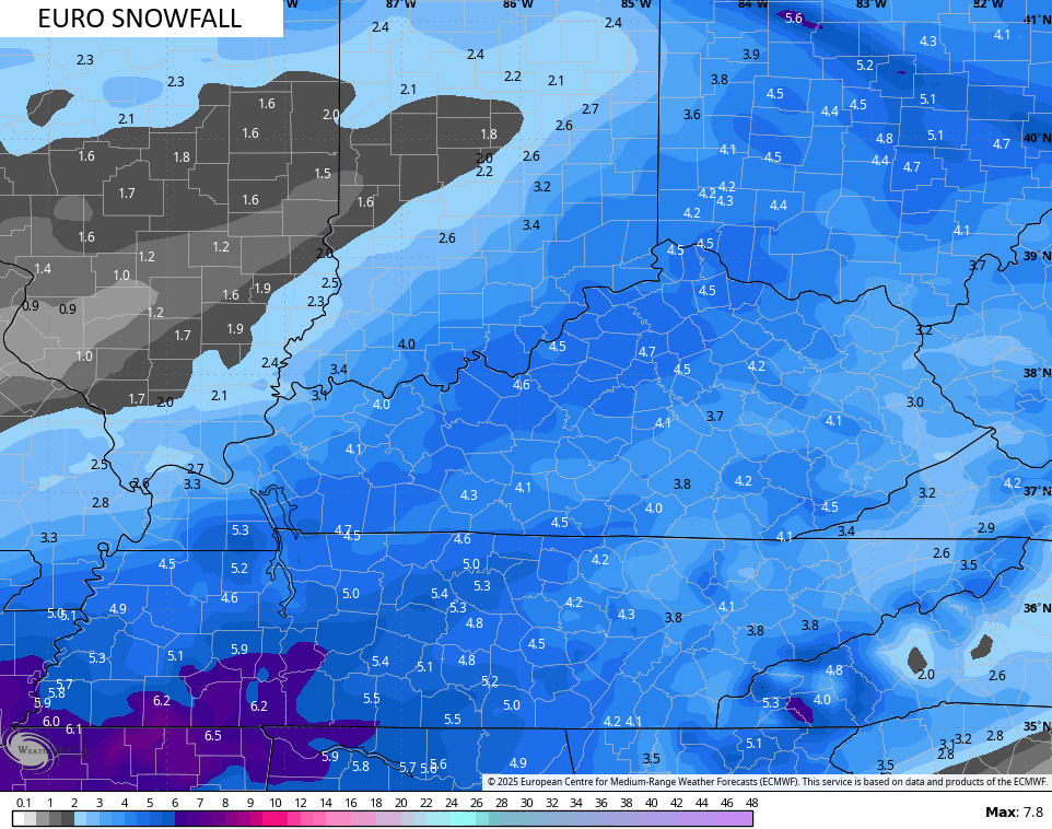
The forecast models are all falling in line with a general 3″-6″ snowfall for the entire state. The EURO has some amounts nearing 5″ all the way into southern Indiana and southern Ohio…
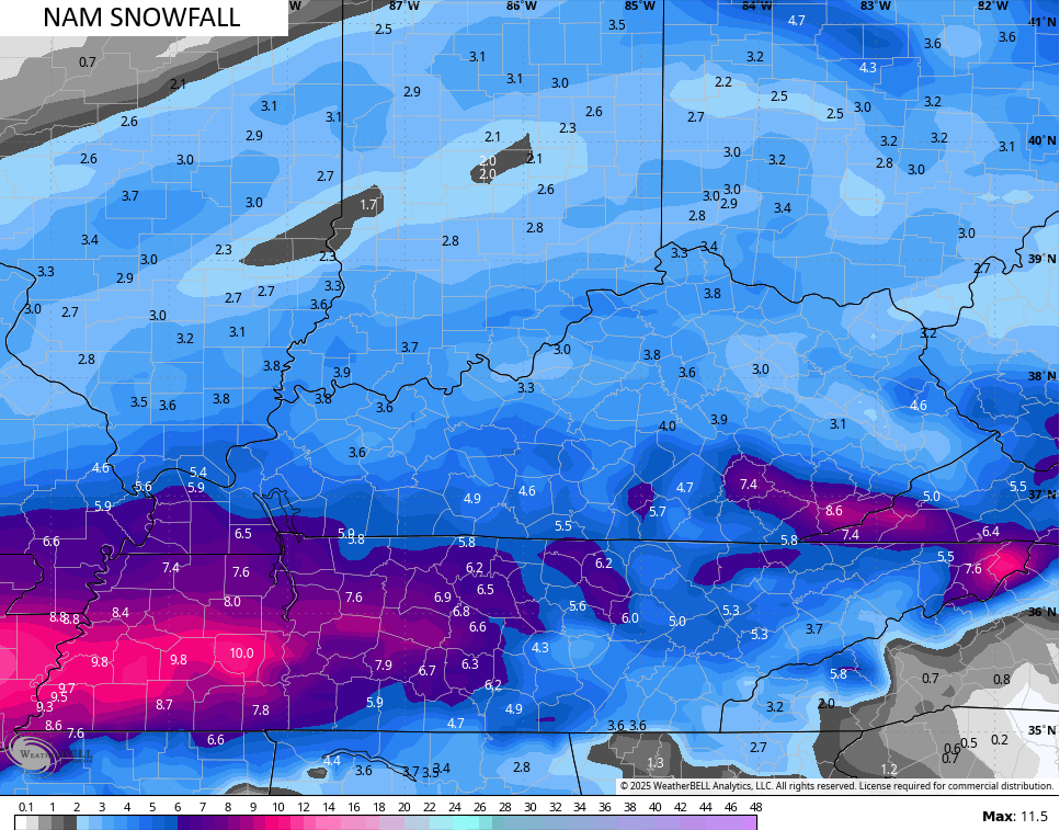
This system is just coming into the timeframe for the NAM to get a handle on it…
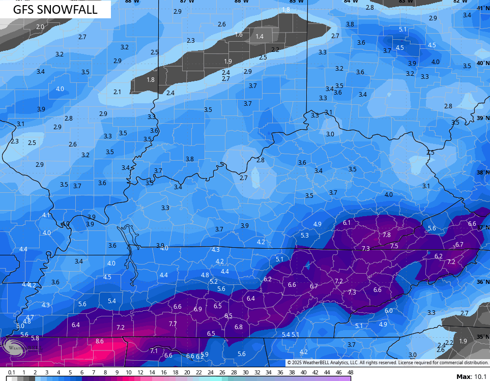
Here’s the GFS…
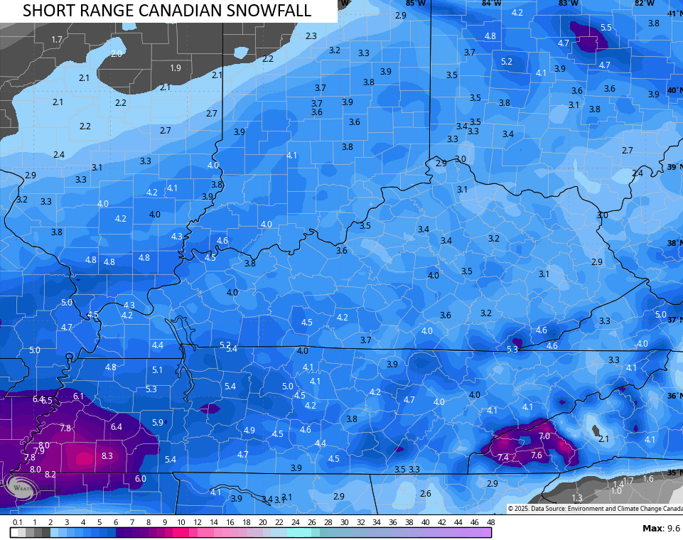
The new Short Range Canadian…
And the ICON…
![]()
![]()
As you can see… the models are on board with a widespread 3″-6″ snowstorm for our region. It’s one that will have a major impact on travel Friday and Saturday.
Two arctic fronts arrive with light snows next week. One on Monday and the other by Wednesday. Bitterly cold air will be noted with these before the pattern relaxes for a few days late next week and weekend. It then comes crashing back in…
That’s harsh again, folks!!
I’ll have the latest on WKYT at 10 and 11 and the full KWC update later tonight. Until then, I have your tracking tools including our Kentucky Weather Cams to watch the flakes flying across different parts of the state…

Enjoy the evening and take care.

Good to see the 18z Euro with more precip