Good Monday, everyone. On this day we honor Dr. Martin Luther King, Jr, we are dealing with a bitterly cold air mass that has engulfed much of the country. This is giving us dangerously cold wind chills that will be a factor for the next several mornings.
Let’s start this out by giving big props to the Canadian Models as they were the only ones to sniff out this entire eastern winter storm. Why was I so gung ho on the Canadian models when none of the other models had this storm? Because it fit the pattern that I outlined more than a week ago. Arctic fronts dropping in like this one almost always pop an arctic wave of low pressure along them, so I found a model that fit my thoughts and there we have it.
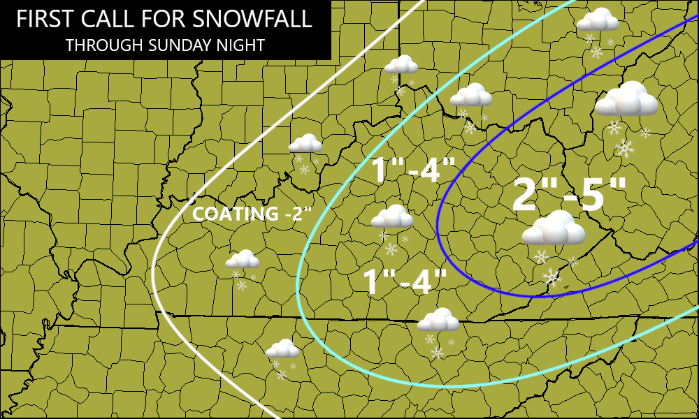
Overall, my forecast map from 3 days ago worked out pretty well…
The American models like the GFS and NAM have been as bad this winter as I’ve ever seen them. They just can’t see cold or winter weather very well, yet every summer the GFS routinely spits out a record number of 100-degree days. I point that out every stinking summer. This doesn’t mean they are totally useless, but you have to know when and how to use them. Here’s hoping the programmers of those models can get all this corrected and that the weather community is seeing you can’t simply take those models at face value. Of course, that goes for any model, but those two are historically bad locally.
Wind chills this morning range from -5 to -15 in most of Kentucky as we push the boundaries for Excessive Cold without a Warning going up. Actual air temps range from -5 to 5 for many areas with the chance for a few of the colder valleys to be even colder.
Any morning flurries and snow showers in the east will move away fairly quickly.
Wind chills through the day should only warm into the singles with actual air temps 10-15 for highs.
Clouds will increase later tonight into Tuesday and that should prevent temps from reaching levels that we had this morning, but they won’t be very far away.
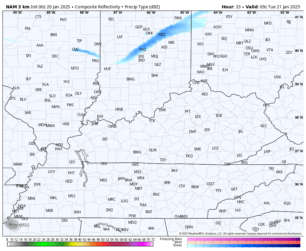
Those clouds are associated with a system that can bring a period of light snow and flurries across the state, and you can see those on the future radar from the Hi Res NAM…
Wind chills will continue to be a major issue Tuesday into Wednesday and will drop even lower behind the departing flakes…
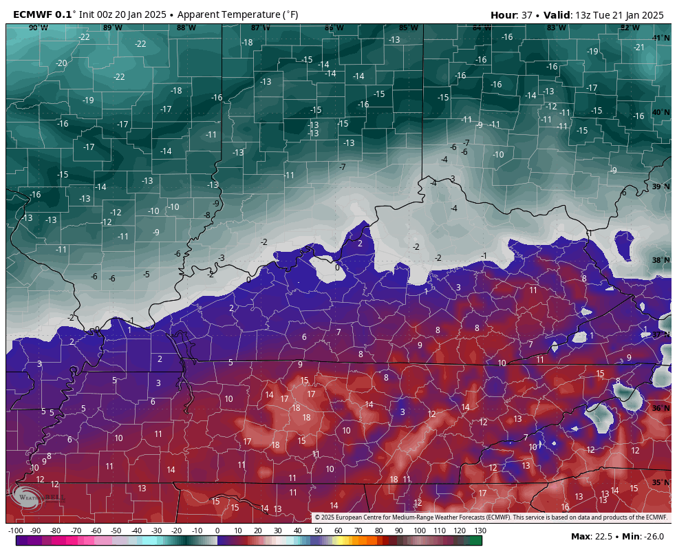
Actual low temps will be below zero in many areas to start Wednesday.
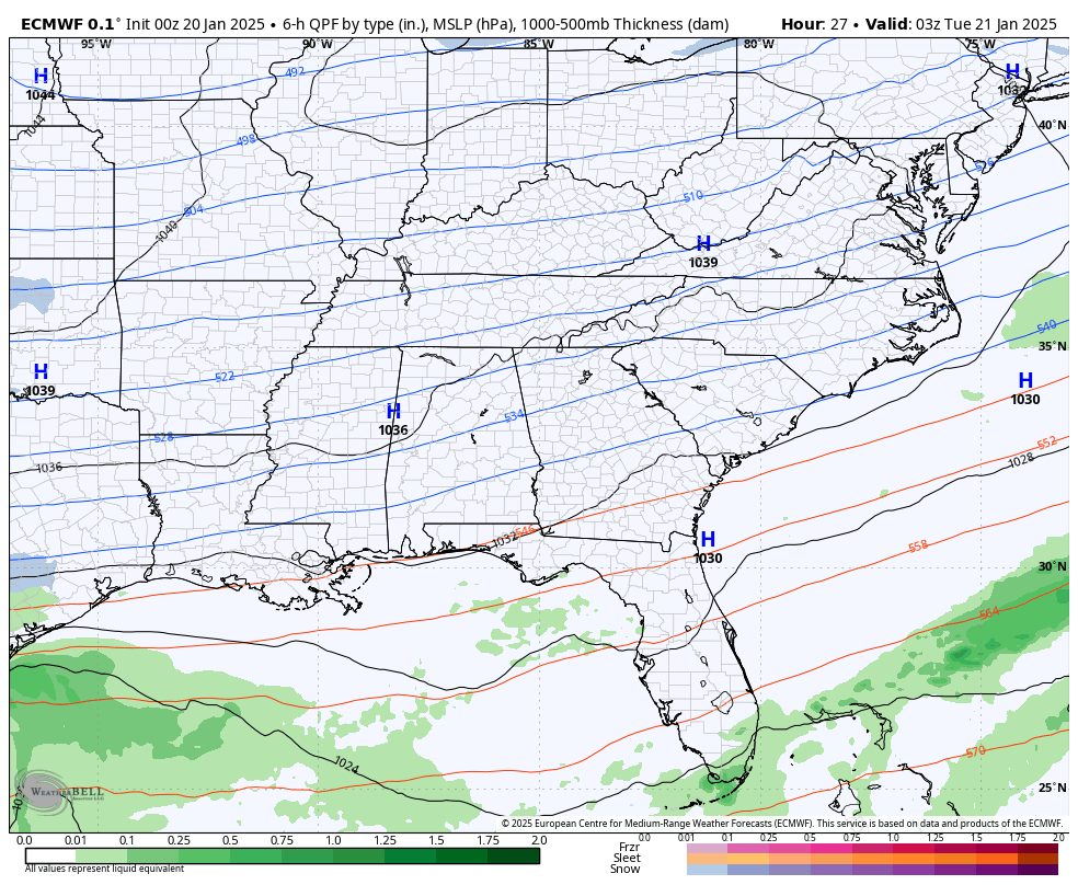
As all this is happening, an historic winter storm is blasting the Gulf Coast from Texas to Florida and then impacting coastal areas of Georgia and the Carolinas. This is something to see…
Look at the snowfall forecast from that run of the EURO…
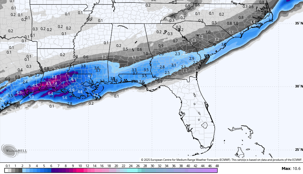
Look at those totals in Louisiana!! How about those snow totals across the Florida Panhandle? Myrtle Beach snow? Check.
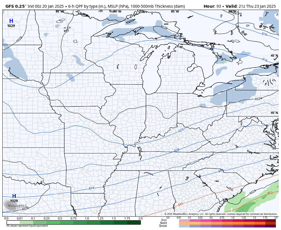
The next system rolls in late Thursday and Friday and is likely a light snow maker that can put down some light accumulations. I’ve been using the GFS for this because it actually matches up with what I think can happen…
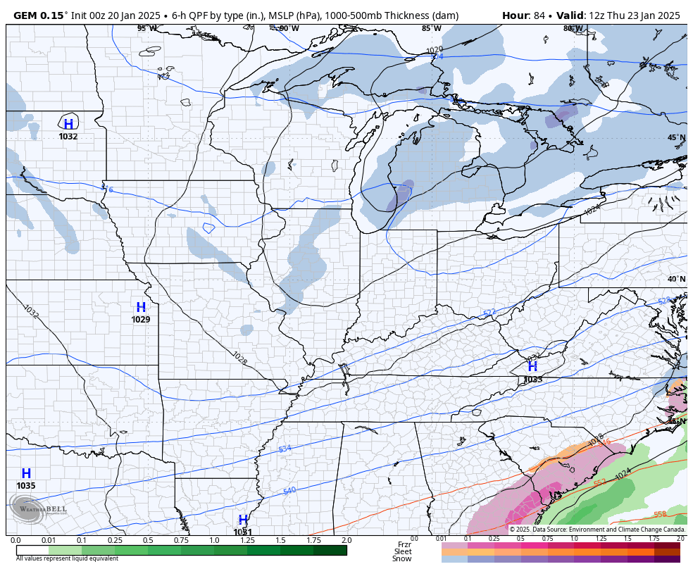
And it’s getting better support from the Canadian as we get closer…
Updates come your way later today. Until then, I have your flake and bitter cold tracking tools including our Kentucky Weather Cams to watch the snows flying across the state…

Enjoy your Monday and stay warm. Take care.

Thanks for the update Chris. Yesterday’s light Snow accumulation here in Maple was about a half inch. Enjoy the day Chris, and keep warm.
We got pounded where I live…I didnt go outside tp measure but easily 4 to 6 inches between overnight Saturday througj overnight Sunday. Big problem is that there was a brief period of freezing rain early Saturday morning that wasn’t predicted & wasn’t in the local forecasts. The National Weather Service put out a “Special Weather Statement” after the fact, but it was too late & people already out on the roads were caught unawares & there were tons of accidents.