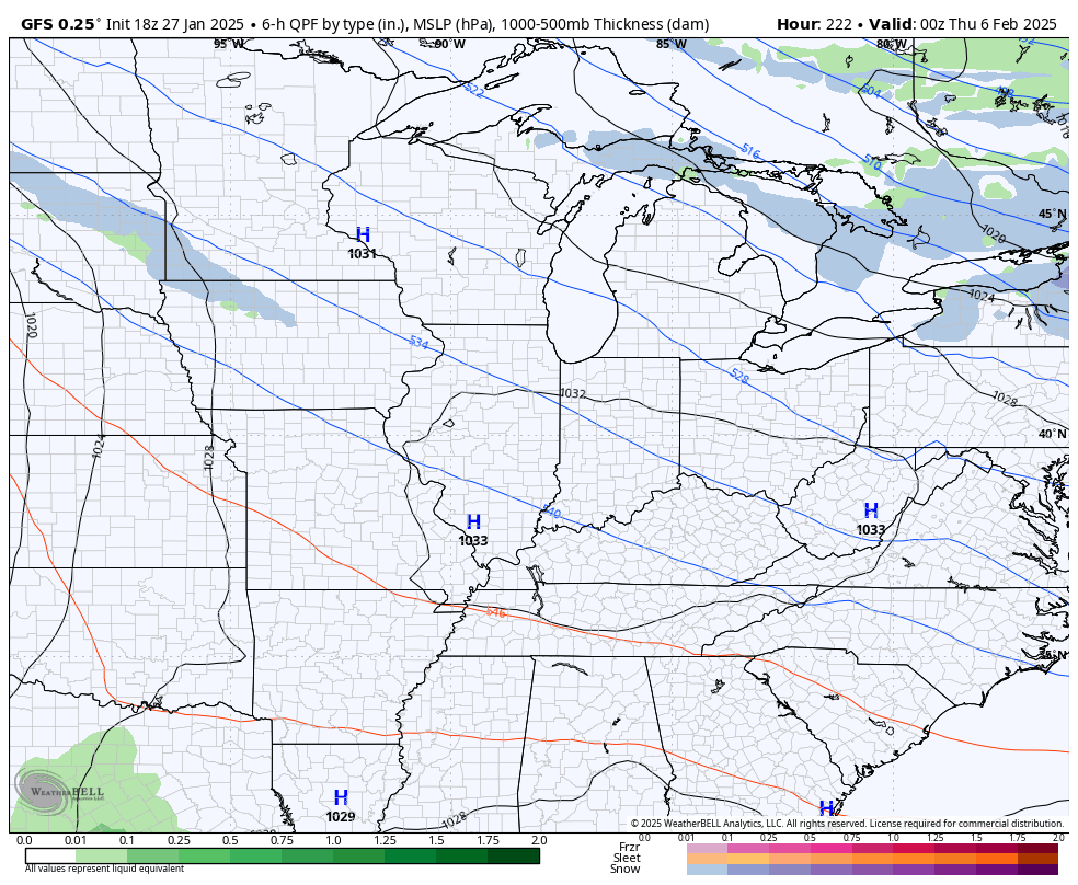
Good evening, everyone. It’s a much better pattern across Kentucky as we turn our attention toward a big storm system to close out January. This blows in with wind and heavy rain late Thursday into Friday.
The weather over the next few days continues to look pretty nice but winds are going to be a player, so keep that in mind.
Speaking of wind, we have a big storm system coming at us Thursday and Friday. That brings gusty winds and heavy rain to our part of the world with the slight chance for a flake or two on the tail end of this system by Friday night…
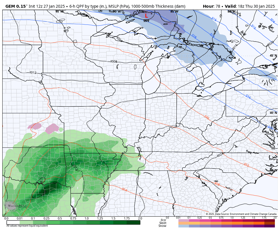
Wind gusts of 40mph or greater will be possible Thursday night and Friday as this low spins through here.
A general 1″-2″ of rain is likely across the state with locally higher amounts possible.
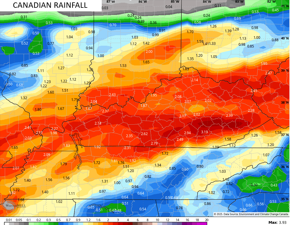
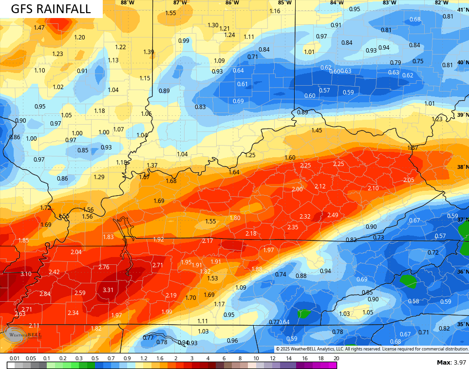
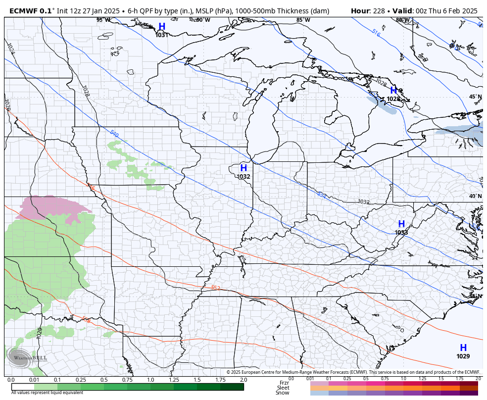
Here’s a look at what some of the forecast models are seeing…
![]()
![]()
From here, all bets are off on how individual storm systems impact our region as the models try to figure out a volatile pattern.
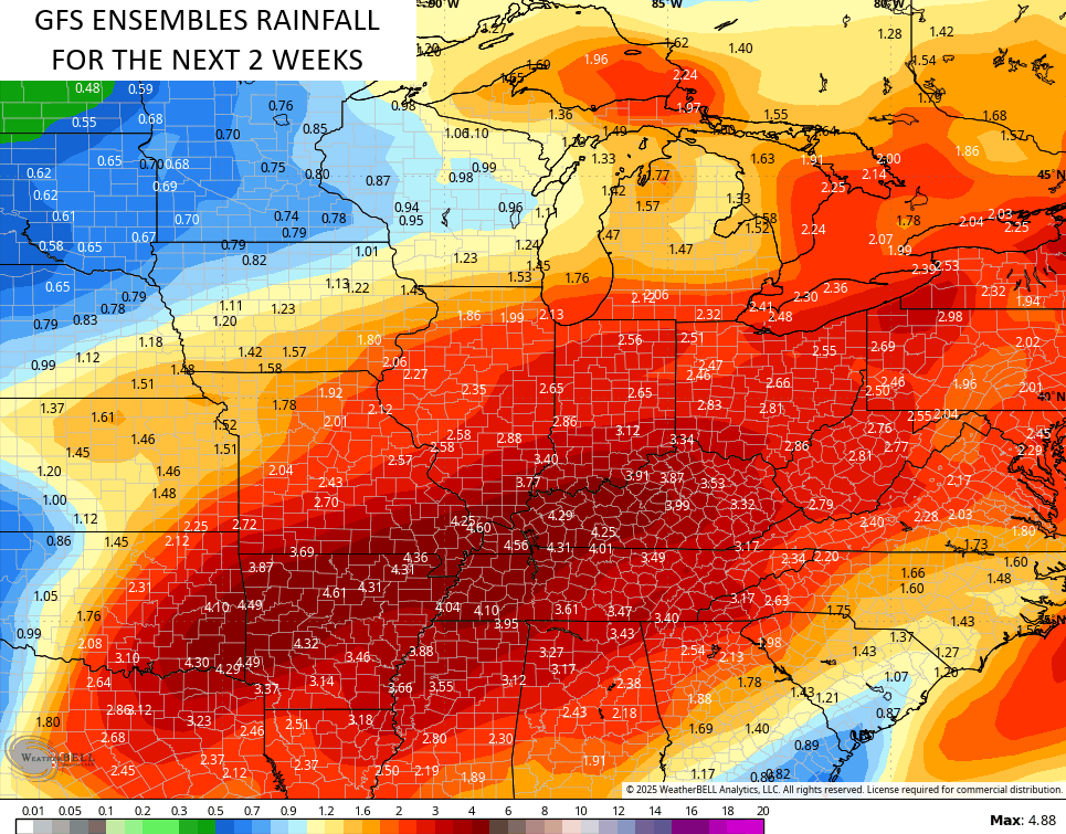
All I know is, we are likely to see several big storm systems over the next few weeks and the models see these, but change from run to run.
Here’s the EURO…
The GFS has a colder look…
This is a lot of precipitation coming over this two week period and the GFS Ensembles sees this…
Enjoy the evening and take care.

Of course now that the cold air is gone we are going to get the big precip numbers. If that had came during the cold we would see a huge snowstorm. Oh well. Guess I’ll have to move if I ever want to see big snows.
OMG you want more snow?