Good afternoon, folks. Winds are really cranking out there today and those gusts continue to increase through tonight. Throw in a low-topped line of showers and thunderstorms and you have the recipe for a sleepless night for much of Kentucky.
Oh, and it snows late Wednesday and Wednesday night.
We continue with a Wind Advisory for most of Kentucky, but I don’t understand how the north and northeast aren’t in this. A Wind Advisory is literally for gusts reaching 40mph or greater which looks possible area wide.
Regardless, here’s the Wind Advisory and all the other watches and warnings out…

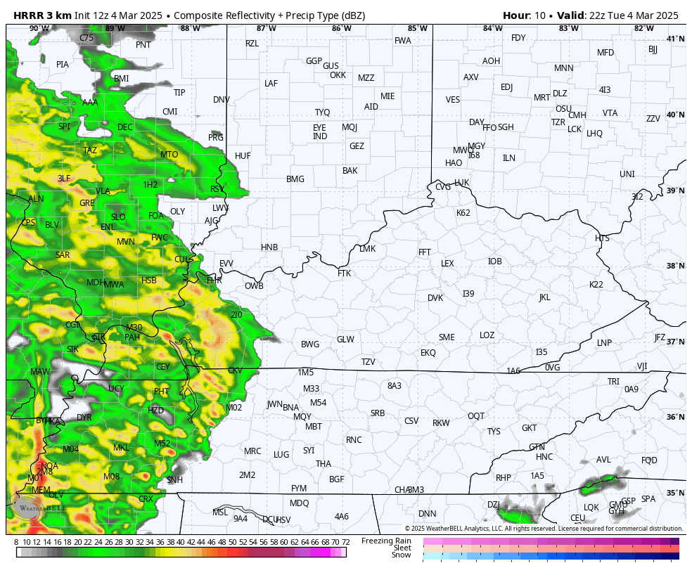
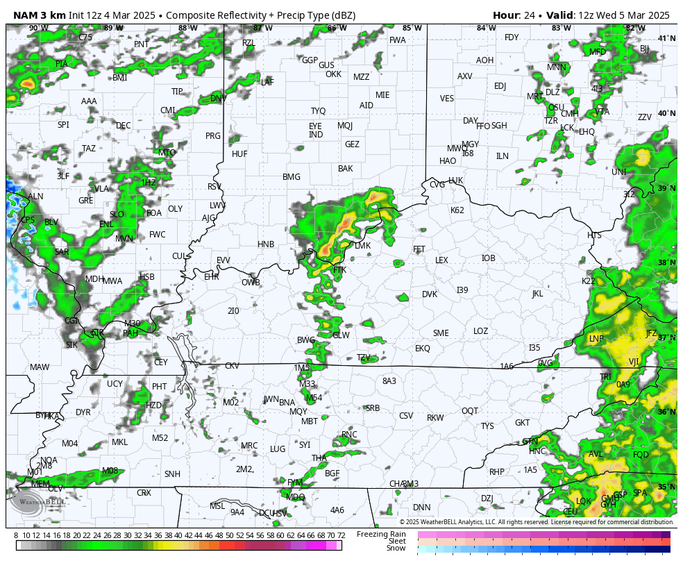
Winds tonight will be enhanced by that low-topped squall line of showers and thunderstorms pushing quickly from west to east across the state. This future radar from the HRRR shows this well…
50mph to 60mph wind gusts are likely for many areas tonight and early Wednesday. The models continue to be REALLY jacked up with the wind gust potential.
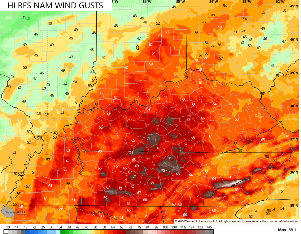
The Hi Res NAM has gusts at 70mph…
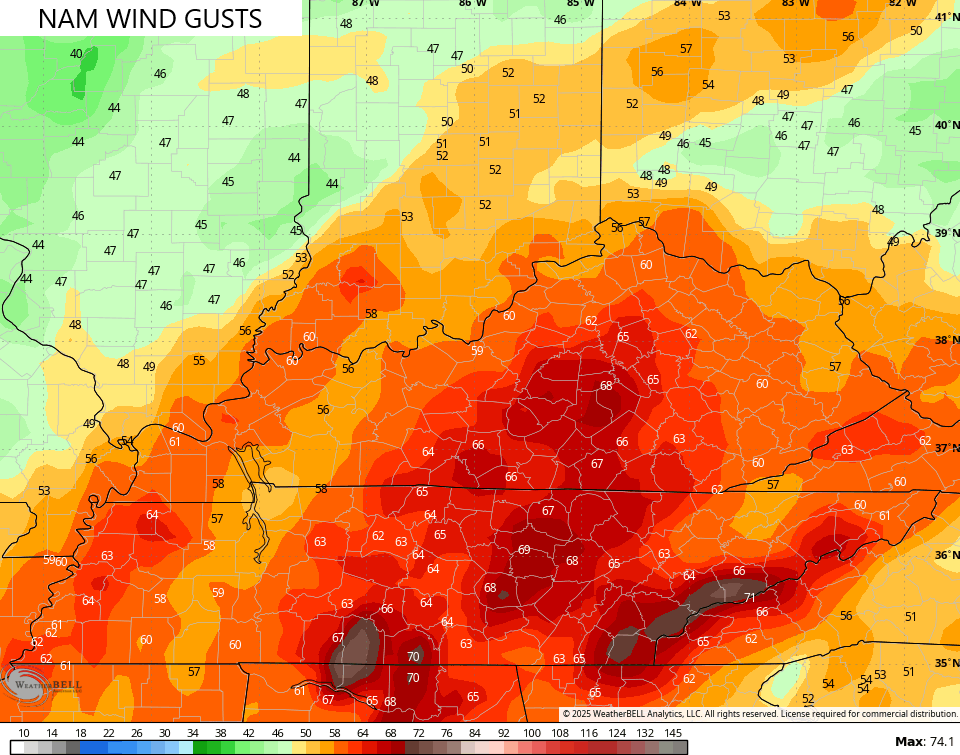
The NAM has gusts greater than 65mph…
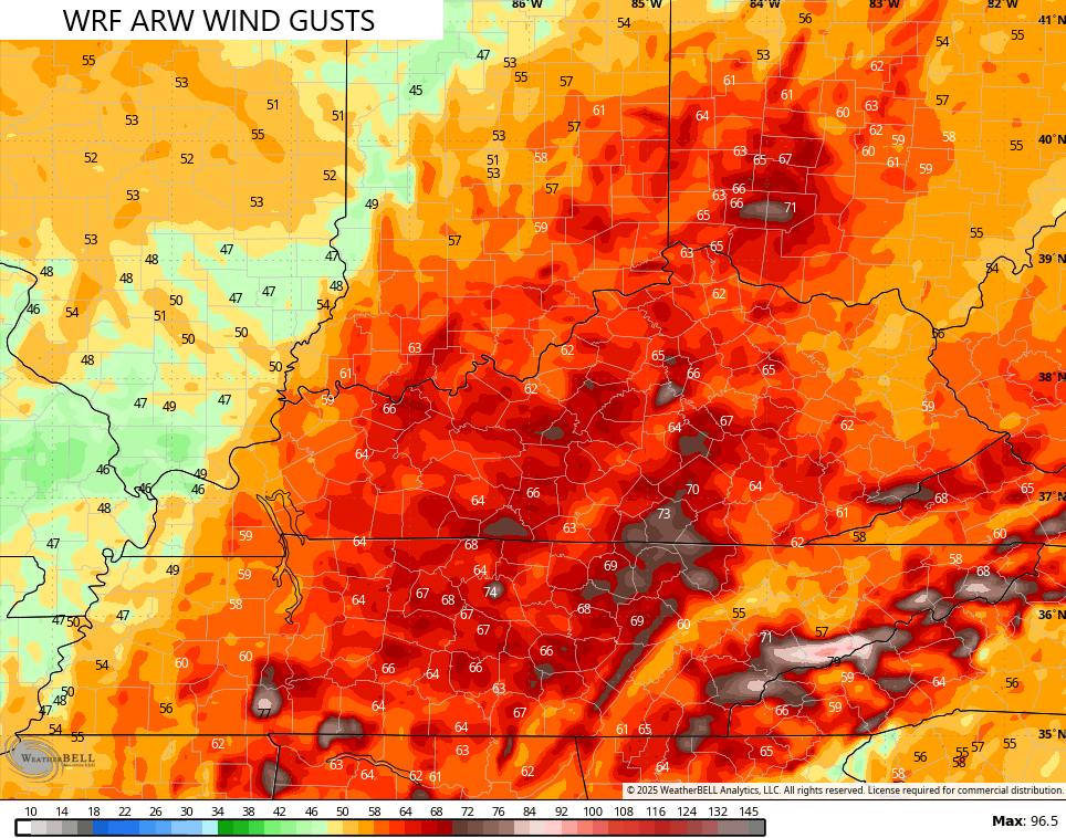
The WRF ARW model also has some winds gusting greater than 70mph…
The GFS is also on board with gusts greater than 70mph…
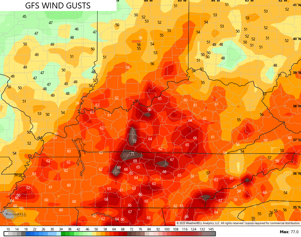
As you can see, this is a significant wind event taking shape tonight and Wednesday morning.
The Storm Prediction Center is rightfully focused on the areas to our southwest, but should have the Marginal Risk deeper into Kentucky…


Behind all this comes a major temperature crash from west to east Wednesday with light to moderate snow breaking out late in the afternoon and evening. That continues across central and eastern Kentucky Wednesday night and early Thursday. Check out the Hi Res NAM future radar that looks like it’s straight outta January…
I’ll have another update later today and I’ll be on WKYT-TV with the latest starting at 4pm. Until then, you guys are all set to track today’s active weather…

Current watches

Possible Watch Areas

Have a great rest of your Tuesday and take care.

Thanks Chris, for keeping us posted on this Rain and High Wind event. Maybe some light accumulations of Snow Wednesday. Even in my County. May not have any power, this time tomorrow.
Good Afternoon and Evening Everyone.
The only big player is the wind.