Good evening, everyone. It’s all eyes on the weekend and the potential for a significant severe weather event for parts of our region. This gets started Friday night and rolls through Saturday night with all modes of severe weather a possibility.
The Storm Prediction Center has a Marginal Risk to Enhanced Risk of severe storms across western and central parts of the state for late Friday and Friday night…

The SPC shows the increased risk for severe weather across the west with the prime time from the late evening into the wee hours of Saturday morning…

That line of storms should weaken the farther east it gets Saturday morning, but another low forms along this front and lifts northeastward Saturday afternoon and evening. Along and ahead of this low finds the increased threat for waves of severe thunderstorms.
The Storm Prediction Center has much of Kentucky in this risk area for Saturday…

I suspect the greatest severe storms risk is across central and eastern parts of the state.
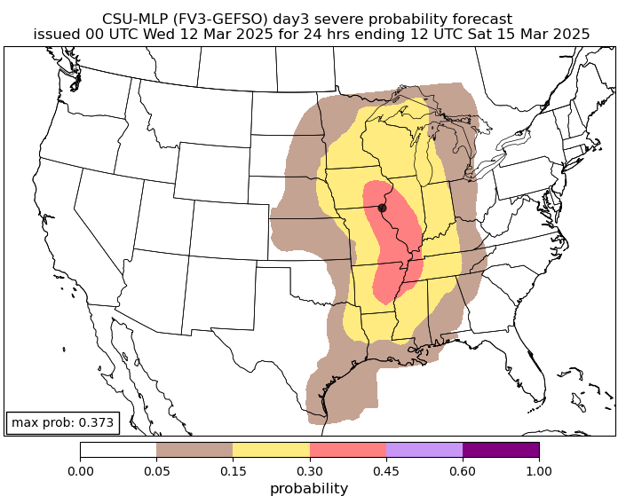
The latest from the Colorado State University composites for severe weather continues to show the Friday threat along the Mississippi River…
The threat for Saturday then REALLY increases from Kentucky into areas of the deep south, where this thing is maxed out…
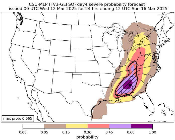
That’s impressive and scary at the same time.
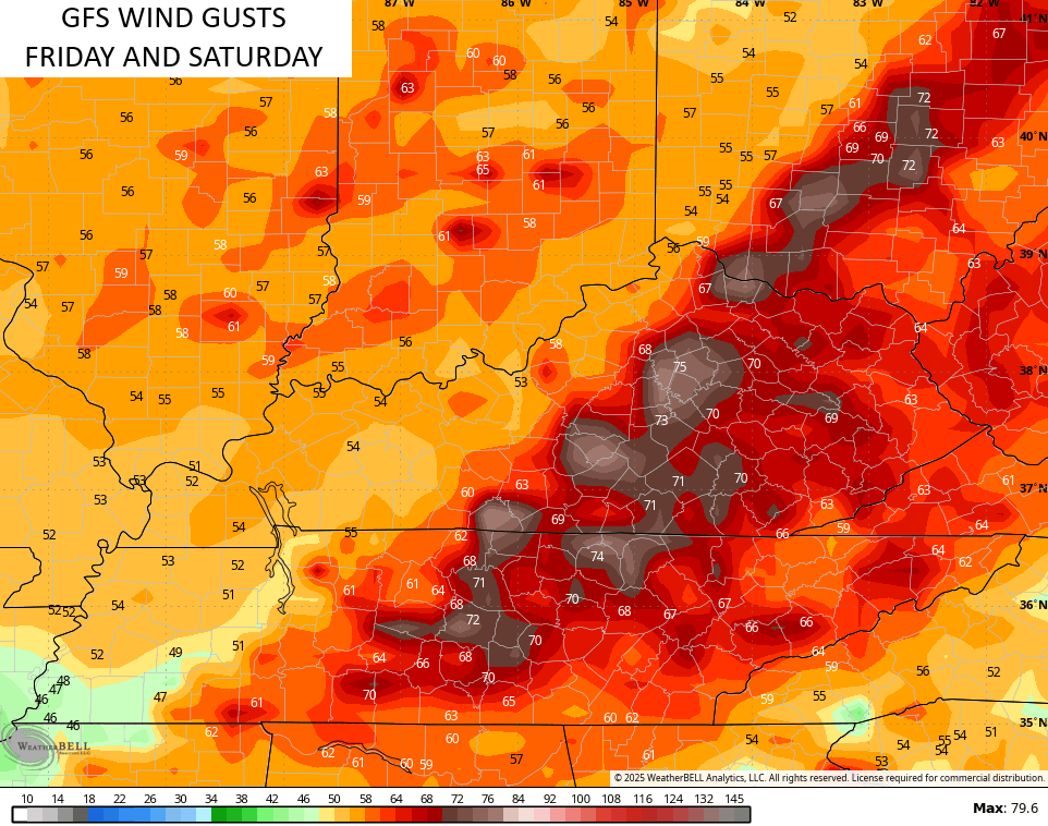
High winds are the main threat for our region with the potential for a tornado or two to spin up.
Speaking of winds, the GFS continues to spin out some serious gusts across central and eastern Kentucky…
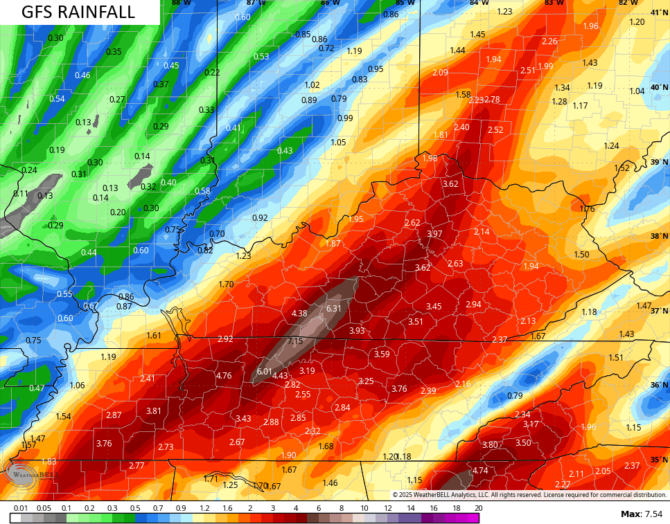
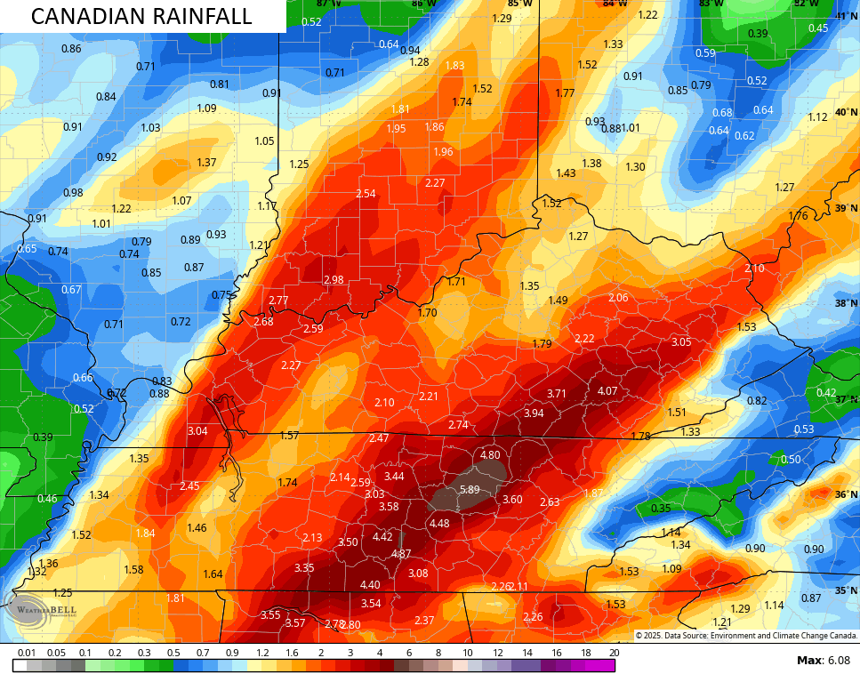
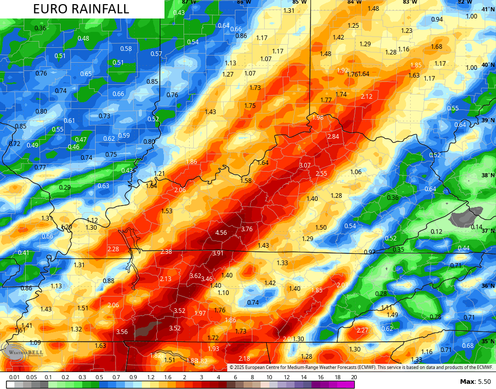
I’m also concerned about flash flooding Saturday into Saturday evening. The GFS has a corridor of torrential rains…
The Canadian sees something similar but to a lesser extreme…
The EURO continues to slowly come around to this thinking…
I’ll have the full update on all this later tonight.
Enjoy the evening and take care.
