Good Tuesday, everyone. The winds of change are blowing out there today as our temps surge once again. This is a short-lived surge of 70s as another big cold front sweeps in Wednesday night, bringing the chance for a few severe storms with snowflakes to follow a few hours later.
Temps today reach 70-75 in most areas on a stout southwest wind. That wind really cranks Wednesday ahead of a deepening Plains storm system. This storm won’t be nearly as strong as the one we just had over the weekend, but it can still be just stout enough to spawn a few strong to severe storms.
The greatest severe threat is to our northwest, but the Storm Prediction Center has a low-end severe risk across parts of Kentucky Wednesday evening…

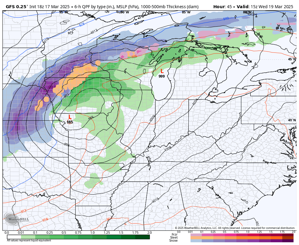
That likely comes from a line of showers and storms racing through here with crashing temps right behind that line. As a matter of fact, we are likely to go from 60s and storms to 30s and snow showers in just a few hours.
The GFS gives us a good look at this…
Some hit and run rooftop coatings are even possible early Thursday. Blah.
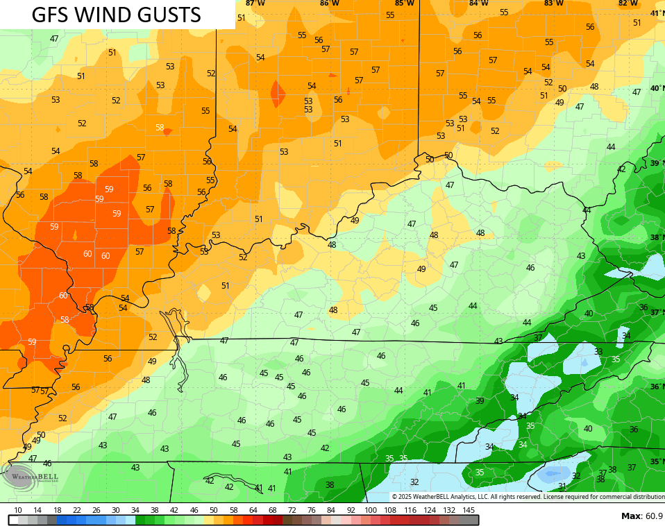
Winds are a big player with this system, especially just ahead of it on Wednesday. Gusts of 40mph or greater will be possible for many with even higher gusts in the west and far north…
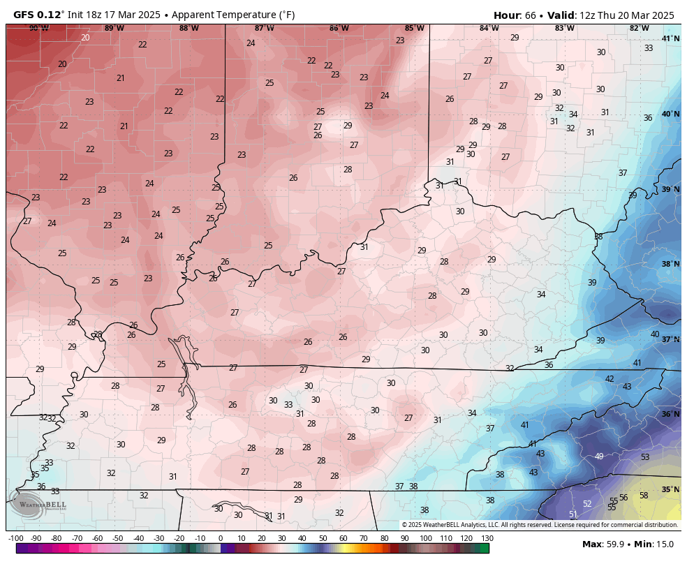
Gusty winds continue into Thursday, but those are a cold wind. Wind chills in the 20s may be common from Thursday morning through Friday morning…
That really, really stinks.
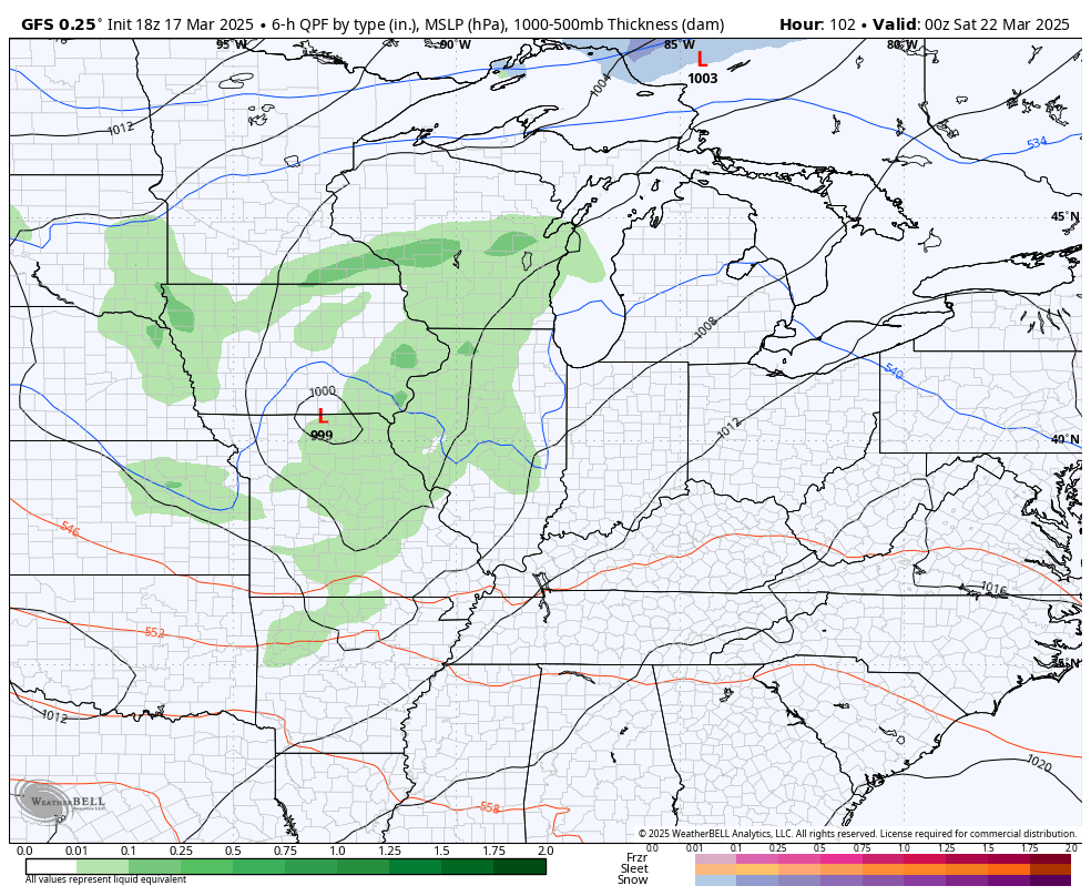
The setup after this continues to skew colder than normal with several gusty shower makers working through here this weekend into next week. There’s even the chance for a few more flakes to fly at some point in this ugly setup…
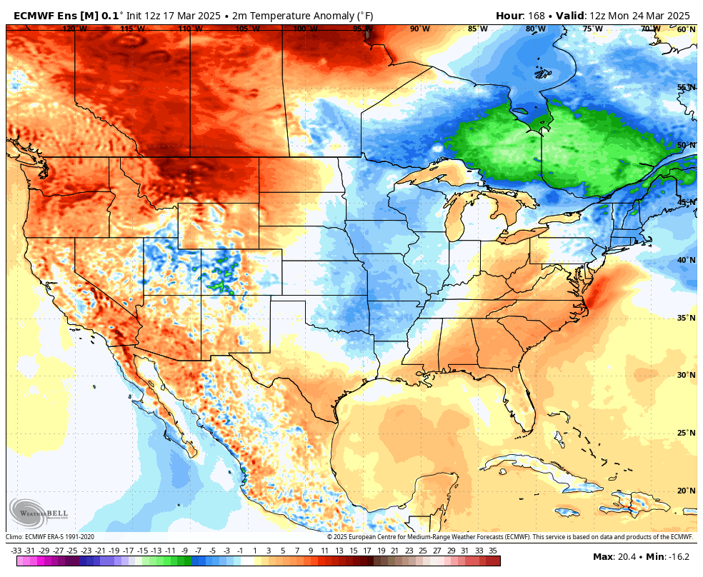
While temps may jump up for a day or two, the overall pattern is skewed colder than normal through the end of the month. You can see the cold showing up more than the warmth in our region on the Euro Ensembles…
Payback is a… Cold snap.
Have a terrific Tuesday and take care.

Ah yes… don’t trust spring around here… that’s for sure.. AC one day, a few days later the heat, then the AC again.
Remember the other day with the heavy rains we had… I thought the majority of it was over. I had no clue Sunday morning I would wake up to a severe t storm scaring the crap out of me. It woke me from a deep sleep.. I ran to the window and I looked out and it looked like a hurricane.. I quickly grabbed my phone and there was a special weather statement…but what I was seeing looked like a straight up severe T storm… then minutes later one was issued…but by that time, the most intense part had stopped.
I’m not impressed with nor concerned by the flakes or colder temps. Just normal March stuff. I also don’t think April will be too wet.